13% Off

Route Length

Max Altitude

Trek Duration

Trek Difficulty

Base Camp Area

Pickup Point
10+ Years Age
First timer can apply, previous trekking experience is more appreciated.
Cover 5 km of distance in 30 minutes without a stress.
+917055048487, +917055048488
trekkingcompass@gmail.com
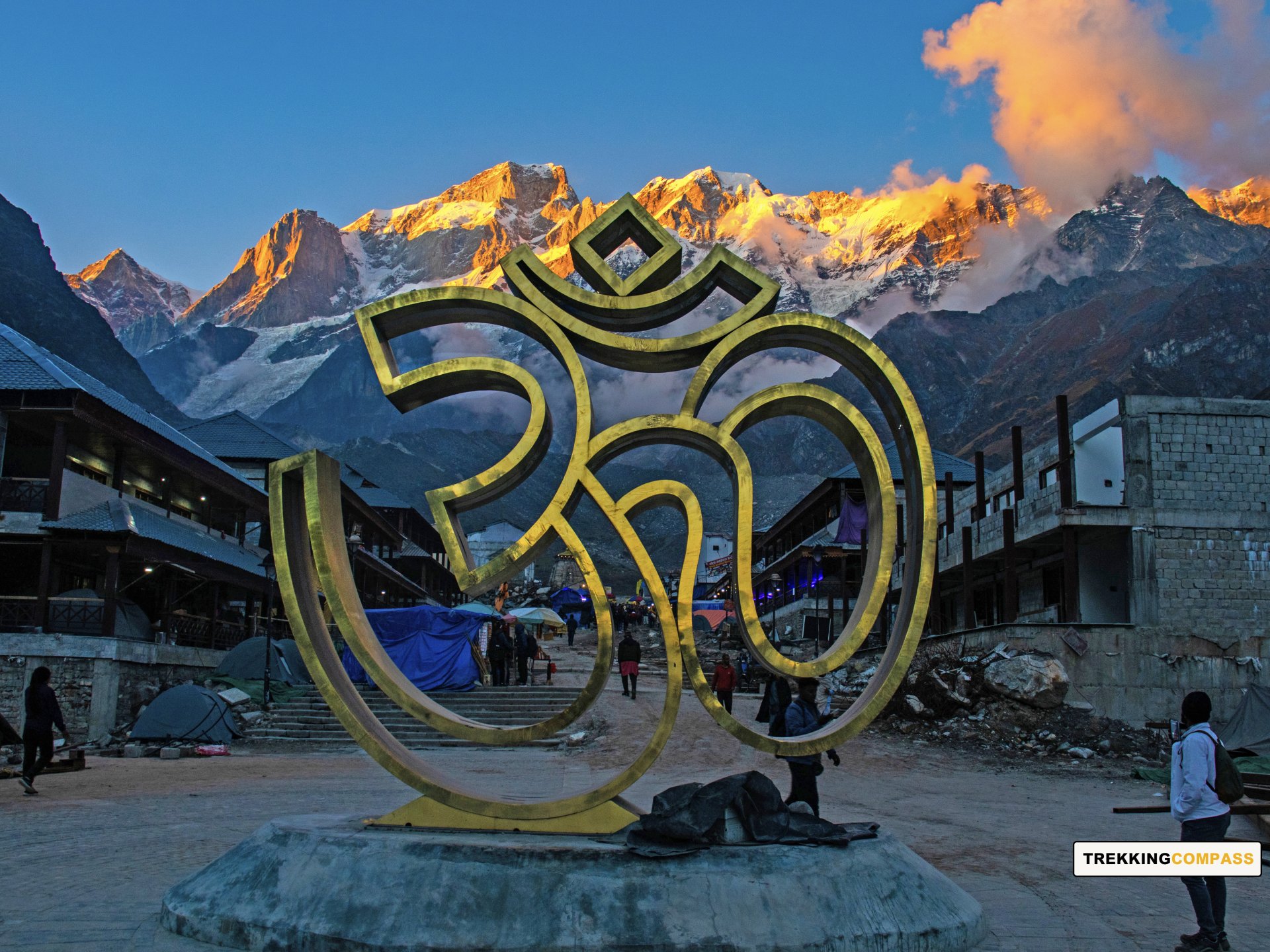
Char Dham Yatra and Do Dham Yatra aren’t the only choices you have to explore your faith and how you connect with it. There’s one trek, which does the same for your curiosity and wonder related to religion and nature. The Panch Kedar Trek, if you haven't heard of it yet, is the time to listen now.
Many revere and idolize Lord Shiva, his barely pompous nature, and calm personality are an attraction like no other. Every devotee relates to him in some way or another, and if you do too, then the Panch Kedar Trek is for you! Along with the very famous Kedarnath Dham and the highest Lord Shiva temple, Tungnath Temple, you get three more temples of Lord Shiva, all located at beautiful sites.
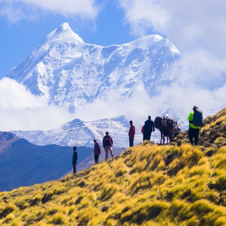
The Panch Kedar trek asks 12 days of your time and promises you stories of wonder, perseverance, and a strong will. Alongside, you get nature in all its glory. Ask for bugyals, you get Lyuti bugyal, Pung bugyal, etc. Ask for waterfalls, ask for hot springs, you get it all, and several mountain peaks from the Garhwal Himalayan Range like Janhukut (6805 m), Nanda Ghunti, Chaukhamba (1, 4), and Kedarnath Main. The river streams that await your arrival are Morkhanda, Kalpa & Madhu Ganga.
If this isn’t all, then the story that binds these 5 Kedars, Pandavas, and Shivji (Lord Shiva) will be the anchor of this entire trip for you. It’s believed by many that the 5 holy temples Kedarnath, Madhyamaheshwar, Tungnath, Rudranath, and Kalpeshwar were discovered by the Pandavas. They built the trails leading to these shrines to somehow reimburse for their sins. Their original goal was to seek reimbursement by meeting Lord Shiva, but he took the form of a bull and camouflaged. Pandavas, determined to repent, found the bull-formed Shiva. Upon being discovered, he went under the ground, leaving behind 5 parts of his body protruding out at 5 different places. These places are now called the Panch Kedars.
Pandavas upon discovering these parts established the 5 temples. Kedarnath is where the hump was found. Tungnath is the arms. Madhyamaheshwar is symbolic of the navel. Rudranath is the face. Finally, Kalpeshwar represents Lord Shiva’s hair. These are the basics, but the stories are more culturally rich and intricate. Anyone who likes details shouldn't miss the Panch Kedar Trek from May to November.
The trek has a predetermined route:
Kedarnath→Madhyamaheshwar→Tungnath→Rudranath→Kalpeshwar.
We follow the same. Would you?!
Rishikesh Altitude: 1,120 ft (340 m)
Sitapur Altitude: 1,320 ft (402 m)
Altitude Gain: 200 ft (61m)
Travel Distance: 206 km
Travel Hours: 8.5 hrs (approx.)
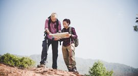
The day will start with you, meeting our representative at Rishikesh, early in the morning. There, after a small introduction, you board a taxi for Sitapur. Driving through the winding roads, lined with pines, along river Ganga and Alakhnanda, you reach Sitapur by evening. After the hotel check-in, you can explore Sitapur or rest for the trek tomorrow. Tomorrow is a big day, especially with the 24 km long trek.
There are many temples on your way to Sitapur. They are Mata Dhari Devi Temple, Shree Vishwanath Temple Guptkashi, Shree Kamaleshwar Mahadev Temple, Raj Rajeshwari Mandir, Vashishth Gufa Temple, etc. On the way to Sitapur, you will also encounter Triveni Ghat, Rudraprayag, Devprayag, Srinagar, Ukhimath, etc.
Kedarnath Altitude: 11,750 ft (3,581 m)
Altitude Gain: 10,430 ft (3,179 m)
Travel Distance: 700 m (light walk) + 6 km (drive) + 24 km (trek)
Travel Hours: 10 mins (light walk) + 1 hr (drive) + 8-9 hrs (trek) = 9 hrs (approx.)
Your morning starts with a light walk (700m) to Sitapur to Sonprayag taxi stand. Here, you board a taxi for Gaurikund, which is a 6 km drive from Sonprayag. At Gaurikund, devotees have two options;
24 km trek to Kedarnath
24 km to Kedarnath on mules/horses
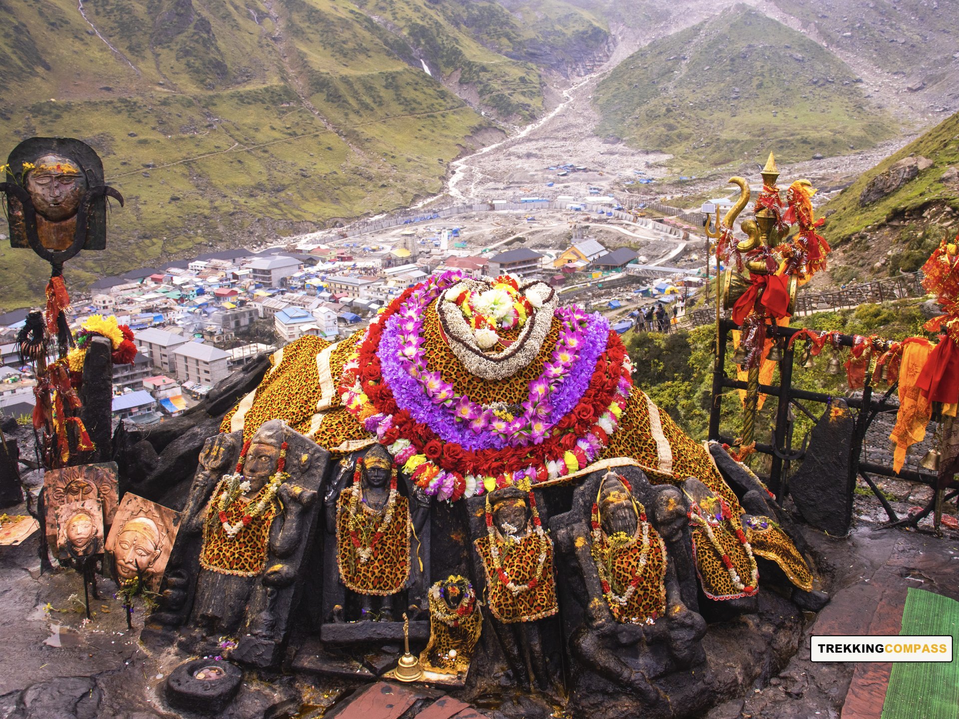
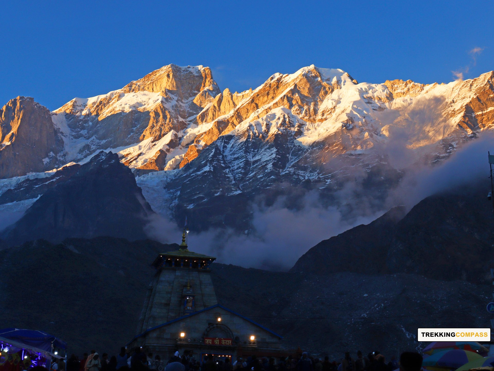
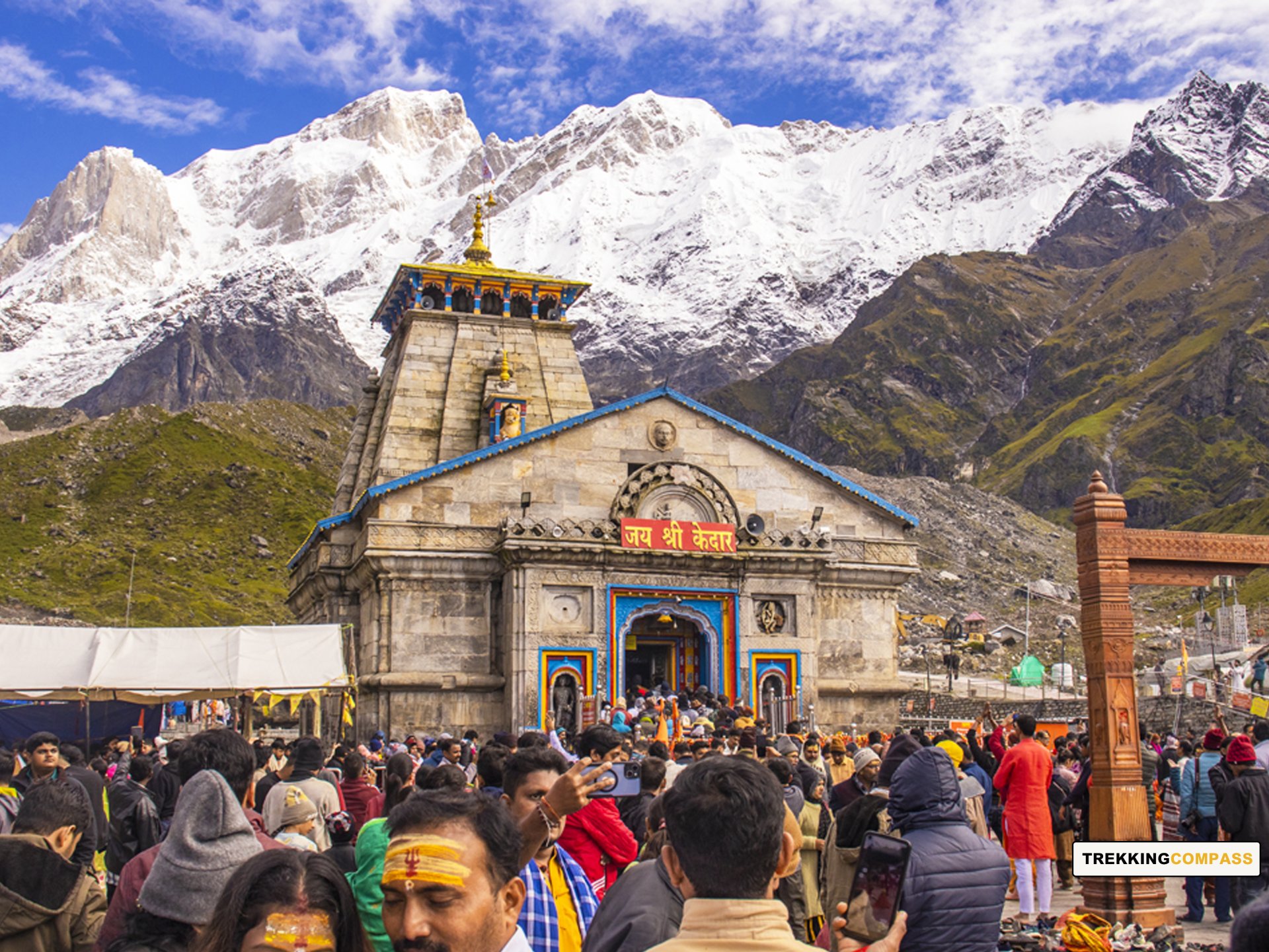
Kedarnath Dham tests your patience and perseverance to get the darshan (view) of Lord Shiva’s idol. After stops and light snacking at some intervals, you eventually reach Kedarnath Dham for evening aarti (prayer). The Kedarnath Temple lights majestically, in the evening’s hue, giving you a one-in-a-million chance to look at Kedarnath Dham.
Kedarnath Dham, apart from its religious significance, is also famous for its placement amidst the Garhwal Himalayan Ranges. The Dham’s backstory is one of Lord Shiva’s trials of the Pandavas’ intentions. He wanted to test their patience and perseverance, and the Dham's location continues to do so at present.
Pandavas built Kedarnath to worship the back hump of Lord Shiva, who was then disguised as a bull. This, along with 4 other Lord Shiva temples in Uttarakhand, make the Panch Kedars, where panch stands for 5. Lord Shiva is the Destroyer in Hindu Mythology. He destroys to make way for more creation, and by destroying the inner demons of the devotees, he helps them turn a new leaf.
Sitapur Altitude: 1,320 ft (402 m)
Altitude Gain: 10,430 ft (3,179 m)
Travel Distance: 24 km (trek) + 6 km (drive) + 700 m (light walk)
Travel Hours: 8-9 hrs (trek) + 1 hr (drive) + 10 mins (light walk) = 9 hrs (approx.)
Today becomes “THE DAY” because you get to see Lord Shiva up close at Kedarnath, early in the morning. Being one of the Panch Kedar and also a Char Dham, Kedarnath marks the perfect beginning of your Panch Kedar Trek. You get your Kedarnath Dham Darshan after an early morning bath. Soak in the divinity of Lord Shiva, have your breakfast, and descend to Gaurikund. For devotees with walking-related issues, mules and horses are available.
The descent brings you views of mountains that you will cherish for a lifetime. Other than that, the whole idea of this day is to trek down to Gaurikund, take a taxi to Sonprayag, and walk to Sitapur. The evening will call for a hotel check-in, where you will have dinner and retire for the night. It’s your time to enjoy the trek to Kedarnath and notice whatever you missed while ascending.
Ransi Altitude: 6,480 ft (1,975 m)
Gaundhar Altitude: 5,750 ft (1,752 m)
Altitude Gain: 4,430 ft (1,350 m)
Travel Distance: 61 km (drive) + 6 km (trek) = 67 km
Travel Hours: 3 hrs (drive) + 5 hrs (trek) = 8 hrs (approx.)
Starting from Sitapur, you will enjoy a scenic drive through Uttarakhand’s green valleys. Watch the terraced fields roll by and spot forests and snow-capped mountains far away. The Mandakini River adds a peaceful touch as you near Ransi village.
Ransi sits high at 6,480 feet and is your gateway to the next part of the journey. From here, a 6-kilometer trek leads down to Gaundhar, winding through thick woods and clear streams. The trail starts just beyond Ransi at a place called Agtoli Dhar. Along the way, you will cross several streams, including a crossing near a waterfall named Bheem si Gadera. You can also stop at Devi Dhar Temple about halfway through for a quick rest.
Gaundhar lies at 5,750 feet, where two rivers, Madhu Ganga and Morkhanda, meet. It’s a small village with a few homestays and local eateries, perfect for relaxing after the day’s travel. Enjoy a quiet evening here, surrounded by the simple beauty of the mountains, and prepare for the days ahead.
This day combines a comfortable drive with a refreshing trek, giving you time to take in nature and local life at a gentle pace.
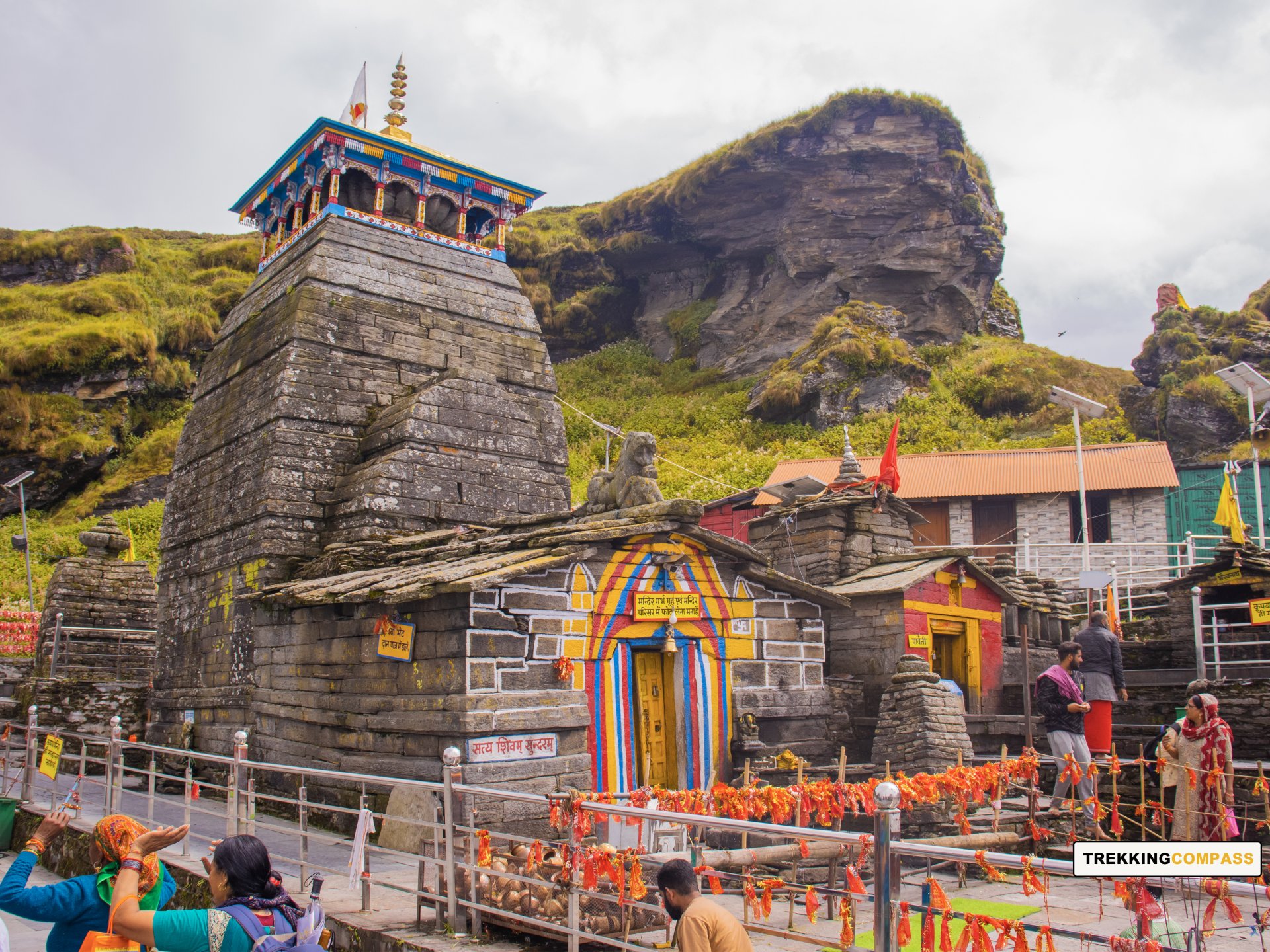
Madhyamaheshwar Altitude: 11,550 ft (3,520 m)
Altitude Gain: 5,800 ft (1,768 m)
Travel Distance: 10 km
Travel Hours: 6.5 hrs (approx.)
Start your day early in the fresh mountain air of Gaundhar, enjoying a simple breakfast before setting off on the trek to Madhyamaheshwar. The trail covers 10 kilometers with an altitude gain of 5,800 feet as you climb from Gaundhar to Madhyamaheshwar, which sits at 11,550 feet.
The path leads through thick oak and rhododendron forests where bird songs and rustling leaves create a calming soundtrack. The trail gently climbs at first, winding alongside streams and rivulets that sparkle in the sunlight.
As you move higher, the forest thins and opens into green meadows, revealing stunning views of the valley and distant peaks. The climb becomes steeper and more challenging, but the changing landscape and peaceful surroundings make each step worthwhile. Along the way, take time to rest and admire the merging rivers below, as well as the vibrant colors of blooming rhododendrons that paint the hillsides.
After about six and a half hours of trekking, you will reach the sacred site of Madhyamaheshwar. This temple, dedicated to Lord Shiva’s navel, sits surrounded by snow-capped peaks that fill the valley with a serene energy. Explore the temple grounds and nearby shrines like Amrit Kund, Maa Parvati, and Bhairav temples, each adding to the spiritual atmosphere of the place.
End your day by settling into a nearby lodge or hotel, enjoying a warm meal, and soaking in the quiet beauty of this holy mountain retreat.
Ransi Altitude: 6,480 ft (1,975 m)
Chopta Altitude: 9,402 ft (2,866 m)
Altitude Loss: 2,148 ft (655 m)
Travel Distance: 16 km (trek) + 50 km
Travel Hours: 9 hrs (trek) + 1.5 hrs (drive) (approx.)
Wake up early to catch the sunrise lighting up the snowy peaks around Madhyamaheshwar. If you have time, visit the Budha Madhyamaheshwar Temple nearby. It is a quiet spot with good views of the Chaukhamba-Mandani peaks. You might notice locals offering biscuits and chocolates as prasad, a small but unique tradition here.
Start your trek downhill back toward Ransi, following the path you came up. The walk takes you through green forests and village fields. Along the way, there are simple roadside dhabas where you can stop to rest and enjoy some snacks. The route is steady and scenic, with plenty of chances to take in the peaceful surroundings.
After about nine hours of walking, you reach Ransi village. From here, a comfortable drive of about one and a half hours takes you to Chopta. On the way, you pass through Ukhimath, a town known for its Omkareshwar Temple dedicated to Lord Shiva and others. If you want, you can make a quick stop here, but Chopta is your final destination for the day.
Arriving in Chopta, you’ll find yourself at a higher altitude of over 9,400 feet. This small mountain town is calm and scenic, a great place to rest and enjoy a warm meal after a long day. Get ready to relax and prepare for the next part of your adventure.
Tungnath Altitude: 11,500 ft (3,505 m)
Chandrashila Altitude: 12,100 ft (3,688 m)
Sagar Village Altitude: 5,700 ft (1,737 m)
Altitude Gain/Loss (Without Chandrashila): 2,098 ft (639 m)/ 5,800 ft (1,768 m)
Altitude Gain/Loss (With Chandrashila): 2,698 ft (822 m)/ 6,400 ft (1,951 m)
Travel Distance: 7 km + 2 km (trek) + 38 km (drive) = 47 km (approx.)
Travel Hours: 7-8 hrs (trek) + 1 hr (drive) = 9 hrs (approx.)
The day will begin early today, considering the 8 hrs of trek and an hour-long drive to Sagar village. There’s always the bonus 2 km trek to Chandrashila through Tungnath Mandir (temple) and back awaits all the trekkers. After the morning breakfast, trekkers will reach the Tungnath Chopta entry gate with our expert guidance. All this while towering and accompanying them from afar will be the Chandrashila Peak. The gate reads “तृतीय केदार तुंगनाथ” which translates to “Third Kedar Tungnath.” For Hindu devotees, Tungnath is of great significance, courtesy of the religious beliefs associated with it.
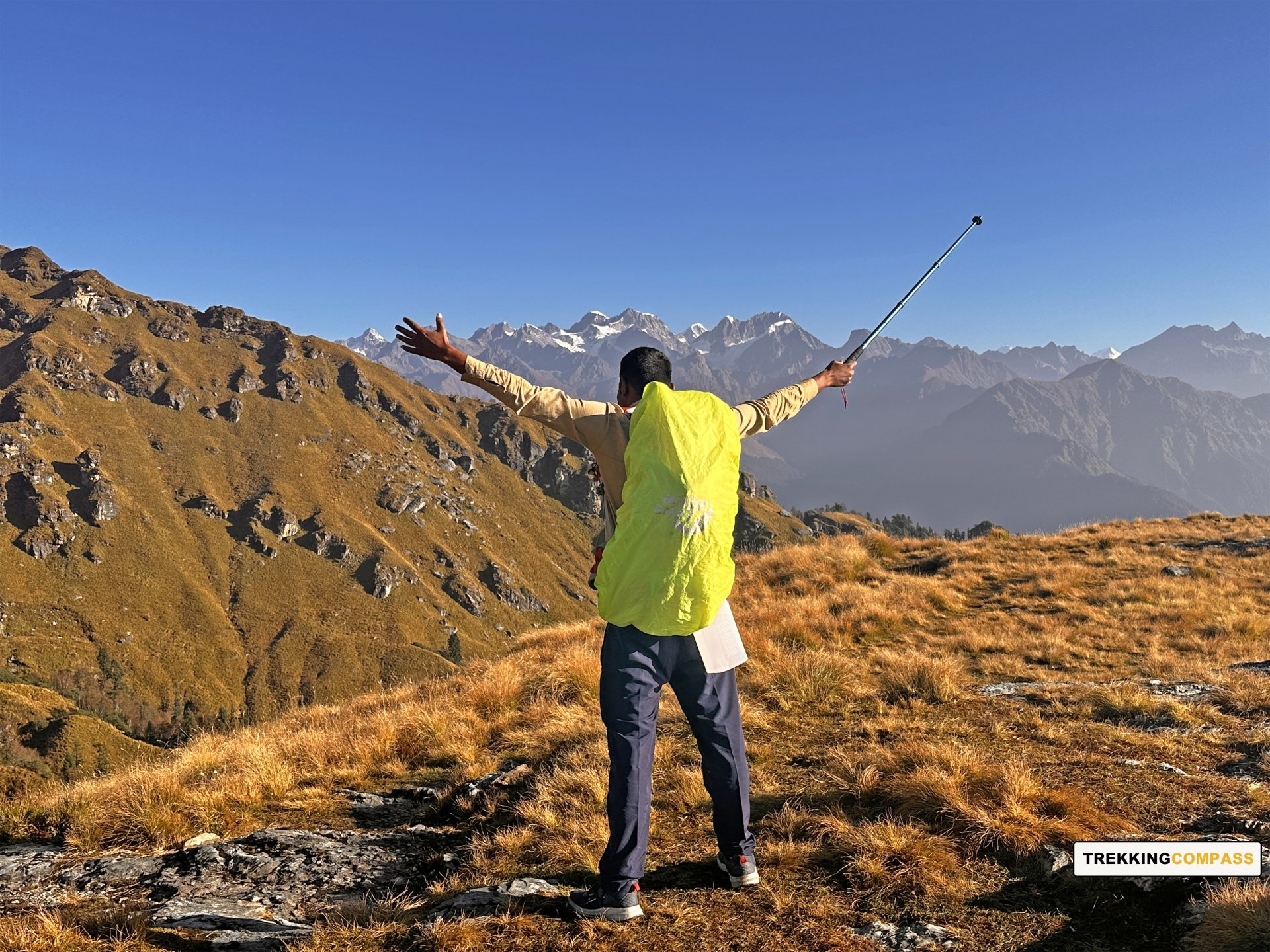
This trek is equally rewarding for other trekkers for the views it offers, along with the flora and fauna in the area. Chopta Chandrashila trek lies on Chandrakant Parvat, hence the name Chandrashila for its summit. The trail to Chandrashila Summit is well-paved and spacious. Unlike other treks, this trek has a moderate crowd in every season. Trekking up, trekkers will hear chants of “जय भोलेनाथ!,” “हर हर महादेव!” All these sum up to praise of Lord Shiva by the devotees climbing up for ‘darshan,’ meaning ‘auspicious sight of a deity.’
The trail will take trekkers through different small meadows where you can see the sheep grazing. The sunlight falling on the wildflowers makes them shine bright and stand out. Himalayan Birch, Pink Rhododendron, Rhododendron (Buransh), Himalayan maple, and Black Juniper are some trees and plants one can spot on this trail. Trekkers can also catch glimpses of birds like the Alpine Accentor, White-throated Bushtit, Eurasian Jay, Himalayan Bluetail, and Himalayan Monal. Other than that, there are rare sightings of Wild Boar, Kedarnath Musk Deer, Himalayan Black Bear, etc.
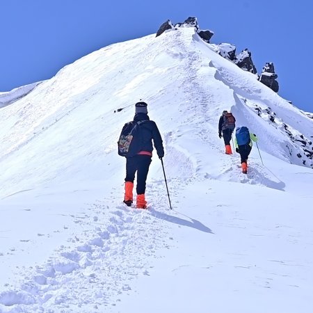
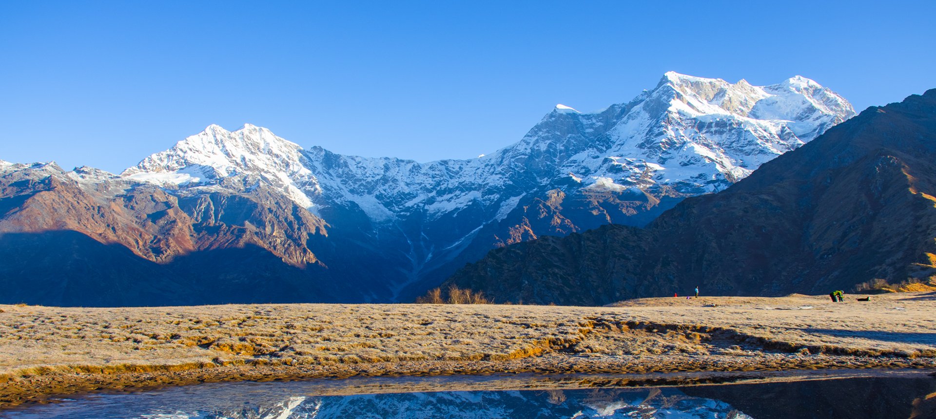
When trekkers are on the paramount of the Chandrashila summit (12,100 ft) at a 1 km distance from Tungnath, the views and experience are dramatic, almost like a movie. They’ll see clouds dancing in the valleys and above the ranges; it's magical, to say the least. The sunset and sunrise view of the Indian Himalayan Ranges makes you want to stay there forever. You see up-close views of Trishul 1 and 2, Nanda Ghunti, Chaukhambha 1 and 4, and Nanda Devi Peak. Other peaks you find almost reachable from Chandrashila are Swachhand (6721 m), Janhukut (6805 m), Bhagirath 1 (6,856 m), Kharchakund (6,612 m), Sumeru (6,351 m), Kedarnath Main (6,940 m), etc.
The views and vibes will incline you to stay, but the last 2 Kedars await, so after you capture these moments on your phones and your memories, it’s time to descend. At Chopta, vehicles will wait to drive you to Sagar village, located 38 kilometers from Chopta.
Lyuti Bugyal Altitude: 9,560 ft (2,914 m)
Altitude Gain: 3,860 ft (1,176 m)
Travel Distance: 9 km
Travel Hours: 6 hrs (approx.)
Start your morning fresh at Sagar Village, where the Rudranath trek begins. After a hearty breakfast, step out through the village gate and into a peaceful world of green alpine meadows and terraced fields where finger millets grow. The trail gently winds through oak and rhododendron forests, filled with the gentle rustling of leaves and bird songs.
Within a few kilometers, you’ll reach Chandrakoti, a small rest stop where you can sip tea and refresh yourself. From here, an uphill stretch of about 2 kilometers leads to Pung Bugyal. This wide-open grassland grazed by horses and mules offers a perfect spot to pause and soak in the mountain air.
Continuing, the trail crosses several streams with small wooden bridges and takes you through dense Himalayan forests alive with fresh mountain scents. You will arrive at Ghimghima Pani, named for the soothing sound of flowing water, a perfect place to fill your water bottles and catch your breath.
The last part of the day is a steady, challenging climb of 3 to 4 kilometers up to Lyuti Bugyal. Along this steep trail, wildflowers color the path and the valley views open up beautifully below. Reaching Lyuti Bugyal, a vast alpine meadow surrounded by towering peaks, you’ll find a peaceful retreat with basic stay options.
Relax here in the cool mountain air, enjoy the quiet wilderness, and get ready for the next day’s adventure. As night falls, the clear sky turns into a brilliant canvas of stars, making Lyuti Bugyal magical, best to rest.
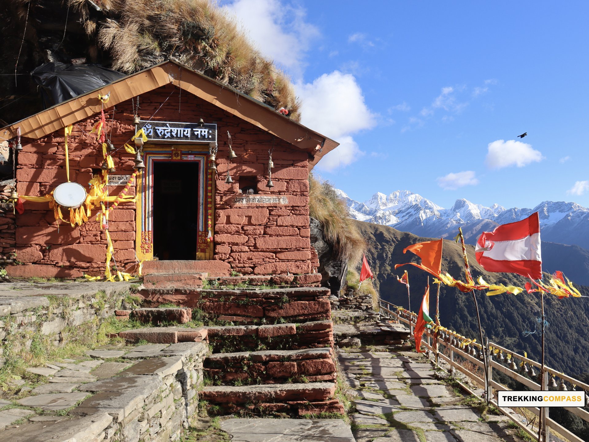
Rudranath Altitude: 11,700 ft (3,566 m)
Altitude Gain/Loss: 2,140 ft (652 m)
Travel Distance: 7.5 km (uphill) + 7.5 km (downhill) = 15 km (approx.)
Travel Hours: 11 hrs (approx.)
Wake up early to a simple breakfast before setting off on one of the most memorable parts of the journey. Today’s trek is about 15 kilometers total and will take roughly 11 hours. Make sure to fill your water bottles here at Lyuti Bugyal since there won’t be any places to refill along the way.
The trail begins with a steady climb of about 7.5 kilometers through a rugged path leading to Panar Bugyal. Along this stretch, you will see soft grasslands dotted with grazing sheep and incredible views of peaks like Nanda Devi, Trishul, and Bandarpunch shining in the sunlight. This sight alone will lift your spirits and remind you why this trek is so special.
As you move past Panar Bugyal, the dense forests open up to wide alpine meadows filled with wildflowers and scattered boulders. Don’t forget to glance back at the stunning valley below. It’s a view worth pausing for. After reaching Pitradhar, the highest point of the trek, the trail shifts downhill for about 6 to 7 kilometers.
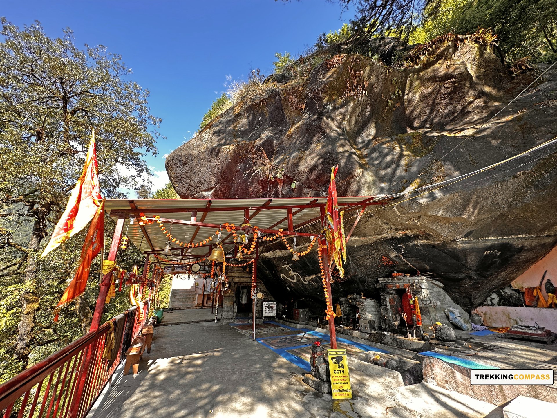
Downhill, you’ll cross the narrow path by Panj Ganga, named for five streams flowing in succession. The sound of flowing water and the surrounding mountain views create a peaceful atmosphere. The approach to Rudranath Temple is marked by colorful wildflowers and prayer flags, with the distant sounds of temple bells growing louder.
At Rudranath, take time to offer your prayers at the ancient temple dedicated to Lord Shiva, where his face is worshipped in the form of a bull. The calm and spiritual vibe here, combined with the stunning mountain backdrop, is truly humbling. After soaking in the serenity and watching the sunset paint the peaks in golden light, you will retrace your steps back to Lyuti Bugyal. There you get a well-deserved rest under the stars.
Sagar Village Altitude: 5,700 ft (1,737 m)
Pipalkoti Altitude: 4,200 ft (1,280 m)
Altitude Loss: 5,360 ft (1,634 m)
Travel Distance: 9 km (trek) + 29 km (drive) = 38 km (approx.)
Travel Hours: 6 hrs (trek) + 1 hr = 7 hrs (approx.)
By now, the Panch Kedar Yatra has brought you close to four of the sacred shrines connected to Lord Shiva’s bull form. Today, the journey takes you down from the green meadows of Lyuti Bugyal toward Sagar Village, where the trek continues its gentle descent. The trail offers fresh mountain air and plenty of lovely views as you make your way downhill.
Once in Sagar, it’s time to take a break. Relax at a local dhaba and enjoy a good meal before the next leg of the trip. The drive ahead is about an hour, covering 29 km through changing landscapes, with the mighty Himalayas standing tall as a backdrop.
As you reach Pipalkoti, the altitude settles at just over 4,200 feet. This marks the gateway for the final shrine of the circuit, Kalpeshwar, waiting for you in the days ahead. After checking into your accommodation, rest and recharge with a warm dinner, ready for what comes next.
Kalpeshwar Altitude: 7,190 ft (2,191 m)
Altitude Gain/Loss: 2,990 ft (911 m)
Travel Distance: 36 km (drive) + 200 m (downhill hike) = 36.2 km x 2 = 72.4 km (approx.)
Travel Hours: 3 hrs (approx.)
After a peaceful night in Pipalkoti, you’ll start your day early with a warm breakfast and an open heart. The road ahead takes you to Kalpeshwar, one of the five sacred Panch Kedar temples. The journey may be short in distance (36 km) but it holds something special for the soul.
As you drive through the mountain roads, the landscape begins to shift. Villages pass by quietly. The green meadows stretch out wide. Wildflowers peek out from the hillsides. The cool mountain breeze slowly replaces the warmth of the early sun. The higher you go, the lighter you begin to feel, like the mountains are slowly lifting the weight off your shoulders.
You’ll reach Urgam Valley, a quiet and lush place where nature still hums its own tune. The last stretch of the drive takes you over a rough path, with a few stones and bumps along the way. After reaching Devgram, it’s just a short walk (200 m) down to the temple.
Kalpeshwar isn't about its grand size, but its powerful spirit. Tucked away in a quiet corner of the valley, this is where Lord Shiva is worshipped in the form of his matted hair (jata). The temple is believed to have been visited by the Pandavas, and its story has lived on through centuries. Surrounded by trees and a gentle stream that joins the Kalp Ganga River, the temple feels otherworldly. Take your time. Sit. Pray. Breathe. Let the silence speak, and let the mountains bless.
Once you have offered your prayers and taken in the calm of Kalpeshwar, you’ll walk back to your vehicle and begin your return drive (36 km) to Pipalkoti. By the time you’re back, the light will have softened. Over dinner, you can rest and reflect on the quiet, yet powerful aura of the place you just visited. The night in Pipalkoti is gentle, just like the day.
Haridwar Altitude: 1,030 ft (314 m)
Altitude Loss: 1,030 ft (314 m)
Travel Distance: 235 km
Travel Hours: 6 hrs (approx.)
Your last day of the Panch Kedar Yatra begins with breakfast in Pipalkoti, followed by a comfortable drive to Haridwar. The journey covers 235 km and takes around six hours, with a steady descent of 1,030 feet.
The road is peaceful and scenic, lined with pine and deodar trees and long winding turns that open up to views of the valley. Along the way, you pass through some beautiful stops like Gopeshwar, Nandaprayag, Karnaprayag, Rudraprayag, Srinagar, Devprayag, and Rishikesh. More than just towns, they are part of the spiritual thread that runs through this entire region.
You’ll also have the option to pause at Dhari Devi Temple, perched beside the river, and Vashishta Gufa, a quiet cave believed to have housed the sage in deep meditation.
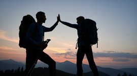
By evening, you arrive in Haridwar. The rivers grow calmer, the roads flatter, and there’s a quiet sense of return. The Panch Kedar Trek (the Yatra) ends, but the journey stays with you.
Accommodation
Meals (Vegetarian only)
Two meals a day—breakfast and dinner—are included from Day 1 dinner to the last day's breakfast.
Expert Support
First Aid Preparedness
Fully equipped medical kit including a stretcher, oxygen cylinder, blood pressure monitor, oximeter, and stethoscope to ensure safety throughout the journey.
Storage Facilities :- A secure room at the base camp to store additional luggage not needed during the trek.
Transportation :- A round-trip transport from the pick-up point and back at the same point as a part of the itinerary.
Trek Equipment
Insurance :- Personal insurance is mandatory and not included in the package.
Permits and Entry Fees :- All permits and entry charges are excluded and must be borne by the trekkers as applicable.
Personal Expenses :- Any expenses of a personal nature, including shopping, snacks, hiring a mule or porter for carrying your belongings, or acquiring personal equipment.
Emergency Costs :- Expenses arising from emergency evacuations, hospitalization, or any medical treatments required.
Unspecified Services :- Any services or items not explicitly mentioned under the "INCLUSIONS" section.
Food Costs :- We will not cover any food costs during your transit to and from the base village.
Trekking is not only about enjoying the change of scenery but also about being responsible. Our (Trekking Compass) responsibility is to provide you with an opportunity for a safe trek. But, how do we do that? We do that when you fulfill your end of the responsibility and are honest with us. To keep you safe we need to be sure there isn’t any inherent threat to your being.
Treks are at higher altitudes and it becomes difficult, almost impossible to provide you with immediate medical assistance. Therefore, we cannot help you if you don’t help us. Trekking is only one of the things you can do, but there are plenty of other things to do too. Don’t risk your life for the thrill.
To approach a trek with utmost safety, we want you to submit the following documents:
Personal Confirmation Statement (Compulsory for anyone over 18 years)
You are participating in a trek at high altitudes and it comes with its own sets of risks. This Personal Confirmation Statement will make sure that you understand all the risks you're buying into. Trekking Compass wants you to confirm your complete understanding of these risks so that you come prepared for any mental or physical challenges ahead.
This statement is also a declaration from you that, "All the information I have provided, including medical conditions, is true. If found false under any circumstances, I will be held accountable and it has nothing to do with Trekking Compass."
We have the utmost empathy for you and will do our best to help wherever possible, but only after assessing your readiness and safety for the trek. This is how our team will adequately prepare for whatever risks we might face during the journey. Concerning individuals are requested to thoroughly cross-check the requirements and only then sign the document.
Parent/Guardian Approval Statement (Compulsory for anyone below 18 years)
For participants under 18 years of age, the Parent/Guardian Approval Statement is essential to confirm that a legal guardian understands and consents to the participation in the trek. Once we have this document, we are affirmed that the parent or guardian is fully aware of the risks involved in trekking at high altitudes and is consenting to their child's participation.
No underage (below 18+) children are welcome on the trek without their parent's consent. Submission of this document reassures us that parents are approving that their child meets the health and fitness requirements for the trek, after a thorough examination.
This legal confirmation holds the parent liable for any discrepancies, freeing Trekking Compass from any liabilities for the same. Parents are requested to thoroughly cross-check the requirements and only then sign the document.
Medical Liability Waiver
The Medical Liability Waiver makes sure participants acknowledge the health risks associated with trekking at high altitudes. Common ailments during treks include altitude sickness, dehydration, muscle cramps, hypothermia, and fatigue, all of which can significantly affect your trekking experience. Additionally, weather changes and the physical demands of the terrain may exacerbate pre-existing conditions.
If you have pre-existing medical conditions such as asthma, diabetes, or heart issues, it’s vital to inform us and carry your necessary medications. Trekking Compass cannot provide immediate medical assistance in remote areas, so having the essential medications, such as inhalers, insulin, or any other prescriptions, is crucial for your safety during the trek.
By signing this waiver, you confirm that you are in good health and have taken the necessary precautions. You acknowledge these risks and agree not to hold Trekking Compass liable for any medical issues or accidents that may arise during the trek.
For any further doubts about anything mentioned above, below is our contact information:
OFFICE ADDRESS: Lane No. 4 Krishna Vihar Mohkampur, Dehradun, Uttarakhand, 248005
PHONE NUMBER: +91 7055048487, 7055048488
EMAIL ADDRESS: info@trekkingcompass.com
HOW TO REACH ? (RISHIKESH)
Note: Keep a buffer day in your getaway in addition to the total days in the itinerary. This day will come in handy in case of any political unrest, landslides, or rains. If not, you can use the extra day to get to know Rishikesh. This means that for an itinerary ending on the 15th of a month, book your return tickets for the 16th.
What are the different ways to reach Rishikesh?
On the Panchkedar trek, our first long-day trip is from Rishikesh to Sitapur (201 km). Therefore, trekkers need to reach Rishikesh to start the trek. The first move to reach Rishikesh for any trekker is to reach either Dehradun or Delhi. Later, every trekker can choose their choice of transport. The available transports for Rishikesh are:
Medium: BUS
A Friendly Note: You should travel by government buses instead of private ones because the private buses tend to take more time than expected. To avoid missing the pick-up time, try traveling by government bus, wherever possible.
Medium: TRAIN
Medium: FLIGHT
Fly Directly to Dehradun and then to Rishikesh: To fly directly at Jolly Grant Airport Dehradun, there are multiple flights from metropolitan cities. The companies that facilitate these flights are:
Fly to Delhi then take a bus or train to Rishikesh: It’s very easy to fly to Delhi from anywhere in the country and take a bus to Rishikesh. You will find a detailed description of buses in the BUS section. The companies that facilitate these flights to Delhi are:
Note: Make sure that the mode of transport you choose should bring you to Rishikesh a day before Day 1, i.e., Day 0. You can fly to Delhi and Dehradun from Mumbai, Kolkata, Bengaluru, Chennai, Hyderabad, Pune, and to Dehradun from Delhi too.
What happens on the drop-off day
Here are the points that explain your drop-off:
Special Case: What if you miss our pick-up?
You shouldn't panic and follow one of the below-mentioned ways to Lohanjung:
| Backpack with rain cover / Trolley Bag | Main bag for gear. |
| Day pack with rain cover (20 - 30 L) | For day essentials, if the main pack is off-loaded. |
| Walking stick | Recommended (at least one). |
| Water bottle/ Hydration pack | 2 bottles (1L each) or 1 hydration pack and 1 bottle. |
| Snacks | Energy bars, dry fruits, ORS/electrolytes. |
| Personal Medical Kit | As prescribed by your doctor. |
| T-shirts (Synthetic, quick-dry) | 2 full-sleeve, 2 half-sleeve. |
| Fleece T-shirts | 2 pieces. |
| Wind-stopper / Fleece jacket (upper) | 1 piece. |
| Windproof jacket | 1 piece |
| Down feather / Hollow jacket | 1 piece |
| Thermal innerwear (Upper & Lower) | 1 set. |
| Trekking pants (Synthetic, quick-dry) | 3 pairs. |
| Wind-stopper / Fleece pants (lower) | 1 pair. |
| Waterproof gloves | Not required. |
| Fleece / Woolen gloves | 1 pair. |
| Poncho / Waterproof jacket and pants | 1 set. |
| Head torch / Hand torch | 1 piece. |
| Sun cap | Required. |
| Woolen cap | 1 piece. |
| Balaclava | 1 piece. |
| Buff/ Neck gaiters | 1 synthetic, 1 woolen. |
| Sunglasses | UV protection with side covers (for spectacle users: contacts or photochromatic lenses). |
| Trekking shoes (waterproof, high ankle, good grip) | 1 pair. |
| Floaters / Flip-flops | 1 pair. |
| Cotton socks | 4 pairs. |
| Woolen socks | 2 pair. |
| Sunscreen | 1 piece. |
| Moisturizer | 1 piece. |
| Lip balm/ Chap-stick | 1 piece. |
| Toothbrush and toothbrush | 1 set. |
| Toilet paper and wipes | 1 pack each. |
| Soap/ Hand sanitizer | 1 piece. |
| Quick-dry towel | 1 piece. |
The Panch Kedar Trek is a spiritual and scenic journey in Uttarakhand that covers the five sacred temples of Lord Shiva — Kedarnath, Tungnath, Rudranath, Madhyamaheshwar, and Kalpeshwar. Each shrine has its own mythological significance linked to the Mahabharata, making this trek a blend of devotion, history, and Himalayan adventure.
The temples open around May (Akshaya Tritiya) and close in October/November (Diwali). The best time to undertake the trek is from May–June and September–October, when the weather is stable and trails are clear.
The trek is moderate in difficulty. While no technical climbing is required, it involves multiple long walking days, steep ascents, and traversing remote Himalayan villages.
The complete Panch Kedar journey covers approximately 119 kms, spread over 11–12 days, depending on the route and pace.
The highest point is Tungnath Temple at 3,680 m (12,100 ft), the highest Shiva temple in the world.
No prior technical trekking experience is required, but good fitness and stamina are necessary due to the long days.
You should be able to walk 10–12 km daily on hilly terrain with ease. Regular walking/jogging and leg-strength exercises before the trek are recommended.
According to legend, after the Kurukshetra war, the Pandavas sought Lord Shiva’s blessings. Shiva avoided them by taking the form of a bull, which then disappeared into the ground at Kedarnath. Different body parts appeared at five locations, now revered as the Panch Kedar shrines.
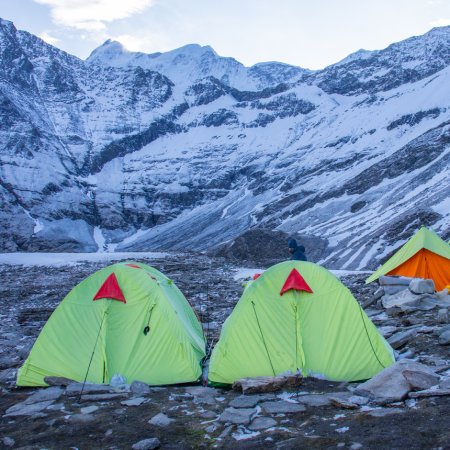
Pilgrim guesthouses, dharamshalas, and small lodges are available near temples. Camping is also an option in some stretches.
No special trekking permits are required, but temple timings and routes are seasonal.
Yes, it is safe when done in the open season. Weather changes should be monitored carefully.
Yes, many families and devotees do the Panch Kedar trek, but physical preparedness is necessary.
ATMs: Limited in Gopeshwar, Ukhimath, and Guptkashi.
Network: Patchy, with BSNL working in most villages.
Electricity: Available in villages, not on remote trails.
Typically 11-12 days, depending on whether you cover all temples in one journey or in parts.
Because it is the only trek that combines devotion, culture, and Himalayan adventure, making it both a pilgrimage and an expedition.
Handpicked routes with strong scenery, reliable pacing, and a premium featured block that still stands apart from the rest of the archive page.
Crafted routes, reliable execution, and a trekking experience that feels premium from planning to summit.
 Safety
Route checks, first-aid readiness, and trained leaders to keep every step confident.
 Routes
Better pacing, better camps, and real acclimatization designed for experience, not speed.
 Groups
Less crowd, more care so you enjoy the trek, not just finish it.
 Trust
Trust
Clear inclusions, no hidden surprises, and real human support on WhatsApp.