
15% Off

Route Length

Max Altitude

Trek Duration

Trek Difficulty

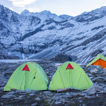
Base Camp Area

Pickup Point
10+ Years Age
First timer can apply, previous trekking experience is more appreciated.
Cover 5 km of distance in 30 minutes without a stress.
+917055048487, +917055048488
trekkingcompass@gmail.com
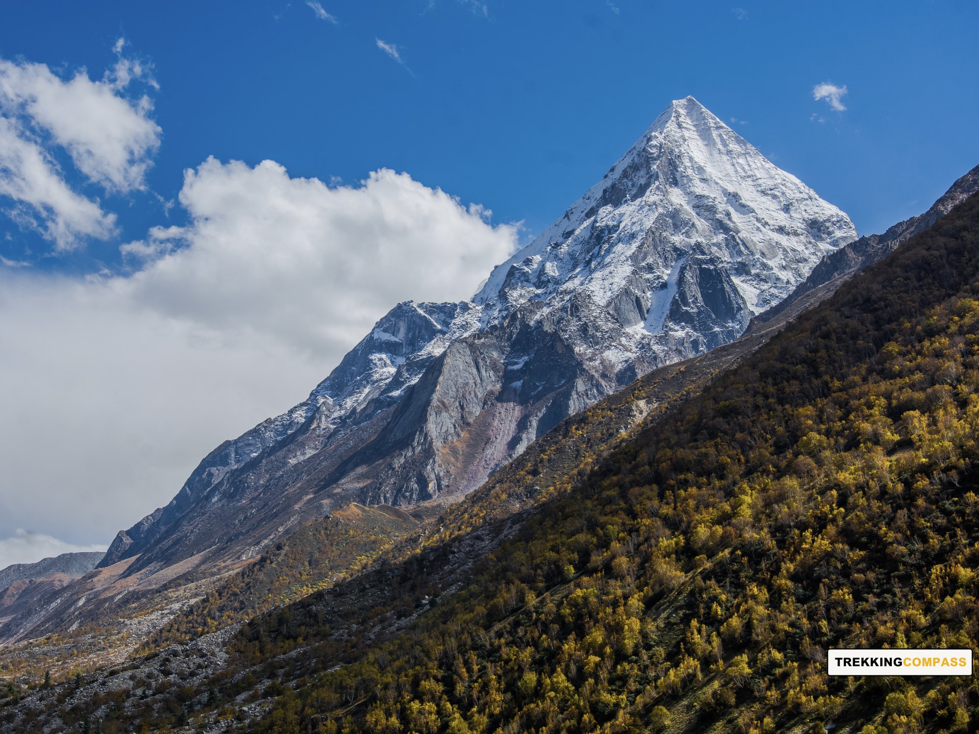
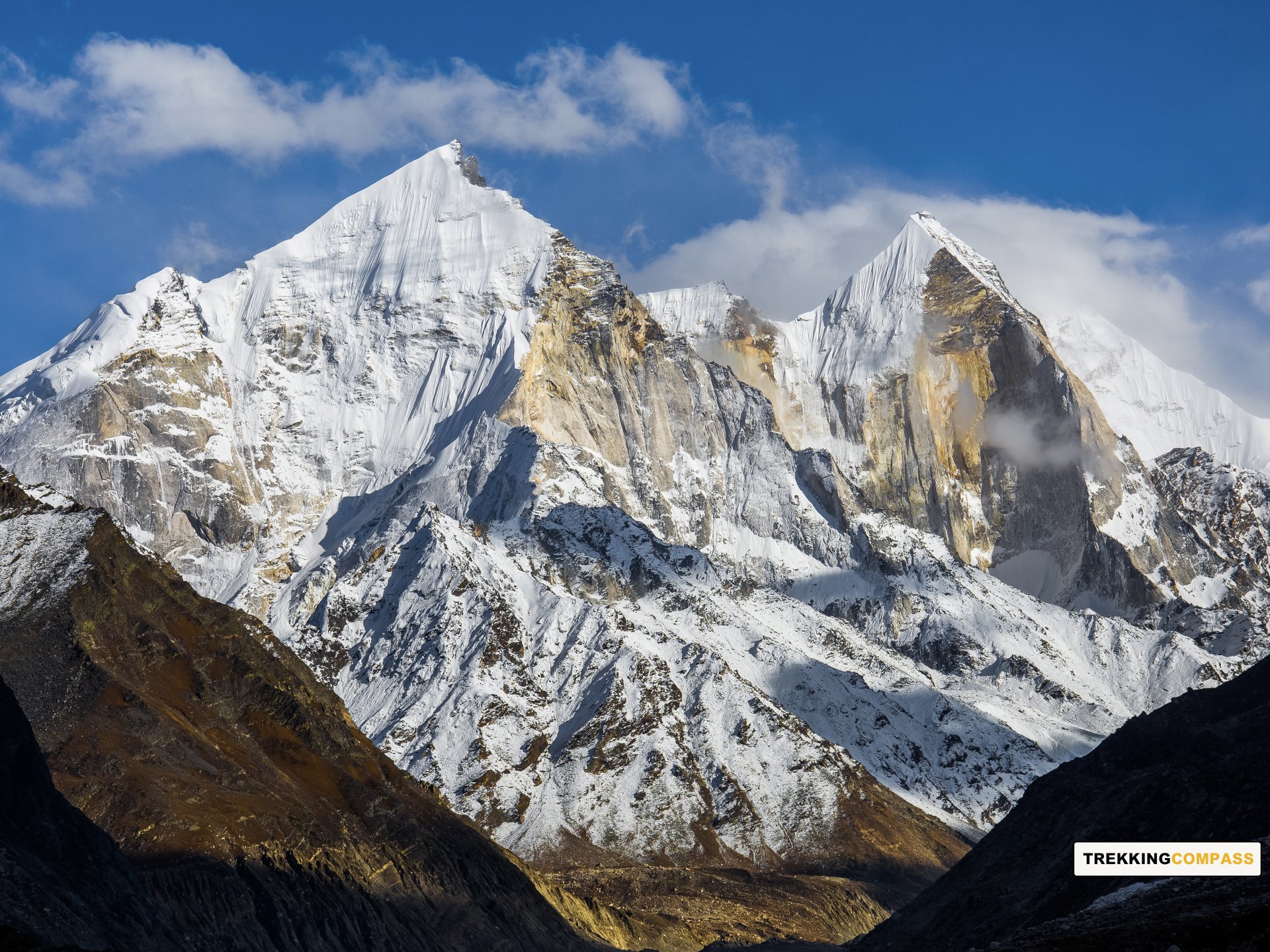
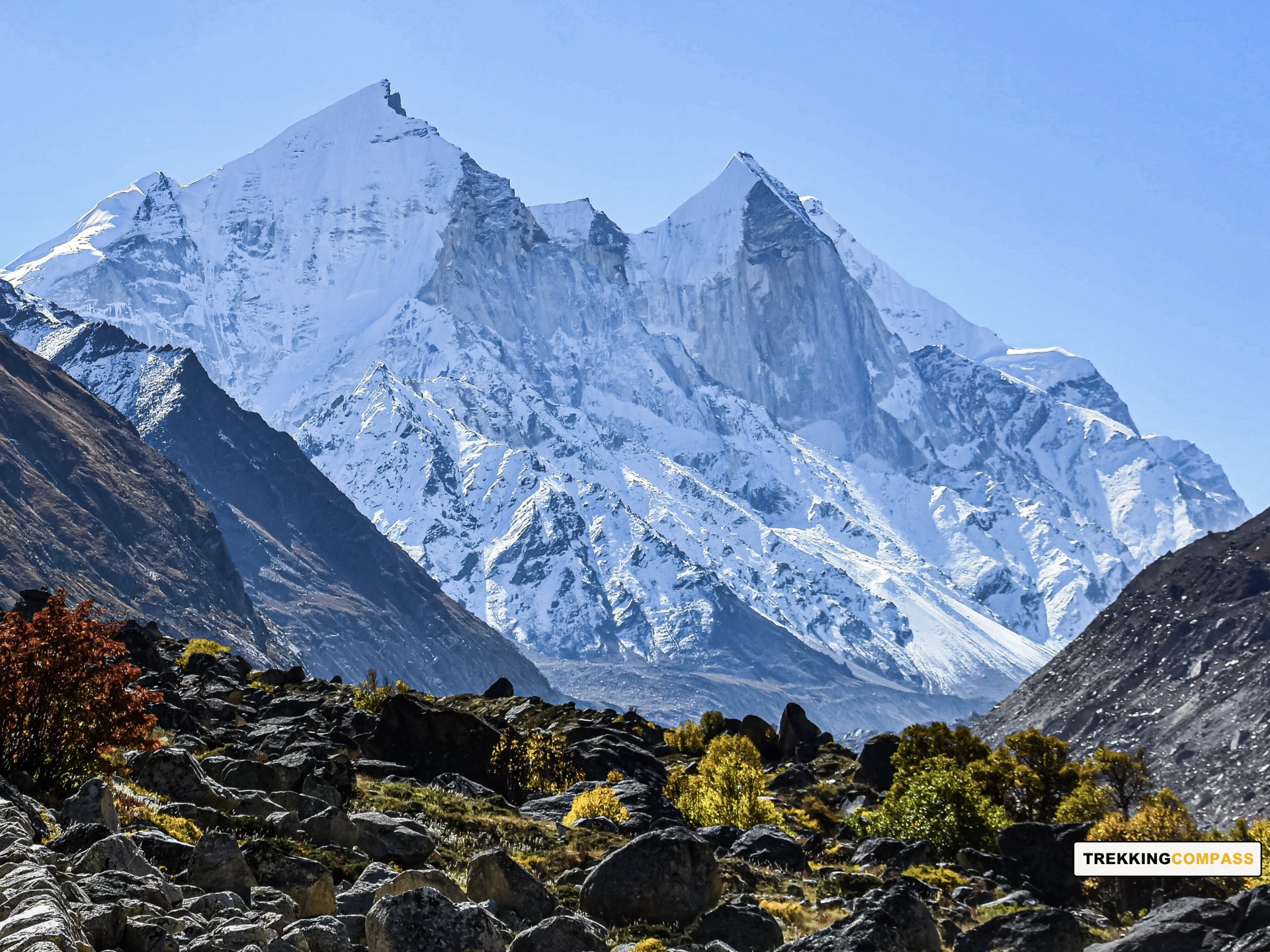
The Gaumukh Tapovan Trek is a remarkable journey that offers an incredible blend of natural beauty, spiritual connection, and physical challenge. Nestled in the Garhwal region of Uttarakhand, this trek is renowned for taking adventurers deep into the heart of the Himalayas, right up to the source of the holy River Ganga at Gaumukh and beyond, to the serene meadows of Tapovan. Gaumukh, meaning "cow’s mouth," refers to the glacier’s snout, from where the river emerges. Tapovan, situated at a staggering altitude of 14,700 feet, is a vast high-altitude grassland surrounded by towering peaks like Mount Shivling and Meru.
This trek is not merely about reaching a destination but about immersing oneself in the pristine wilderness of the Himalayas. It involves traversing dense forests, vast meadows, glacial terrains, and rocky paths. Each step of the journey unfolds mesmerizing landscapes—from pine-scented woods to barren alpine stretches, culminating in a surreal experience of standing at the foot of some of the most iconic mountains in the world.
What sets the Gaumukh Tapovan Trek apart from other Himalayan treks is its spiritual essence. Gangotri, the trek’s starting point, is one of the four Chota Char Dham pilgrimage sites and holds deep religious significance for Hindus. Pilgrims and trekkers visit Gangotri to pay homage to Goddess Ganga at the ancient Gangotri Temple before embarking on the trek. Along the trail, you can witness sadhus (ascetics) meditating in remote caves, further enhancing the trek’s spiritual atmosphere.
The trek begins with a scenic drive from Rishikesh, passing through Uttarkashi and Harsil, where lush forests, apple orchards, and the ever-present Bhagirathi River provide a picturesque backdrop. From Gangotri, the trail ascends steadily, passing through Chirbasa and Bhojbasa before reaching the glacier. Each campsite offers a unique charm—Chirbasa with its pine forests, Bhojbasa with its wide-open valley views, and Tapovan with its surreal alpine beauty and close-up views of Mount Shivling.
Although challenging due to its high altitude and rugged terrain, the Gaumukh Tapovan Trek rewards trekkers with breathtaking views, tranquility, and a deep sense of accomplishment. It’s a journey that not only tests physical endurance but also rejuvenates the mind and soul, making it a truly unforgettable experience for anyone seeking adventure and solace in the Himalayas.
Gangotri Altitude: 10,060 ft (3,066 m)
Altitude Gain: 8940 ft (2,723 m)
Travel Distance: 260 km
Travel Hours: 9 hrs (approx.)
Your journey begins in the spiritual town of Rishikesh, often called the Yoga Capital of the World. From Rishikesh, a long but scenic drive takes you through the picturesque towns of Uttarkashi, Harsil, and the dense forests of the Garhwal region. As you ascend, the Ganges River accompanies you for much of the route, offering captivating views of its pristine waters cutting through the valleys.
The journey to Gangotri is an experience in itself, as you pass through apple orchards and witness breathtaking views of snow-clad peaks in the distance. En route, you can visit the famous hot springs at Gangnani, where many pilgrims take a dip before proceeding to Gangotri. The winding roads and changing landscapes keep the drive engaging, with pine forests and rocky cliffs enhancing the overall beauty.
Upon arrival at Gangotri, you can explore the revered Gangotri Temple dedicated to Goddess Ganga. Pilgrims from across the country visit this temple to seek blessings. Spend the night at a guesthouse or campsite, preparing for the trek that starts the next day. The cool mountain air and spiritual ambiance of Gangotri make it an ideal starting point for your trekking adventure. Ensure you take enough rest and acclimatize to the altitude.
Chirbasa Altitude: 11,650 ft (3,551 m)
Altitude Gain: 1,590 ft (485 m)
Travel Distance: 9.5 (approx.)
Travel Hours: 6 hrs (approx.)
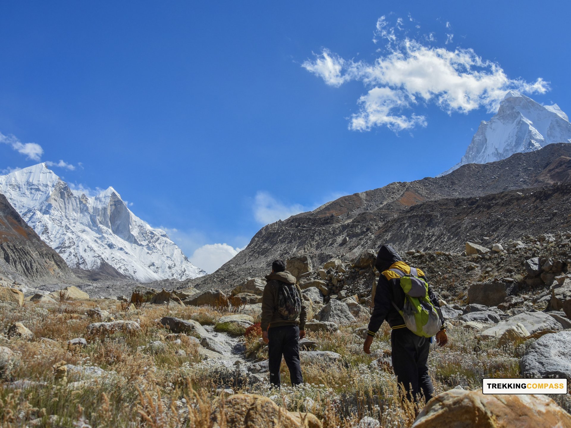
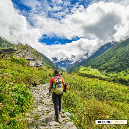
The trek begins with a relatively moderate climb from Gangotri. The trail winds along the Bhagirathi River, offering stunning views of its turquoise waters. As you leave the bustling town behind, the landscape transitions into dense pine forests, with occasional glimpses of snow-covered peaks peeking through the canopy.
The initial section of the trek is marked by a well-paved path, making it easy to navigate. As you proceed, the forested trail provides ample shade, and you can spot a variety of Himalayan flora and fauna. Occasionally, you may encounter herds of mountain goats grazing along the way. The sound of the river flowing nearby adds a calming rhythm to your trek.
Midway through the trek, you will find a few rest points where you can take a break and rejuvenate. Remember to stay hydrated and keep your energy levels up by snacking on dry fruits or energy bars. The final stretch to Chirbasa involves a gentle ascent, and upon arrival, you are greeted by a stunning view of the Bhagirathi peaks.
Chirbasa, meaning "Abode of Pines," is a serene campsite surrounded by tall pine trees. The cool breeze and the picturesque setting make it an ideal place to relax after a long day of trekking. Set up camp, enjoy a hot meal, and spend the night under a star-lit sky.
Bhojbasa Altitude: 12,450 ft (3,795 m)
Altitude Gain: 800 ft (244 m)
Travel Distance: 5 km
Travel Hours: 4 hrs (approx.)
The trek from Chirbasa to Bhojbasa is relatively short but offers equally mesmerizing views. The trail continues along the Bhagirathi River, with the towering Bhagirathi peaks dominating the skyline. As you move forward, the pine forests begin to thin out, and the terrain becomes more barren and rocky.
The initial part of the trail is a gradual ascent, with occasional rocky patches that require careful footing. The Bhagirathi River continues to accompany you, its roaring waters providing a constant backdrop. Along the way, you may encounter trekkers returning from Bhojbasa or Gaumukh, sharing tales of their experiences.
About halfway through the trek, you will notice the vegetation becoming sparse, with only a few shrubs and hardy plants dotting the landscape. This is an indication that you are approaching Bhojbasa, which lies in a more rugged and exposed terrain.
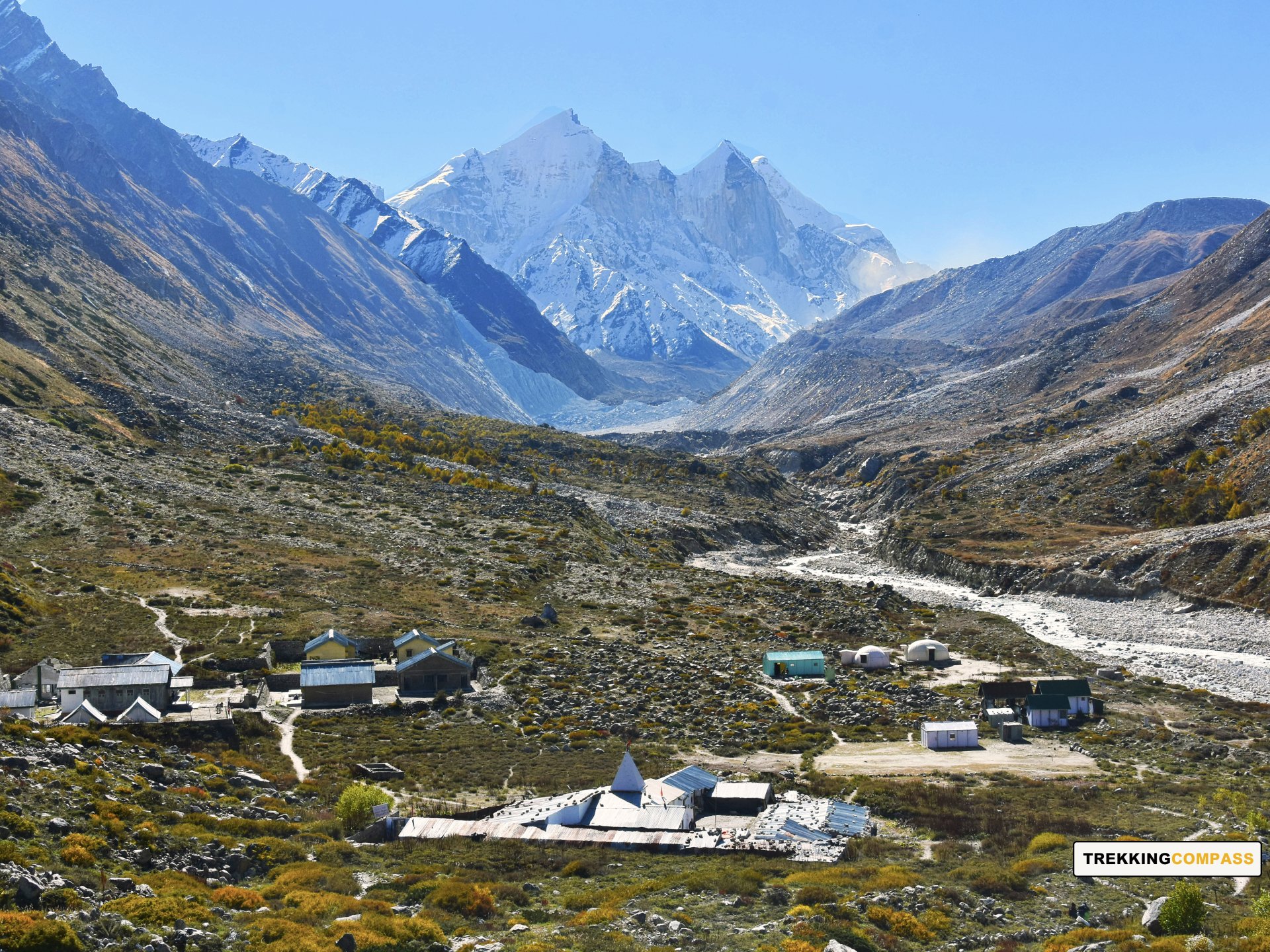
Bhojbasa is named after the Bhojpatra trees that were once abundant in the area. It serves as a popular campsite for trekkers heading towards Gaumukh and Tapovan. Upon reaching Bhojbasa, you can set up camp or opt to stay at the ashram or GMVN guesthouse.
The evening can be spent exploring the surroundings or simply relaxing. The wide-open spaces and the majestic view of the Bhagirathi peaks make for a perfect setting to unwind. As night falls, temperatures drop significantly, so make sure to bundle up and get a good night's rest.
Tapovan Altitude: 14,700 ft (4,480 m)
Altitude Gain: 2,250 ft (686 m)
Travel Distance: 6 km
Travel Hours: 8 hrs (approx.)
The trek from Chirbasa to Bhojbasa is relatively short but offers equally mesmerizing views. The trail continues along the Bhagirathi River, with the towering Bhagirathi peaks dominating the skyline. As you move forward, the pine forests begin to thin out, and the terrain becomes more barren and rocky.
The initial part of the trail is a gradual ascent, with occasional rocky patches that require careful footing. The Bhagirathi River continues to accompany you, its roaring waters providing a constant backdrop. Along the way, you may encounter trekkers returning from Bhojbasa or Gaumukh, sharing tales of their experiences.
About halfway through the trek, you will notice the vegetation becoming sparse, with only a few shrubs and hardy plants dotting the landscape. This is an indication that you are approaching Bhojbasa, which lies in a more rugged and exposed terrain.
Bhojbasa is named after the Bhojpatra trees that were once abundant in the area. It serves as a popular campsite for trekkers heading towards Gaumukh and Tapovan. Upon reaching Bhojbasa, you can set up camp or opt to stay at the ashram or GMVN guesthouse.
The evening can be spent exploring the surroundings or simply relaxing. The wide-open spaces and the majestic view of the Bhagirathi peaks make for a perfect setting to unwind. As night falls, temperatures drop significantly, so make sure to bundle up and get a good night's rest.
Gaumukh Altitude: 13,123 ft (4000 m)
Bhojbasa Altitude: 12,450 ft (3,795 m)
Altitude Loss: 2,250 ft (686 m)
Travel Distance: 6 km
Travel Hours: 6 hrs (approx.)
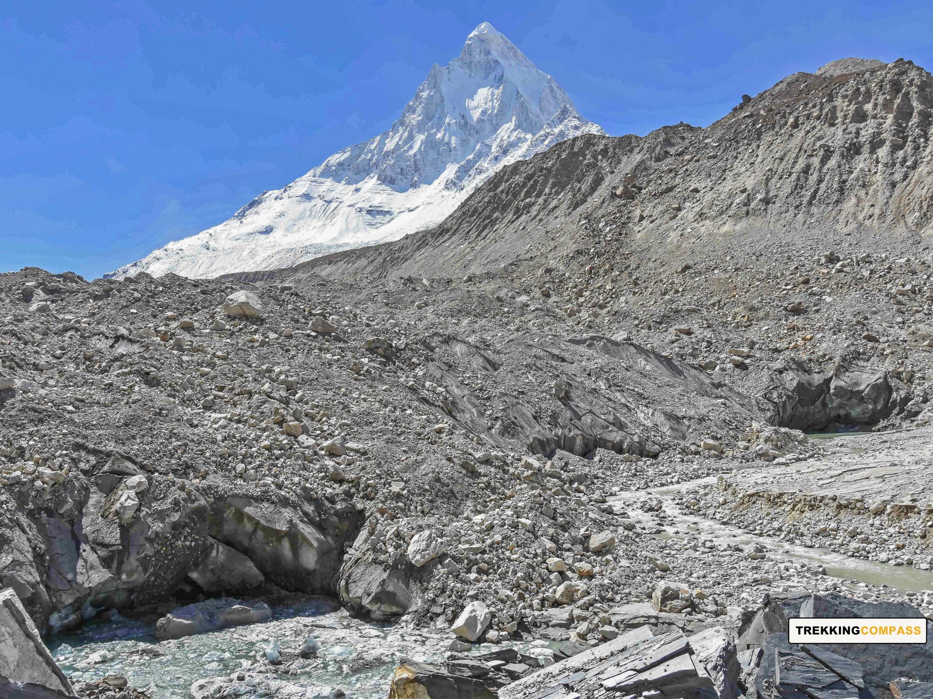
This is the most exciting and challenging day of the trek. The trail from Bhojbasa to Gaumukh, the snout of the Gangotri Glacier, is relatively straightforward but involves walking on loose gravel and rocky terrain. Gaumukh, at an altitude of 13,123 ft (4,000 m), is where the holy River Ganga emerges from the glacier.
After spending some time at Gaumukh, the trek becomes more demanding as you climb steeply towards Tapovan. The ascent involves crossing the glacier and negotiating through moraine and boulder fields. This section requires careful footing and may test your endurance.
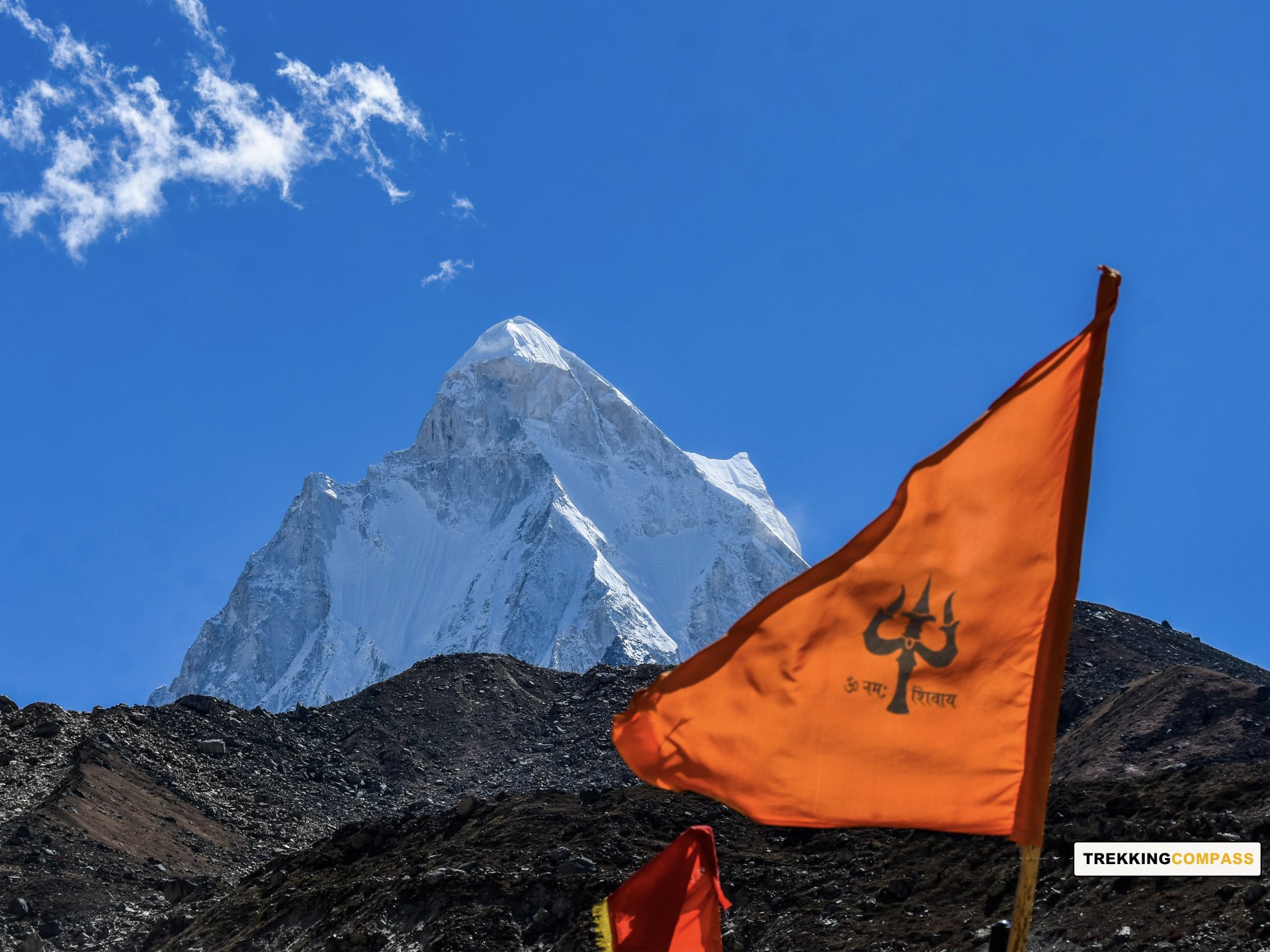
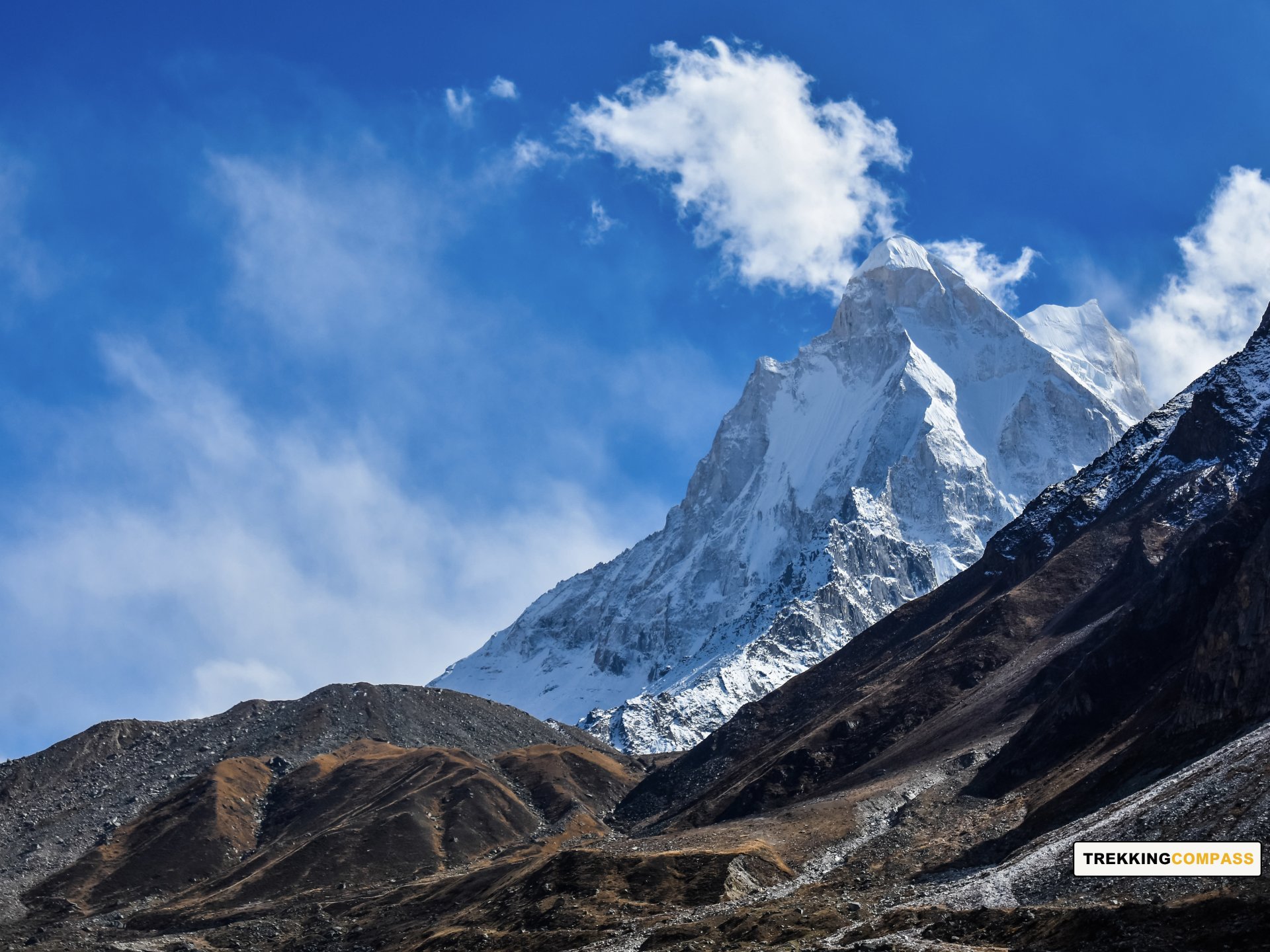
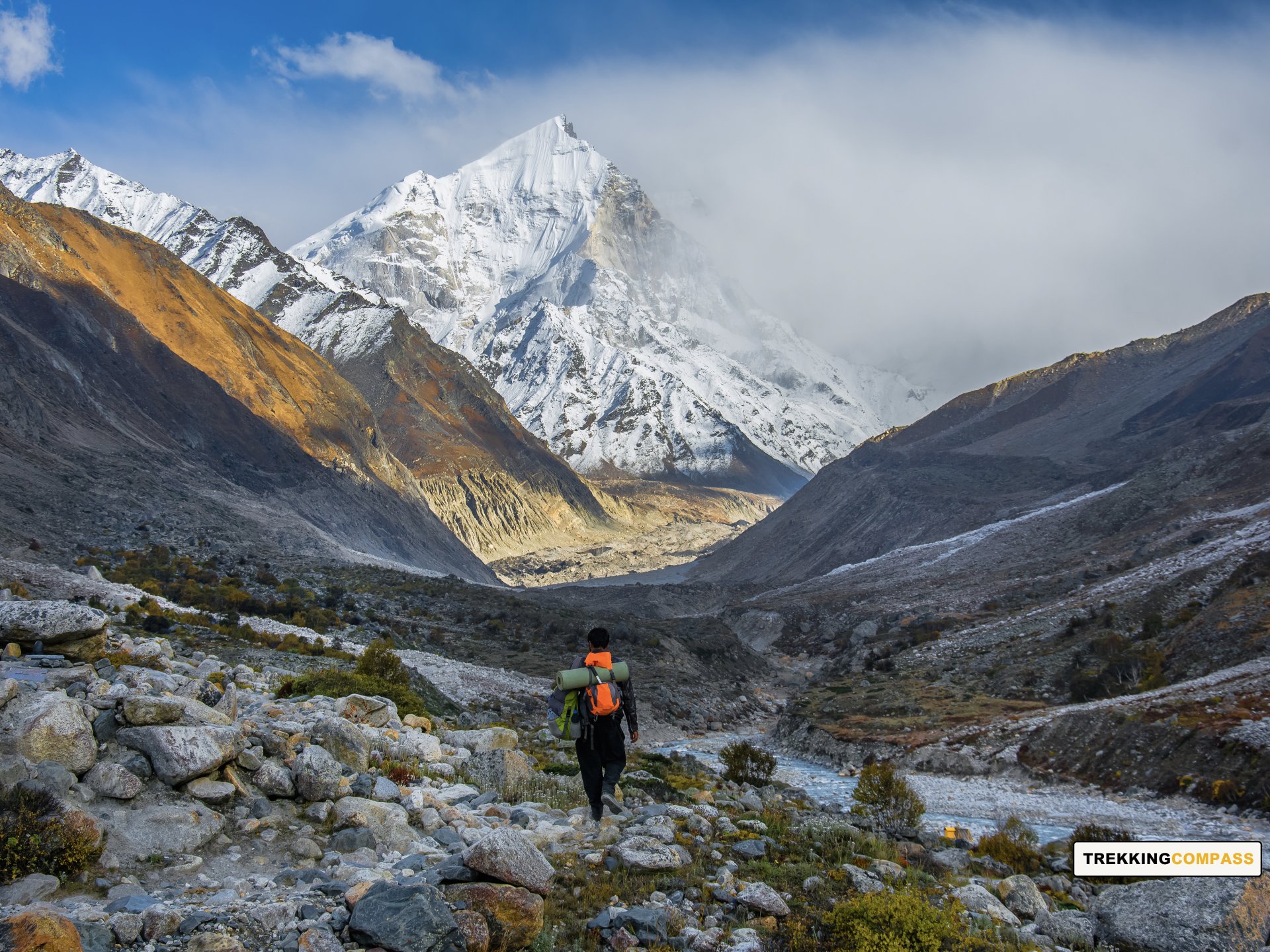
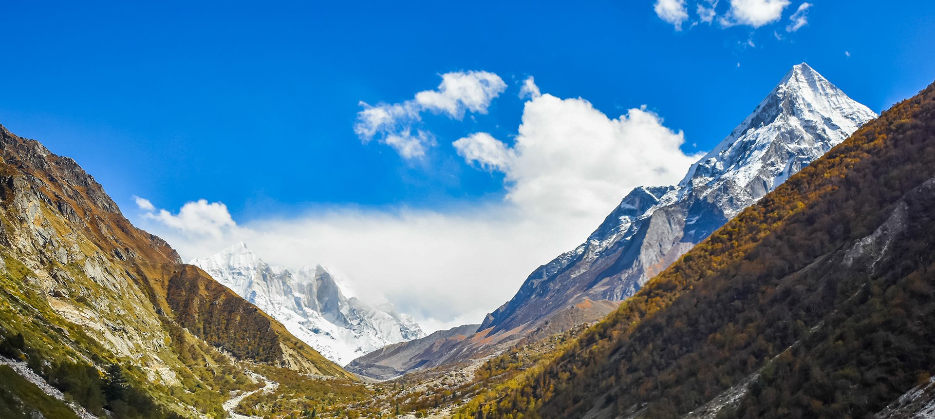
Upon reaching Tapovan, you will be rewarded with panoramic views of the majestic Mount Shivling, Meru, and the Bhagirathi peaks. Tapovan is known for its vast meadows, which are surprisingly lush at such a high altitude.
Begin your descent from Tapovan, retracing your steps through the boulder fields and glacial moraines. The descent is relatively easier, but you still need to be cautious while crossing the glacier. Take a moment to once again appreciate the beauty of Gaumukh before continuing towards Bhojbasa.
As you descend, the oxygen levels increase, making breathing easier. Upon reaching Bhojbasa, you can rest and relax, enjoying the scenic beauty of the valley. The evening can be spent sharing stories with fellow trekkers or simply soaking in the peaceful atmosphere.
Gangotri Altitude: 10,060 ft (3,066 m)
Altitude Loss: 2,390 ft (728 m)
Travel Distance: 14 km
Travel Hours: 7 hrs (approx.)
The final day of trekking involves a long but gradual descent from Bhojbasa to Gangotri. The familiar trail offers stunning views of the river and surrounding peaks. As you approach Gangotri, the pine forests return, and the landscape becomes greener.
Upon reaching Gangotri, you can visit the temple once again to offer your gratitude for a successful trek. The town has several small eateries where you can enjoy a warm meal and reflect on your trekking experience. Spend the night at a guesthouse, resting after a long day of trekking.
Rishikesh Altitude: 1,120 ft (340 m)
Altitude Loss: 8940 ft (2,723 m)
Travel Distance: 260 km
Travel Hours: 9 hrs (approx.)
On the final day, you are in for a long but rewarding drive back to Rishikesh. As you leave the serene town of Gangotri, take one last look at the majestic mountains and the river that guided your trek. The return journey offers a sense of completion and reflection. Driving through the scenic valleys of Uttarakhand, you will pass through several charming villages and towns, each with its unique beauty and culture.
En route, you can make brief stops at picturesque locations or small dhabas to enjoy local delicacies. The winding roads through the mountains gradually lead you down to lower altitudes, with the weather becoming warmer and the air fresher. As you approach Rishikesh, the Ganges once again become a familiar companion, now calmer and wider.
Reaching Rishikesh marks the end of your incredible trekking adventure. You can choose to explore the town's famous ashrams, cafes, and markets or simply relax by the riverbanks, reminiscing about your journey. This trek not only challenges your physical endurance but also enriches your soul with its breathtaking landscapes and spiritual vibes. The memories of the Gaumukh Tapovan Trek are sure to stay with you for a lifetime.
Accommodation
Meals (Vegetarian only )
Nutritious meals from Day 1's dinner to last day's breakfast, following the itinerary schedule.
Expert Support
First Aid Preparedness
Fully equipped medical kit including a stretcher, oxygen cylinder, blood pressure monitor, oximeter, and stethoscope to ensure safety throughout the journey.
Storage Facilities :- A secure room at the base camp to store additional luggage not needed during the trek.
Permits and Entry Fees :- Coverage of all necessary permits and entry fees, in line with standard charges for Indian nationals.
Transportation :- A round-trip transport from the pick-up point and back at the same point as a part of the itinerary.
Trek Equipment
Insurance :- Personal insurance is mandatory and not included in the package.
Personal Expenses :- Any expenses of a personal nature, including shopping, snacks, hiring a mule or porter for carrying your belongings, or acquiring personal equipment.
Emergency Costs :- Expenses arising from emergency evacuations, hospitalization, or any medical treatments required.
Unspecified Services :- Any services or items not explicitly mentioned under the "INCLUSIONS" section.
Food Costs :- We will not cover any food costs during your transit to and from the base village.
Trekking is not only about enjoying the change of scenery but also about being responsible. Our (Trekking Compass) responsibility is to provide you with an opportunity for a safe trek. But, how do we do that? We do that when you fulfill your end of the responsibility and are honest with us. To keep you safe we need to be sure there isn’t any inherent threat to your being.
Treks are at higher altitudes and it becomes difficult, almost impossible to provide you with immediate medical assistance. Therefore, we cannot help you if you don’t help us. Trekking is only one of the things you can do, but there are plenty of other things to do too. Don’t risk your life for the thrill.
To approach a trek with utmost safety, we want you to submit the following documents:
Personal Confirmation Statement (Compulsory for anyone over 18 years)
You are participating in a trek at high altitudes and it comes with its own sets of risks. This Personal Confirmation Statement will make sure that you understand all the risks you're buying into. Trekking Compass wants you to confirm your complete understanding of these risks so that you come prepared for any mental or physical challenges ahead.
This statement is also a declaration from you that, "All the information I have provided, including medical conditions, is true. If found false under any circumstances, I will be held accountable and it has nothing to do with Trekking Compass."
We have the utmost empathy for you and will do our best to help wherever possible, but only after assessing your readiness and safety for the trek. This is how our team will adequately prepare for whatever risks we might face during the journey. Concerning individuals are requested to thoroughly cross-check the requirements and only then sign the document.
Parent/Guardian Approval Statement (Compulsory for anyone below 18 years)
For participants under 18 years of age, the Parent/Guardian Approval Statement is essential to confirm that a legal guardian understands and consents to the participation in the trek. Once we have this document, we are affirmed that the parent or guardian is fully aware of the risks involved in trekking at high altitudes and is consenting to their child's participation.
No underage (below 18+) children are welcome on the trek without their parent's consent. Submission of this document reassures us that parents are approving that their child meets the health and fitness requirements for the trek, after a thorough examination.
This legal confirmation holds the parent liable for any discrepancies, freeing Trekking Compass from any liabilities for the same. Parents are requested to thoroughly cross-check the requirements and only then sign the document.
Medical Liability Waiver
The Medical Liability Waiver makes sure participants acknowledge the health risks associated with trekking at high altitudes. Common ailments during treks include altitude sickness, dehydration, muscle cramps, hypothermia, and fatigue, all of which can significantly affect your trekking experience. Additionally, weather changes and the physical demands of the terrain may exacerbate pre-existing conditions.
If you have pre-existing medical conditions such as asthma, diabetes, or heart issues, it’s vital to inform us and carry your necessary medications. Trekking Compass cannot provide immediate medical assistance in remote areas, so having the essential medications, such as inhalers, insulin, or any other prescriptions, is crucial for your safety during the trek.
By signing this waiver, you confirm that you are in good health and have taken the necessary precautions. You acknowledge these risks and agree not to hold Trekking Compass liable for any medical issues or accidents that may arise during the trek.
For any further doubts about anything mentioned above, below is our contact information:
OFFICE ADDRESS: Lane No. 4 Krishna Vihar Mohkampur, Dehradun, Uttarakhand, 248005
PHONE NUMBER: +91 7055048487, 7055048488
EMAIL ADDRESS: info@trekkingcompass.com
HOW TO REACH ? (RISHIKESH)
Note: Keep a buffer day in your getaway in addition to the total days in the itinerary. This day will come in handy in case of any political unrest, landslides, or rains. If not, you can use the extra day to get to know Rishikesh. This means that for an itinerary ending on the 15th of a month, book your return tickets for the 16th.
What are the different ways to reach Rishikesh?
On the Gaumukh Tapovan Trek, our first long-day trip is from Rishikesh to Gangotri (260 km). Therefore, trekkers need to reach Rishikesh to start the trek. The first move to reach Rishikesh for any trekker is to reach either Dehradun or Delhi. Later, every trekker can choose their choice of transport. The available transports for Rishikesh are:
Medium: BUS
A Friendly Note: You should travel by government buses instead of private ones because the private buses tend to take more time than expected. To avoid missing the pick-up time, try traveling by government bus, wherever possible.
Medium: TRAIN
Medium: FLIGHT
Fly Directly to Dehradun and then to Rishikesh: To fly directly at Jolly Grant Airport Dehradun, there are multiple flights from metropolitan cities. The companies that facilitate these flights are:
Fly to Delhi then take a bus or train to Rishikesh: It’s very easy to fly to Delhi from anywhere in the country and take a bus to Rishikesh. You will find a detailed description of buses in the BUS section. The companies that facilitate these flights to Delhi are:
Note: Make sure that the mode of transport you choose should bring you to Rishikesh a day before Day 1, i.e., Day 0. You can fly to Delhi and Dehradun from Mumbai, Kolkata, Bengaluru, Chennai, Hyderabad, Pune, and to Dehradun from Delhi too.
What happens on the drop-off day
Here are the points that explain your drop-off:
Special Case: What if you miss our pick-up?
You shouldn't panic and follow one of the below-mentioned ways to Lohanjung:
| Backpack with rain cover / Trolley Bag | Main bag for gear. |
| Day pack with rain cover (20 - 30 L) | For day essentials, if the main pack is off-loaded. |
| Walking stick | Recommended (at least one). |
| Water bottle/ Hydration pack | 2 bottles (1L each) or 1 hydration pack and 1 bottle. |
| Snacks | Energy bars, dry fruits, ORS/electrolytes. |
| Personal Medical Kit | As prescribed by your doctor. |
| T-shirts (Synthetic, quick-dry) | 2 full-sleeve, 2 half-sleeve. |
| Fleece T-shirts | 2 pieces. |
| Wind-stopper / Fleece jacket (upper) | 1 piece. |
| Windproof jacket | 1 piece |
| Down feather / Hollow jacket | 1 piece |
| Thermal innerwear (Upper & Lower) | 1 set. |
| Trekking pants (Synthetic, quick-dry) | 3 pairs. |
| Wind-stopper / Fleece pants (lower) | 1 pair. |
| Waterproof gloves | Not required. |
| Fleece / Woolen gloves | 1 pair. |
| Poncho / Waterproof jacket and pants | 1 set. |
| Head torch / Hand torch | 1 piece. |
| Sun cap | Required. |
| Woolen cap | 1 piece. |
| Balaclava | 1 piece. |
| Buff/ Neck gaiters | 1 synthetic, 1 woolen. |
| Sunglasses | UV protection with side covers (for spectacle users: contacts or photochromatic lenses). |
| Trekking shoes (waterproof, high ankle, good grip) | 1 pair. |
| Floaters / Flip-flops | 1 pair. |
| Cotton socks | 4 pairs. |
| Woolen socks | 2 pair. |
| Sunscreen | 1 piece. |
| Moisturizer | 1 piece. |
| Lip balm/ Chap-stick | 1 piece. |
| Toothbrush and toothbrush | 1 set. |
| Toilet paper and wipes | 1 pack each. |
| Soap/ Hand sanitizer | 1 piece. |
| Quick-dry towel | 1 piece. |
The Gaumukh Trek is one of the most spiritually and geographically important treks in the Indian Himalayas. Located in Uttarkashi, Uttarakhand, this trek takes you to the Gaumukh Glacier, which is the source of the holy Ganga River. The word Gaumukh means “Cow’s Mouth,” as the glacier snout is shaped like the mouth of a cow. The trek is not only a physical journey but also a spiritual pilgrimage, attracting trekkers, saints, and pilgrims alike. Along the trail, trekkers pass through the Gangotri National Park, which is home to alpine forests, rare Himalayan wildlife, and breathtaking views of snow peaks like Shivling, Bhagirathi, and Sudarshan Parbat.
The trek is best done in two windows:
The trek is rated as moderate, suitable for fit beginners but also rewarding for seasoned trekkers. The trail involves gradual ascents through forests and meadows, but the final approach to the glacier snout at 4,000 m requires endurance. The terrain becomes rocky and glacial near the end, demanding careful footing. Compared to treks like Kedarkantha or Brahmatal, Gaumukh is more challenging due to its length and altitude, but it does not involve technical climbing.
The trek is about 46 km (round trip) and usually takes 7 days. It begins at Gangotri (3,100 m), a revered pilgrimage town, and progresses via Bhojwasa and Chirbasa before reaching Gaumukh. Each day involves 5–7 hours of trekking, with gradual altitude gain. Many itineraries also extend the trek to Tapovan (4,463 m), a high-altitude meadow beyond Gaumukh that offers majestic views of Mt. Shivling.
The Gaumukh Glacier snout lies at 4,000 m (13,200 ft). If extended to Tapovan, trekkers climb higher to 4,463 m (14,640 ft). From these altitudes, trekkers can see iconic Himalayan peaks like Shivling (6,543 m), Bhagirathi I–III, and Sudarshan Parbat.
Not strictly, but prior experience is helpful. The trek can be done by fit beginners with preparation, but its longer distance and higher altitude make it more demanding than easy treks like Dayara Bugyal or Chopta–Chandrashila. Those with no trekking background should train well in advance with cardio and stamina-building exercises.
Preparing for Gaumukh Tapovan trek means:
The Gaumukh Glacier is considered one of the holiest sites in Hinduism because it is the source of the Ganga, India’s most sacred river. According to mythology, King Bhagiratha meditated to bring the river Ganga to Earth to purify his ancestors, and she descended from heaven through Lord Shiva’s locks at Gaumukh. The trek begins at Gangotri Temple, one of the Char Dham shrines, making it a journey of both devotion and adventure.
At Gangotri, there are hotels, lodges, and dharamshalas for pilgrims and trekkers. During the trek, accommodation is either in GMVN guesthouses (such as at Bhojwasa) or tented campsites. Bhojwasa has ashrams and forest rest houses as well, which provide basic facilities.
Yes. Since the trek passes through the Gangotri National Park, entry permits are required. These can be obtained from the forest office at Uttarkashi or Gangotri. A limited number of trekkers are allowed per day to preserve the fragile ecosystem. ID proof is mandatory for obtaining permits. Trekking compass will take care for all your permits, as it is included in the package given to you.
The trek begins from Gangotri town (3,100 m).
Yes, since the trek reaches 4,000 m, trekkers are at risk of Acute Mountain Sickness (AMS). Symptoms include headache, nausea, dizziness, and fatigue. Proper acclimatization, hydration, and gradual ascent are key. If extending to Tapovan (4,463 m), trekkers must be extra cautious. Guides usually carry basic first aid and oxygen cylinders.
Yes, with proper guidance. The trail is popular and well-marked, especially till Bhojwasa. However, the glacier zone near Gaumukh has loose rocks and boulders, requiring caution. Monsoon trekking is unsafe due to landslides. With a certified trek leader and proper gear, the trek is considered safe for both solo trekkers and groups.
Because it combines natural grandeur with spiritual depth. Few treks allow you to witness the birthplace of India’s most sacred river, while also offering Himalayan beauty and cultural significance. For beginners, it is a gateway into high-altitude trekking, and for seasoned trekkers, it is a pilgrimage as well as an adventure. Standing at the snout of Gaumukh, watching the Ganga gush out of ancient ice, is an experience that blends spirituality, history, and raw nature into one unforgettable journey.
Our trek leaders are trained in first aid and equipped with oxygen cylinders and stretchers. The nearest medical facilities are available at Gangotri, and evacuation arrangements are made if required. Travel insurance covering trekking is strongly advised.
Yes, trekkers who don’t wish to carry their backpack can opt for mule/porter services at an extra cost. This allows you to trek light while still enjoying the Gaumukh Tapovan trek experience.
Handpicked routes with strong scenery, reliable pacing, and a premium featured block that still stands apart from the rest of the archive page.
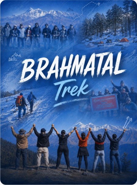
Crafted routes, reliable execution, and a trekking experience that feels premium from planning to summit.
 Safety
Route checks, first-aid readiness, and trained leaders to keep every step confident.
 Routes
Better pacing, better camps, and real acclimatization designed for experience, not speed.
 Groups
Less crowd, more care so you enjoy the trek, not just finish it.
 Trust
Trust
Clear inclusions, no hidden surprises, and real human support on WhatsApp.