14% Off

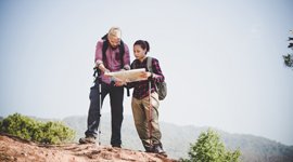
Route Length

Max Altitude

Trek Duration

Trek Difficulty

Base Camp Area

Pickup Point
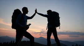
10+ Years Age
First timer can apply, previous trekking experience is more appreciated.
Cover 5 km of distance in 30 minutes without a stress.
+917055048487, +917055048488
trekkingcompass@gmail.com
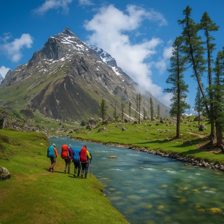
The Kashmir Great Lakes (KGL) Trek is a testament to Amir Khusrau’s quote “Gar firdaus, zamin asto, ami asto, ami asto, ami asto.” Every day has a new set of surprises for the trekkers on the KGL trek. This trek takes you from Shitkadi to Naranag and everything in between. Look on either side and your mouth will only open to say, “WOW!”
KGL Trek gives you several reasons to appreciate its beauty. From the start to finish of this trek, the feeling of peace settles in on your physical, mental, and emotional well-being. Very early in the trek, after you cross Shitkadi (8,350 ft), the traces of humans disappear and almost diminish. You are alone with enough time to look within and learn about yourself.
In the company of the Sind River, you reach the trek’s base camp and then to Shekhdur (a meadow amid the towering mountains). The next stop is Nichnai (3,536 m) at 11,600 ft. The upcoming destinations are Vishansar Lake (12,010 ft), Nichinai Pass (4,023 m), Gadsar Lake (3,322 m), Gadsar Pass (13,700 ft), Satsar (3,654 m), Gangabal Twin Lakes (3,502 m), and Naranag (2,316 m). Every destination has something new to offer like lakes, a pass, and the story behind a stone hut.
All the lakes on this trek have local lore to tell, which keeps you spellbound and wanting more. Sitting there, you will not have time to think about work problems or the stress of returning to the good old hustle and bustle. The 73 km of Kashmir Great Lakes Trek lacks any lows, apart from the vast valleys like Sonamarg Valley.
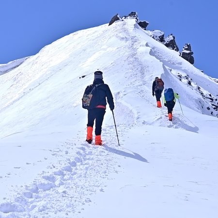
The trek has pinnacles, meadows, boulder zones, glaciers, lakes, mountain views, rocky barren lands, and gurgling streams. There is something for everyone, but if alpine lakes are your calling then this 7-day and 6-night trek in Kashmir is for you. The trek is moderately difficult as the ascents are not as steep, but the trekking trails are as long as 15 km in a day. So, you should always remember, “Trekking is not a race.”
Shitkadi Altitude: 8,350 ft (2,545 m)
Altitude Gain: 3,150 ft (960 m)
Travel Distance: 80 km
Travel Hours: 3 hrs (approx.)
Today marks the beginning of the Kashmir Great Lakes Trek as soon as you meet our representative at Srinagar. You board the vehicles for Shitkadi village here. After a 3-hour drive, you are at the trek’s base village. It is the shortest hectic day for the trek as longer, more strenuous, and far more beautiful days await you.
At Shitkadi village, you have a lot to explore. Eventually, you are in Kashmir, and everywhere your eyes look, they see beauty. The base village is your chance to acclimatize and look at mountain peaks like Amarnath, Tribal, Machoi Glacier, and Kolahoi. Other watchworthy things include the whole way to Shitkadi and the vast meadows expanding around the village.
Your way to Shitkadi is thrilling. You cross the Sind River at Wayil Bridge, and the river accompanies you till Shitkadi. Other attractions on the way are Hung Park, Lavender Field, Ganderbal waterfall, Anchar Lake, etc. The way also takes you over the Jhelum River right after you cross the Darsih Kadal Bridge over the Soner Kol.
After the 3-hour drive, you have the entire day to explore around the campsite. You can talk to the locals, take pictures (they are Instagram-worthy!), and contemplate the days ahead. Time slows down here, so don’t be in a hurry. Take your time. Take evening snacks, have dinner, and rest for the day. The trek starts tomorrow.
Nichinai Altitude: 11,600 ft. (3,536 m)
Shekdur Altitude: 11,100 ft. (3,383 m)
Altitude Gain: 3,250 ft. (991 m)
Travel Distance: 11 km
Travel Hours: 7 to 8 hrs
Today’s trek involves a steep ascent, then a descent, and finally an easy ascent to Nichinai (Campsite 1). The trail makes an almost inverted triangle because of the descent to Shekhdur. Shekdur lies at a lower elevation on the trail and is a must-visit on the Kashmir Great Lakes trek. Shekdur is the last forest cover you find on this trail, and it does justice to its scarce nature. You rarely see any trees, except one after Shekdur.
The trek starts at 3 km from Sonmarg. You recognize the starting point by a lone Dhaba at the right side of the Sonamarg-Srinagar road. Here, you descend the main road towards the Sind River, and once on its level, ascend starts. Soon, you are in a green meadow. The meadow is where you get a clear view of Sonamarg. As you ascend on this trail, other small villages around Sonamarg also open up and make a beautiful sight.
At the top of this meadow, a tree line starts to appear. These trees are mostly Maple and Pine. After a while, you descend to a small brook, and the climb begins again. Not long after, you are in a dense Maple forest cover (a rarity only found in Kashmir). These Maple trees follow you till the treeline ends as you ascend a pass. As you stand on the pass, you have a meadow in front of you, and in the back, you see the maple tree fringes you trekked from.
Slowly descend from the pass into the green meadows with Silver Birch trees all around. This 40-ft meadow is rich in little brooks and has some shepherd huts. It’s also considered the last human touch on this trek, and the next one is at Naranag directly. But that’s not the case, and you see it on Day 5! The meadow you are currently enjoying is Shedhur. Several trekkers camp here if they are coming directly from Srinagar. But, our campsite (Nichinai) for the day is 2.5 hrs from here.
After a time well spent in Shekdur meadow, it’s time for a gradual ascent to the River valley. An upstream river divides the meadow and eventually joins the Sindh River. In this valley, you go along the river bank, and behind are the snow-clad mountains of the Sonamarg Valley. In the front, you have a promise of a beautiful campsite after a trek through the rocks. The vast, green valley that opens up is Nichinai (Campsite 2). Enjoy the night sky, your dinner, and a good night’s sleep before tomorrow’s trek.
Vishansar Lake Altitude: 12,010 ft (3,661 m)
Nichinai Pass Altitude: 13,200 ft. (4,023 m)
Altitude Gain: 1,600 ft (488 m)
Altitude Loss: 1,190 ft (363 m)
Travel Distance: 13 km
Travel Hours: 7 hrs (approx.)
Like yesterday, today’s itinerary includes a long trek, but it’s less strenuous than the 14 km trail from yesterday. Thanks to the altitude, the day begins at Nichnai campsite and the cold glacial water stream beside it. By now you know the campsite is perfect for camping with a night sky appearing at an arm’s distance. What makes this day more special is the Vishansar Lake (the 1st Great Lake on the KGL trek).
The trek starts with a gradual ascent to a ridge visible from the campsite, but do not mistake it for Nichnai Pass. The Nichnia pass only comes up after two inward turns on the ascent from the campsite to the pass at 13,200 ft. On your way to the Nichnia pass, you encounter thousands of sheep grazing on these beautiful high-altitude meadows in Kashmir. It’s surreal and nothing like the scattered sheep population seen on the treks in Uttarakhand.
The grasslands on the KGL trek extend for kilometers. It’s pure beauty everywhere you see. If the bugyals of Dayara and Ali-Bedni surprised you, then you should know that the KGL meadows put them both to shame. Once you are atop the Nichnai Pass, you only have descent left for the rest of the day till Vishansar Lake.
Nichnai Pass allows you to rest at a Maggie point. Nearby, there’s a painted rock that says, “Don’t destroy nature; it is our future.” Follow this lesson during and after the trek to keep enjoying nature in all its glory.
As you leave the Nichnai pass behind, you descend into a beautiful valley lined with Ladakh-like mountains. The valley’s grandeur opens up in front of you as you descend downwards and into the valley. The mountains on the valley's left have snow patches that give them an appraisable contrast. For flora enthusiasts, the valley is covered in wildflowers that come in different colors. In some places, they make the greenish grass appear painted maroon on its tips.
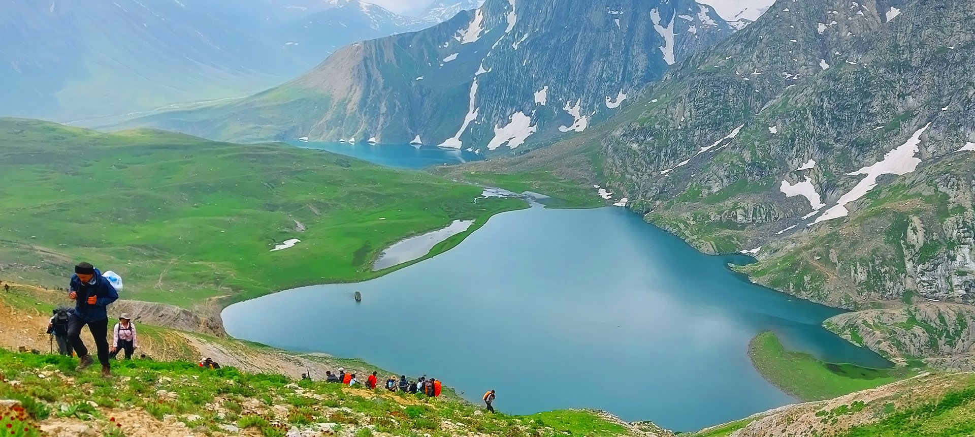
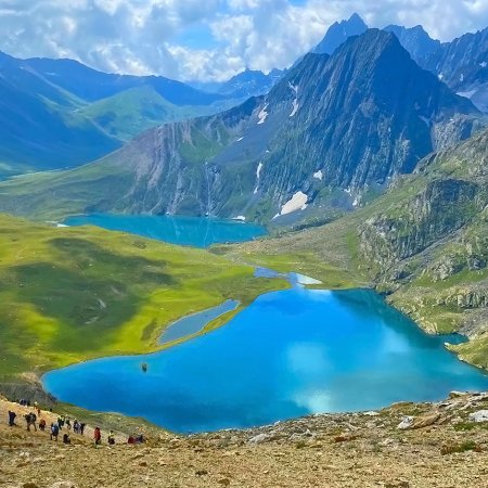
Your walk halts as you reach a stream that cuts through the valley, dividing it in two. For the remainder of today’s trek, walk alongside the stream and watch the valley opening up to a potential cricket stadium (a perfect campsite if allowed). Soon enough you are at Vishansar Lake, also called Vishnusar (because it’s dedicated to Lord Vishnu). This lake looks amazing from a top view, almost like a nature-made infinity pool on one side. On the other side, 4 peaks tower over the lake. The reflection of Kishansar Peak with the others on this lake, is a site to die for. This lake changes colors at different times of the day. It’s clear in the morning and blue during the day.
Vishansar Lake gets its water from the glaciers around it and the Kishansar Lake behind it. A stream of water flows from the lake and in front of our campsite (100 ft below Vishansar) for the day.
Gadsar Lake Altitude: 10,900 ft. (3,322 m)
Gadsar Pass Altitude: 13,700 ft. (4,176 m)
Altitude Gain: 1,690 ft (515 m)
Altitude Loss: 2,800 ft (853 m)
Travel Distance: 15 km
Travel Hours: 9 hrs (approx.)
Today is the most scenic and challenging segment of the KGL trek. In 9 hours, you cover the 15 km from Vishansar Lake to Gadsar Lake at 10,900 ft. The 1st half of this trail has a steep altitude gain of 1,690 ft (515 m) as you ascend to the trek's highest point, Gadsar Pass. It stands at an impressive 13,700 ft (4,176 m). The altitude loss after crossing the pass is 2,800 ft (853 m) as you descend to Gadsar Lake, located at 10,900 ft (3,322 m).
Trek starts at a narrow trail etched into the mountainside at the Kishansar Lake. Follow this trail without paying attention to the diverging paths, and stick to the track leading higher up the ridge. The climb usually takes around 1.5 hours from the 9 hours you have to clock today. Roughly 45 minutes into the ascent, you get the second reward of the day after Kishansar Lake as you view Kishansar and Vishansar Lakes glistening together below you. Atop the ridge, you are at Gadsar Pass, the highest point of your trek. From this point onwards, the view of a valley dotted with small lakes and lined with snow-clad peaks opens up for you.
The descent from Gadsar Pass is straightforward but steeper than other descents on this trek. On your way to Gadsar Lake, you pass Yamsar Lake, which locals believe is associated with Lord Yama. Another nameless lake follows soon after the Yamsar Lake. The trail now takes you to a valley filled with vibrant wildflowers. They are available in different colors like red blossoms, blue, and purple Iris flowers. This floral spectacle is also your landmark when you are approaching Gadsar Lake.
Situated at the base of towering, snow-covered cliffs, Gadsar Lake presents a serene landscape, with blue wildflowers blooming on one side and snow slabs sliding into the lake on the other. A crystal-clear stream connects Gadsar with the lakes above it. You may choose to camp near Gadsar Lake for its sheer beauty, but only if you can leave the area as spotless as you found it. Note that most trekkers do not camp here. However, if you choose to, there is a small abandoned shelter nearby.
If camping at Gadsar Lake isn’t an option, continue downhill on the trail. Within half an hour, the valley broadens, and you’ll spot another blue lake to your left. As you descend further, the snow-covered mountains give way to lower, barren peaks. After an hour of descent, you’ll come across a few shepherd huts. Continuing further downhill, you’ll enter a beautiful tree-lined area, signaling the end of the day’s trek.
Satsar Altitude: 11,990 ft (3,654 m)
Altitude Gain: 1,090 ft (332 m)
Travel Distance: 10 km
Travel Hours: 6 hrs (approx.)
After a refreshing night at Gadsar Lake, your journey continues towards Satsar, a serene collection of alpine lakes nestled at an altitude of 11,990 ft (3,654 m). The trek covers a distance of 10 km, taking approximately 6 hours with an altitude gain of 1,090 ft (332 m). This stretch promises unique landscapes, a moderate climb, and picturesque campsites.
The trail begins by crossing a gentle stream. From here, follow the path that winds up the mountain. The terrain feels reminiscent of a typical Western Ghats trek—lush greenery with trees and a river valley below you. As you ascend steadily, the tree line recedes, offering expansive views of the valley. This hour-and-a-half-long climb elevates you by around 1,100 ft, bringing you to an altitude of 11,500 ft.
At this point, the trail transitions into a more relaxed traverse. The path curves gently to the left, leaving the river valley behind. You’ll now find yourself walking on a flat meadow surrounded by towering mountains. To your right, a few deep craters dot the landscape—this area is known as Maengandob. The scenery ahead is captivating, with isolated mountain peaks in the distance. A small ridge appears to the right, while a flat green bed stretches in front, crisscrossed by a meandering stream. This makes for an excellent campsite, especially if you started your day at Gadsar Lake.
If you began from the Gadsar army camp, it’s wise to push ahead and camp closer to the Satsar lakes. Crossing the ridge, you’ll reach the Satsar army checkpost, a crucial checkpoint that marks the third line of defense near the Line of Control. As with earlier checkpoints, you’ll need to undergo the standard process of identity verification and questioning. It’s best to complete this formality today, ensuring a hassle-free trek tomorrow.
Just 10 minutes beyond the army camp, you’ll arrive at the first of the Satsar lakes. This lake, surrounded by lush greenery and towering mountains, is quite large and offers a stunning, tranquil setting. Depending on the season, you may spot 4 to 5 lakes with water, though Satsar is known for having a total of 7 lakes in the region. Find a suitable spot near the first lake and set up camp for the day. This is a great place to relax and take in the scenic beauty before continuing your trek the next morning.
Gangabal Twin Lakes Altitude: 11,490 ft (3,502 m)
Zaj Pass Altitude: 13,100 ft (3,992 m)
Altitude Gain: 1,110 ft (338 m)
Altitude Loss: 1,610 ft (499 m)
Travel Distance: 10 km
Travel Hours: 6 hrs (approx.)
Today is about the destination because the trail is all boulders and rocky mountains. Your day begins at Satsar Campsite, where after having your breakfast, you start with the shortest trail (10 km) of the Kashmir Great Lakes Trek. You can choose between two routes on this trail to Gangabal. One goes through the last and the largest of the Satsar Lakes, and the other goes uphill from the Satsar campsite.
Trail 1: Mild Ascent→ Gradual Descent→ Long Steep Ascent→ Long Steep Descent→ Mild ups → Mild Downs.
Trail 2: Long Steep Ascent→ Long Steep Descent→ Mild ups → Mild Downs.
These trails become one after you climb that last steep ascent of the day and the entire Kashmir Great Lakes Trek to Zaj Pass. At 13,100 ft, Zaj Pass gets the crown for the highest point on the KGL trek. The long and steep climb to the Zaj Pass is stony. It has no traces of the beautiful meadows you crossed the previous day.
At Zaj Pass, you have two weirdly opposite views on either side. In the front, you have Mt. Satmukh (also called “Harmukh”) and two glacial lakes at its foot. The name Harmukh also translates to ‘Shiv ka Mukut.’ Among the two glacial lakes, the bigger one is Gangabal Lake, and the relatively smaller one is Nundkul Lake.
A little down the Zaj Pass, you will realize that the stream from Gangabal Lake joins Nundkul Lake. A ridge separates the two lakes from each other, and it is advisable to avoid crossing the lakes through the stream, no matter how low the water flow.
The close view of the lakes makes the descent appear shorter, but it is not. You cross two streams, one small meadow, and a wooden bridge to reach the shores of the Nundkul lake. Spend some time there and then take a 20-minute hike to reach Gangabal Lake on the left side of Mt. Harmukh (5,142 m).
Gangabal Jheel has stories of Kashmiri Pandits performing the last rites here. Parallels are also drawn between Gangabal waters and Maa Ganga (River Ganges), so much so that its running water is called Harmukh Ganga. Every year on Ashtami, the Kashmiri Pandits gather here for the Harmukh Gangbal Yatra.
Gangabal Twin Lake’s beauty is in its views of the streams descending Mt. Harmukh, the popular trout fishing, the Hanuman temple, and wild rats around the place. This lake is around 2 km lengthwise, making it the lengthiest known lake on KGL Trek. It will take an hour or two to go around this lake.
Naranag Altitude: 7,600 ft (2,316 m)
Srinagar Altitude: 5,200 ft (1,585 m)
Altitude Loss: 6,290 ft (1,917 m)
Travel Distance: 14 km (trek) + 50 km (drive) = 64 km (approx.)
Travel Hours: 6 hrs + 2 hrs = 8 hrs (approx.)
Today is the last day of the Kashmir Great Lakes Trek, and you wake up near two popular lakes. On your left-hand side is Nandkol Lake, and Gangabal Lake is in front. Today, you transcend down from here to Naranag and Srinagar. It’s time to say your goodbyes, pack the best memories and carry them down.
The trek begins early, as we can only cross the checkpost at Naranag before 4 pm. Today’s trail from Gangabal to Naranag is mostly descent, with a 200 km ascent within the tree fringes of the pine forest on your way back. For the first 30 minutes, you descend gradually from the Gangabal campsite and the usual cell signal troubles, but that changes soon for Airtel users. For others, it marks the end of the descent on a ridge, and they enter a green meadow. This meadow is brimming with tiny yellow flowers that add to its charm.
After this meadow, you gradually descend to the treeline visible in the front. An hour into today’s trek, you are at the tree line and continue on the trail that goes through the fringes of the dense pine forest. It is the only part of today’s trek where you ascend from 10,800 ft to 11,000 ft. Being a gradual ascent, you will hardly realize it. Soon, you’ll be inside that area’s thick pine forest cover.
The trail remains at 10,800 ft for ⅔ rd of the trek distance and only starts to descend after you leave back the thick tree cover. Now is the time for your toes and knees to feel the heat as the steep ascent begins. The beginning trail is muddy and rough but less challenging than the rocky and bizarre trail ahead. This trail and the steep ascent are why Shitkadi is a better place to start than here. Still, you will see some trekkers climbing uphill from Naranag. You get that ‘sigh of relief’ once you cross the gate at Naranag that reads: Kashmir Great Lakes.
Naranag has an ancient Hindu Temple that people often visit, so if we’ve got the time, a trip to our rich history is a must. The temple remains in its remains, with only a Shivling intact. You can learn more about the place from the locals at Naranag. Lastly, you’ll board the vehicles for Srinagar and reach there within the next 2 hours.
Accommodation
Meals (Vegetarian only with eggs option available)
Nutritious meals from Day 1's dinner to last day's breakfast, following the itinerary schedule.
Expert Support
First Aid Preparedness
Fully equipped medical kit including a stretcher, oxygen cylinder, blood pressure monitor, oximeter, and stethoscope to ensure safety throughout the journey.
Storage Facilities :- A secure room at the base camp to store additional luggage not needed during the trek.
Permits and Entry Fees :- Coverage of all necessary permits and entry fees, in line with standard charges for Indian nationals.
Transportation :- A round-trip transport from the pick-up point and back at the same point as a part of the itinerary.
Trek Equipment
Insurance :- Personal insurance is mandatory and not included in the package.
Personal Expenses :- Any expenses of a personal nature, including shopping, snacks, hiring a mule or porter for carrying your belongings, or acquiring personal equipment.
Emergency Costs :- Expenses arising from emergency evacuations, hospitalization, or any medical treatments required.
Unspecified Services :- Any services or items not explicitly mentioned under the "INCLUSIONS" section.
Food Costs :- We will not cover any food costs during your transit to and from the base village.
Trekking is not only about enjoying the change of scenery but also about being responsible. Our (Trekking Compass) responsibility is to provide you with an opportunity for a safe trek. But, how do we do that? We do that when you fulfill your end of the responsibility and are honest with us. To keep you safe we need to be sure there isn’t any inherent threat to your being.
Treks are at higher altitudes and it becomes difficult, almost impossible to provide you with immediate medical assistance. Therefore, we cannot help you if you don’t help us. Trekking is only one of the things you can do, but there are plenty of other things to do too. Don’t risk your life for the thrill.
To approach a trek with utmost safety, we want you to submit the following documents:
Personal Confirmation Statement (Compulsory for anyone over 18 years)
You are participating in a trek at high altitudes and it comes with its own sets of risks. This Personal Confirmation Statement will make sure that you understand all the risks you're buying into. Trekking Compass wants you to confirm your complete understanding of these risks so that you come prepared for any mental or physical challenges ahead.
This statement is also a declaration from you that, "All the information I have provided, including medical conditions, is true. If found false under any circumstances, I will be held accountable and it has nothing to do with Trekking Compass."
We have the utmost empathy for you and will do our best to help wherever possible, but only after assessing your readiness and safety for the trek. This is how our team will adequately prepare for whatever risks we might face during the journey. Concerning individuals are requested to thoroughly cross-check the requirements and only then sign the document.
Parent/Guardian Approval Statement (Compulsory for anyone below 18 years)
For participants under 18 years of age, the Parent/Guardian Approval Statement is essential to confirm that a legal guardian understands and consents to the participation in the trek. Once we have this document, we are affirmed that the parent or guardian is fully aware of the risks involved in trekking at high altitudes and is consenting to their child's participation.
No underage (below 18+) children are welcome on the trek without their parent's consent. Submission of this document reassures us that parents are approving that their child meets the health and fitness requirements for the trek, after a thorough examination.
This legal confirmation holds the parent liable for any discrepancies, freeing Trekking Compass from any liabilities for the same. Parents are requested to thoroughly cross-check the requirements and only then sign the document.
Medical Liability Waiver
The Medical Liability Waiver makes sure participants acknowledge the health risks associated with trekking at high altitudes. Common ailments during treks include altitude sickness, dehydration, muscle cramps, hypothermia, and fatigue, all of which can significantly affect your trekking experience. Additionally, weather changes and the physical demands of the terrain may exacerbate pre-existing conditions.
If you have pre-existing medical conditions such as asthma, diabetes, or heart issues, it’s vital to inform us and carry your necessary medications. Trekking Compass cannot provide immediate medical assistance in remote areas, so having the essential medications, such as inhalers, insulin, or any other prescriptions, is crucial for your safety during the trek.
By signing this waiver, you confirm that you are in good health and have taken the necessary precautions. You acknowledge these risks and agree not to hold Trekking Compass liable for any medical issues or accidents that may arise during the trek.
For any further doubts about anything mentioned above, below is our contact information:
OFFICE ADDRESS: Lane No. 4 Krishna Vihar Mohkampur, Dehradun, Uttarakhand, 248005
PHONE NUMBER: +91 7055048487, 7055048488
EMAIL ADDRESS: info@trekkingcompass.com
Note: You are in for trekking in the mountain areas, where the probability of landslides, rains, etc., is widespread. Sometimes, political unrest becomes a hindrance in your trek itinerary. Communal tensions at Srinagar can also be a reason for a curfew, usually under control now, but better cautious than sorry. Therefore, while booking your return tickets, keep a buffer day. For instance, if your trek is 6 days long, book a return ticket for the 7th day.
What are the different ways to reach Srinagar?
Kashmir Great Lakes Trek starts when you reach Srinagar. Hereon, you are up for a 3-hour drive to Shitkadi, and it is all trekking from there. Therefore, you should all know “How to reach Srinagar?” To reach Srinagar, reaching any major airports in North India should be your goal, but direct flights from southern cities with major airports like Bangalore are also available. The complications arise when you aren’t chosing by air transport and a combination. Therefore, these are the available transports to Srinagar for your ease of use:
Medium: Bus/Car
1.A Must-Know: Bus Specific
No buses, from any major or minor city in India travel directly from that city to Srinagar. All trekkers planning to reach Srinagar by bus have to compulsorily switch buses at Jammu. At Jammu ISBT, you take the State Transport Bus to Srinagar. This bus takes 7 hours to cover the distance between Jammu and Srinagar. The other option is a shared cab for 700 - 1000 INR/person.
You can get direct buses to Jammu from the following cities:
To reach the above cities, you either need to be living there or you can board flights, trains, or buses to whichever city is the closest to you.
For Cars/Taxis
Srinagar is well connected to the road network throughout India, making it an ideal destination to reach while having enjoyed a road trip. There are no permit requirements, other than the usual tolls and state border checks. An Inner Line Permit (ILP) is only required if you are going near restricted borders.
If you have days to spare before the trek starts, you can choose a taxi or a personal car to reach Srinagar. Get a rough idea of the days below:
Medium: TRAIN
There is no direct train to Srinagar, so, for the train's scenic views to Srinagar, you need to switch from train to bus/taxi and then back to a train. Below you will see how it pans out. Popular train routes to Jammu Tawi are from these places within India:
Once you are at Jammu Tawi Railway Station, you get to choose from the below two:
1: Jammu Tawi Railway Station to Udhampur to Banihal to Srinagar
Jammu Tawi to Udhampur: 53 km by Train (1 hr approx.)
Udhampur to Banihal: 88 km by bus/car (2 to 3 hrs approx.)
Banihal to Srinagar Railway Station (SINA): 80 km by local train (1 to 1.5 hours approximately), where you are to pay a ticket fee of 20 INR for adults and 10 INR for kids.
From SINA, you can reach Srinagar City Centre through a cab. The distance between the station and the centre is: 7 to 8 km.
Note: The train ticket is 940 INR for the Vistadome train running from Banihal to Srinagar.
2:Jammu Tawi Railway Station to Banihal to Srinagar: Train + Bus + Local Train
Jammu Tawi to Banihal: 155 km by Cab/Bus (4 hrs approx.)
Banihal to Srinagar Railway Station (SINA): 80 km by local train (1 to 1.5 hours approximately), where you are to pay a ticket fee of 20 INR for adults and 10 INR for kids.
Note: The train ticket is 940 INR for the Vistadome train running from Banihal to Srinagar.
3:Jammu Tawi Railway Station to Jammu ISBT to Srinagar
In this way, you take a train to Jammu, and complete the rest of the journey on the bus or shared cab to Srinagar.
Tip: Chances of getting a cab at Jammu ISBT>>> Chances of getting a cab at Jammu Tawi Railway Station. So, travel to Jammu ISBT to catch a cab quickly. The fares to reach Jammu ISBT by bus and auto are 10 INR & 80 to 100 INR respectively.
Medium: FLIGHT
Fly Directly to Srinagar: Almost 10 major cities around India have airports that offer direct flights to Srinagar. You have to reach that city and fly to Srinagar Airport. These cities are:
From Srinagar Airport, the City Centre is at a 12 km distance i.e., a 20 to 30-minute cab ride.
Note: Make sure that the mode of transport you choose should bring you to Srinagar a day before Day 1, i.e., Day 0. You can even fly to Delhi and Dehradun from Mumbai, Kolkata, Bengaluru, Chennai, Hyderabad, Pune, and Dehradun from Delhi.
What happens on the drop-off day?
Here are the points that explain your drop-off:
Special Case: What if you miss our pick-up?
You shouldn't panic and follow one of the below-mentioned ways to Srinagar:
1st Way: Delhi to Jammu Tawi Railway Station then to Srinagar (train)
2nd Way: Delhi to Jammu ISBT then to Srinagar (by bus)
Note: The start points shall vary according to your convenience.
| Backpack with rain cover / Trolley Bag | Main bag for gear. |
| Day pack with rain cover (20 - 30 L) | For day essentials, if the main pack is off-loaded. |
| Walking stick | Recommended (at least one). |
| Water bottle/ Hydration pack | 2 bottles (1L each) or 1 hydration pack and 1 bottle. |
| Snacks | Energy bars, dry fruits, ORS/electrolytes. |
| Personal Medical Kit | As prescribed by your doctor. |
| T-shirts (Synthetic, quick-dry) | 2 full-sleeve, 2 half-sleeve. |
| Fleece T-shirts | 2 pieces. |
| Wind-stopper / Fleece jacket (upper) | 1 piece. |
| Windproof jacket | 1 piece |
| Down feather / Hollow jacket | 1 piece |
| Thermal innerwear (Upper & Lower) | 1 set. |
| Trekking pants (Synthetic, quick-dry) | 3 pairs. |
| Wind-stopper / Fleece pants (lower) | 1 pair. |
| Waterproof gloves | Not required. |
| Fleece / Woolen gloves | 1 pair. |
| Poncho / Waterproof jacket and pants | 1 set. |
| Head torch / Hand torch | 1 piece. |
| Sun cap | Required. |
| Woolen cap | 1 piece. |
| Balaclava | 1 piece. |
| Buff/ Neck gaiters | 1 synthetic, 1 woolen. |
| Sunglasses | UV protection with side covers (for spectacle users: contacts or photochromatic lenses). |
| Trekking shoes (waterproof, high ankle, good grip) | 1 pair. |
| Floaters / Flip-flops | 1 pair. |
| Cotton socks | 4 pairs. |
| Woolen socks | 2 pair. |
| Sunscreen | 1 piece. |
| Moisturizer | 1 piece. |
| Lip balm/ Chap-stick | 1 piece. |
| Toothbrush and toothbrush | 1 set. |
| Toilet paper and wipes | 1 pack each. |
| Soap/ Hand sanitizer | 1 piece. |
| Quick-dry towel | 1 piece. |
The Kashmir Great Lakes Trek (KGL) is often described as the crown jewel of Indian treks. It takes trekkers through a series of breathtaking alpine lakes set amidst lush meadows and snow-capped peaks in the Kashmir Valley. The trek covers seven major lakes — Vishansar, Krishansar, Gadsar, Satsar, Gangbal, Nundkol, and Yamsar — each uniquely colored and fed by glacial streams. The route traverses high passes, rolling grasslands, and river valleys, all framed by the Himalayan giants of the Pir Panjal and Zanskar ranges. It’s a photographer’s paradise and a dream for nature lovers, offering unparalleled views of Kashmir’s raw, untouched beauty.
The trek is open from late June to mid-September, the only time when snow melts enough to make the route accessible.
The trek is rated moderate to difficult due to its long walking days and multiple high passes. You’ll be trekking for 6–8 hours daily over mixed terrain — meadows, moraines, boulders, and snow patches. However, the gradual ascent and descent make it manageable for fit beginners with good stamina. Proper acclimatization and pacing are key.
The KGL trek covers approximately 72 km over 7 days, including travel days.
The highest point of the trek is Gadsar Pass (4,200 m / 13,800 ft). Several camps, like Vishansar and Gangbal, are above 3,500 m. The altitude gain is gradual, allowing for good acclimatization, but trekkers should remain aware of altitude-related fatigue.
While not mandatory, prior high-altitude trekking experience is recommended due to the trek’s length and remoteness. First-time trekkers with solid fitness can complete it comfortably, but mental endurance is crucial. If you’ve done moderate treks like Hampta Pass or Kuari Pass, you’ll find this a natural next step.
Trekkers should be able to jog 5 km in under 35 minutes and sustain 6–8 hours of walking daily with a backpack. The terrain includes steep climbs, river crossings, and high-altitude stretches. Begin preparing at least 4–6 weeks in advance with cardio (running, cycling), endurance exercises, and strength training for legs and core.
The trek lies in the heart of Kashmir’s alpine belt, where shepherds known as Bakarwals graze their flocks during summer. Trekkers often meet these nomadic families, offering a glimpse into centuries-old mountain life. Many lakes hold mythological significance — Vishansar and Krishansar are associated with Lord Vishnu and Krishna, while Gangbal is revered as a sacred site linked to Lord Shiva. The region’s blend of Sufi and Hindu traditions adds a spiritual dimension to the journey.
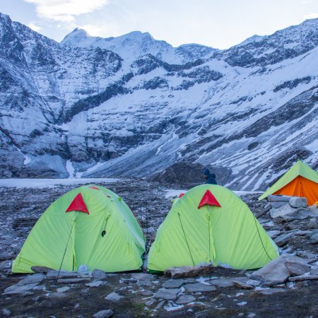
In Srinagar, trekkers usually stay in hotels or houseboats. During the trek, accommodation is in tented camps at scenic locations near lakes or meadows. Each tent (2–3 sharing) includes sleeping bags and mats. Campsites are remote and beautifully set beside rivers or under starry skies, such as Vishansar, Gadsar, and Gangbal.
Yes. The Kashmir Great Lakes Trek requires special trekking and forest permits issued by the Jammu & Kashmir Tourism Department. In addition, trekkers must carry valid ID proofs, as the region is close to sensitive border zones. Trekking Compass will handle all necessary permissions because it is included in the package.
The trek begins from Sonamarg (2,730 m), about 80 km from Srinagar.
Yes, as the trek remains above 3,000 m for several days, mild AMS can occur. Trekkers should acclimatize properly, stay hydrated, and avoid overexertion. The ascent profile is gradual, reducing risks. Symptoms like headache, nausea, or dizziness should be reported to the trek leader immediately. Guides carry oxygen cylinders and first aid kits.
Yes, the trek is safe and well-managed, especially when done with reputed organizers. The route is patrolled by the local army and forest officials. However, weather in Kashmir can change quickly — rain, fog, or even snow at high passes. Trekkers must be prepared with proper rain gear, warm clothing, and follow safety guidelines. Political or curfew-related disturbances rarely affect remote trekking routes, but it’s wise to check local updates before arrival.
Because it’s not just a trek — it’s a journey through paradise. Every step introduces you to a new lake, a new valley, and a new canvas of color. You’ll walk through wildflower meadows, camp beside mirror-like lakes, cross snowfields, and interact with nomads — all while surrounded by majestic Himalayan peaks. For trekkers who dream of seeing the Himalayas in their most pristine, poetic form, the Kashmir Great Lakes Trek is the ultimate experience. It blends adventure, serenity, and culture in one unforgettable expedition — a true masterpiece of Himalayan trekking.
Handpicked routes with strong scenery, reliable pacing, and a premium featured block that still stands apart from the rest of the archive page.

Crafted routes, reliable execution, and a trekking experience that feels premium from planning to summit.
 Safety
Route checks, first-aid readiness, and trained leaders to keep every step confident.
 Routes
Better pacing, better camps, and real acclimatization designed for experience, not speed.
 Groups
Less crowd, more care so you enjoy the trek, not just finish it.
 Trust
Trust
Clear inclusions, no hidden surprises, and real human support on WhatsApp.