14% Off

Route Length

Max Altitude

Trek Duration

Trek Difficulty

Base Camp Area

Pickup Point
10+ Years Age
First timer can apply, previous trekking experience is more appreciated.
Cover 5 km of distance in 30 minutes without a stress.
+917055048487, +917055048488
trekkingcompass@gmail.com
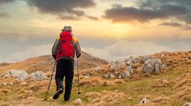
The Chopta-Chandrashila-Deoria Tal trek is outstanding without any questions asked. You have throughout this journey the opportunity to explore places that people dream of visiting. Your journey begins at Rishikesh and ends at Rishikesh, both highly desirable destinations. This is just the tip of the iceberg that is the Deoria Tal Chandrashila trek.
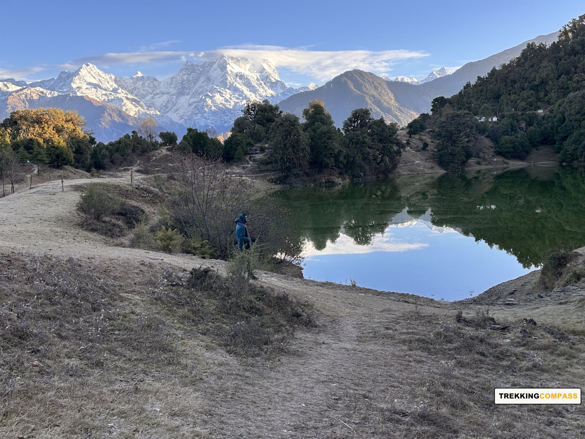
The journey will take you to Sari village whose raw beauty is not to be left unexplored. Then on your trek ahead, you have Deoria Tal, a lake nestled in the Garhwal ranges. This trek rewards you at every stop, like Deoria Tal, a beautiful site surrounded by forests of huge oak and rhododendron trees.
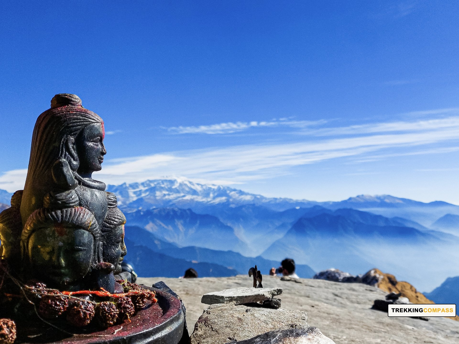
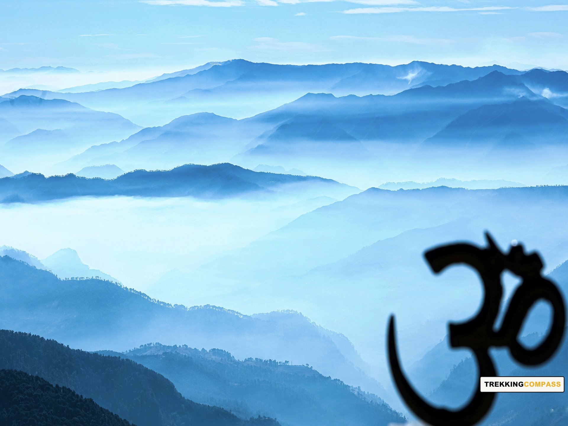
On Chandrashila Deoria Tal Trek, you'll never experience a loss of views of the Indian Himalayan Ranges. Whether from Deoria Tal or Chandrashila you will have unmatched views of peaks like Chaukhambha, Neelkantha, Bandarpoonch, Kedar range, and Kalanag. Some peak views are enough to steal your breath from Chandrashila Summit. These include Trishul Parvat 1 (7,120 m) and 2 (6,690 m), Nanda Ghunti (6,309 m), Chaukhambha 1 (7,138 m) and 2 (6,854 m), and Nanda Devi (7816 m). In total, the Chandrashila Summit at an altitude of 3,690 m offers you out-of-the-world views of 30+ different peaks of the Great Indian Himalayas.
Scenic beauty isn't all that the Chopta Chandrashila and Deoriatal trek has to offer. It is of high religious significance to the Hindu devotees. Every stop has a mythological story to tell and keeps the devotees brimming with emotions. While at Deoria Tal, they are reminded of the 5 Pandavas and their interaction with Yaksha. Throughout the trek from Chopta to Chandrashila, devotees reminisce the essence of Lord Shiva's presence and stories of Lord Rama, Ravana, and 5 Pandavas.
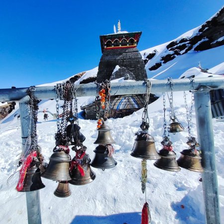
Two other stops make this trek nearly perfect. The Tungnath Mandir is believed to be one of the 5 Kedars, and Chopta, a place often compared to Switzerland. Chopta is also called the “Mini Switzerland of Uttarakhand.” Tungnath breaks down to become Lord of the Peaks where “Tung” stands for Peaks and “Nath” stands for Lord. Living up to its name, a 1 km ascent from Tungnath offers trekkers a thrilling, spellbinding view of the Garhwal Himalayas. If you prefer mystery, look down at the sweeping valleys from the trail’s viewpoints. You'll find yourself smaller and smaller, but being a part of nature, you'll still feel grander than ever before.
Sari Altitude: 6,600 ft (2013 m)
Altitude Gain: 5,490 ft (1,673 m)
Travel Distance: 188 km
Travel Hours: 6 to 7 hrs (approx.)
Trekkers will start their day as they meet our travel instructors who'll help them onboard the vehicles to Sari village. Sari is a small village with a lot of culture and natural beauty, untouched by irrelevant development. To reach this village at an altitude of 6,601 ft, trekkers will drive 188 km from Rishikesh to Sari.
The 6 to 7-hours long drive itself becomes rewarding with the views and locations trekkers will pass through. They will have the opportunity to pass Srinagar, a breathtakingly beautiful city which is the best for getaways and rejuvenation. While on the roads spiralling the Garhwal hills, they'll be witness to pine trees with patches of deodars and oaks at places.
On their way from Rishikesh, trekkers will come across Neer Waterfall and Lakshman Jhula. Sites like these make the drive worth more than the motion sickness some trekkers might face. On reaching Sari trekkers will get ample time to rest at the booked homestays.
Sari village offers the trekkers a range of trees, some are seasonal fruit trees like orange trees. The fields at Sari village during springtime are covered with mustard crops, making the perfect blend of green and yellow. At sunset when trekkers look around, Sari will be the first stop to greet their eyes with a vibrant sunset at Chandrashila Peak.
Deoria Tal Altitude: 7,900 ft (2,408 m)
Altitude Gain/Loss: 1,300 ft (396 m)
Travel Distance: 6 km
Travel Hours: 3 to 4 hrs (approx.)
Trekkers will today wake up to a sunrise at Sari village. Away from the hustle and bustle of your daily life, the sunrise will feel heavenly. The shimmering mountain peaks will only add to the overall ambience and elevate everyone's mood. After breakfast at Sari, trekkers will start trekking up the raw trail.
On their way to Deoriatal, which is 3 km from Sari, they'll take 2 to 3 hrs (Max). These will be hours well spent as they'll be gazing at Sari village with a fresh point of view. The paddy fields at the village will be white, green, and yellow depending on the season trekkers are travelling. The trail will take trekkers under the gentle shade of Rhododendron and oak (golden and green) trees.
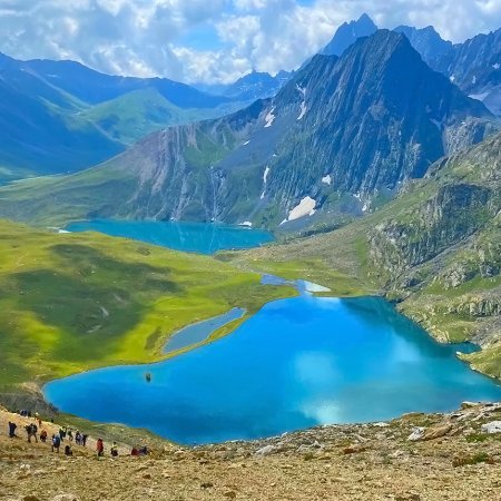
Ascending the steep climb, trekkers will cover forests and open meadows and reach Deoria Tal also known as Devariyatal. The name Devariyatal comes from a mythological story. Some believe it's the Tal where Hindu gods came and took baths. Others believe that it's where Yudhishthira freed his 4 brothers by answering the questions by Yaksha. There's also a Hindu ancient text that mentions the lake as ‘Indra Sarovar.’
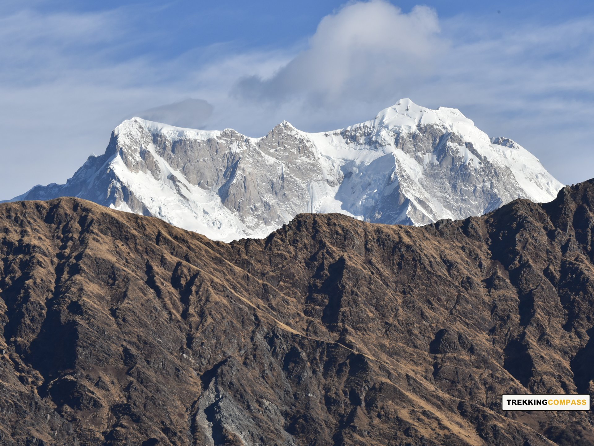
Deoria Tal is famous for Chaukhambha Peak’s reflection on its waters. The view is magnificent as trekkers can see the rare site of Chaukhambha in front of their eyes and it's doubled with the reflection in the lake. Deoria Tal’s watchtower takes the Himalayan view from the lake to a different perspective. Trekkers can get the sights of Chaukhambha, Kedar Dome (6,831 m), Kedarnath, Mandani Parvat (6,193 m), and Thalay Sagar Peak (6,904 m).
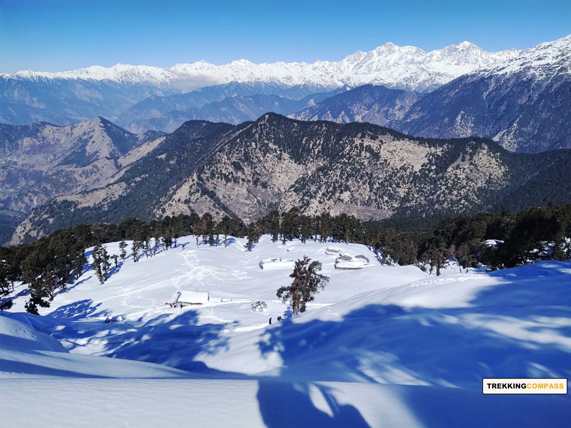
Chopta Altitude: 9,402 ft (2,866 m)
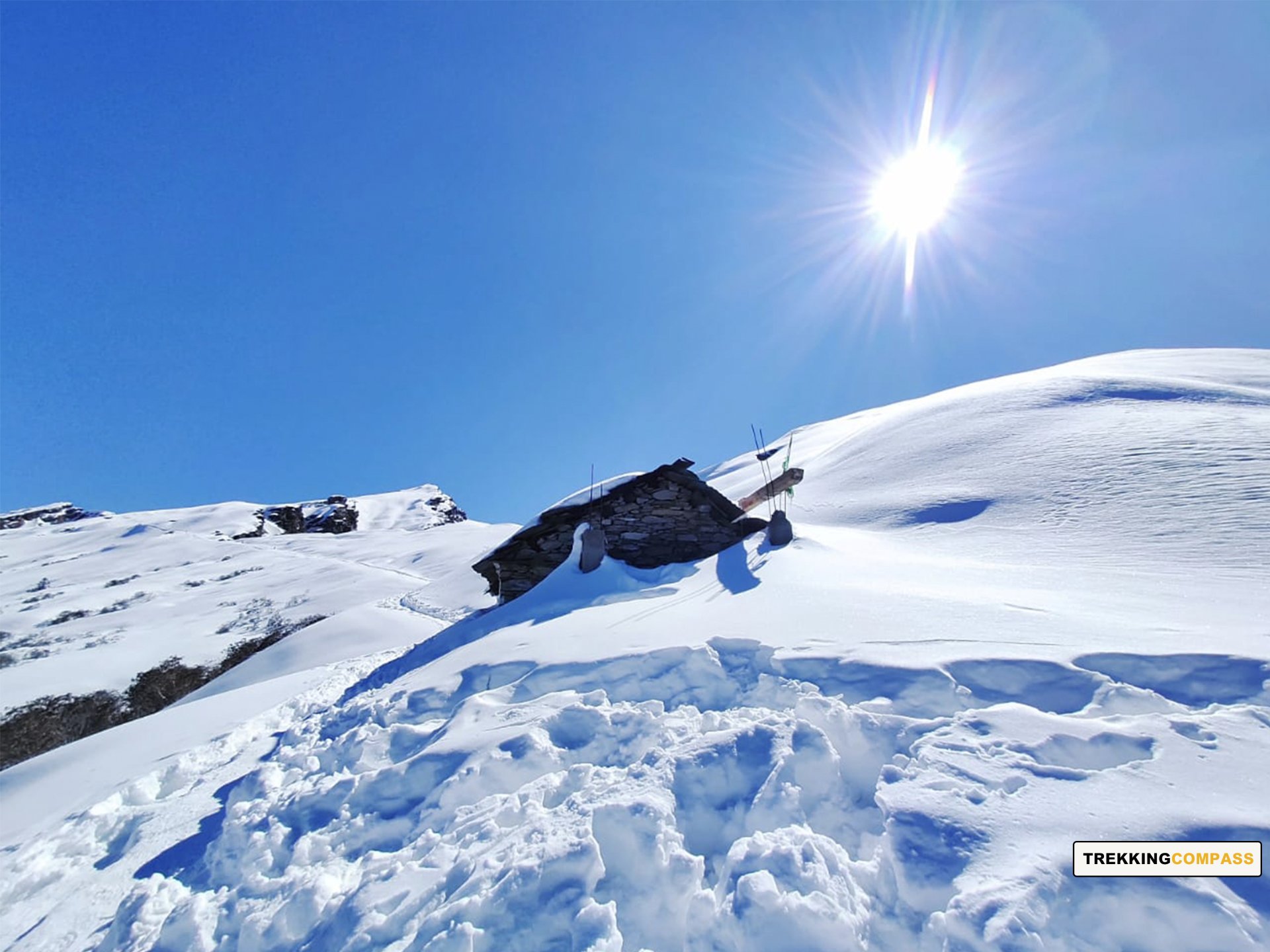
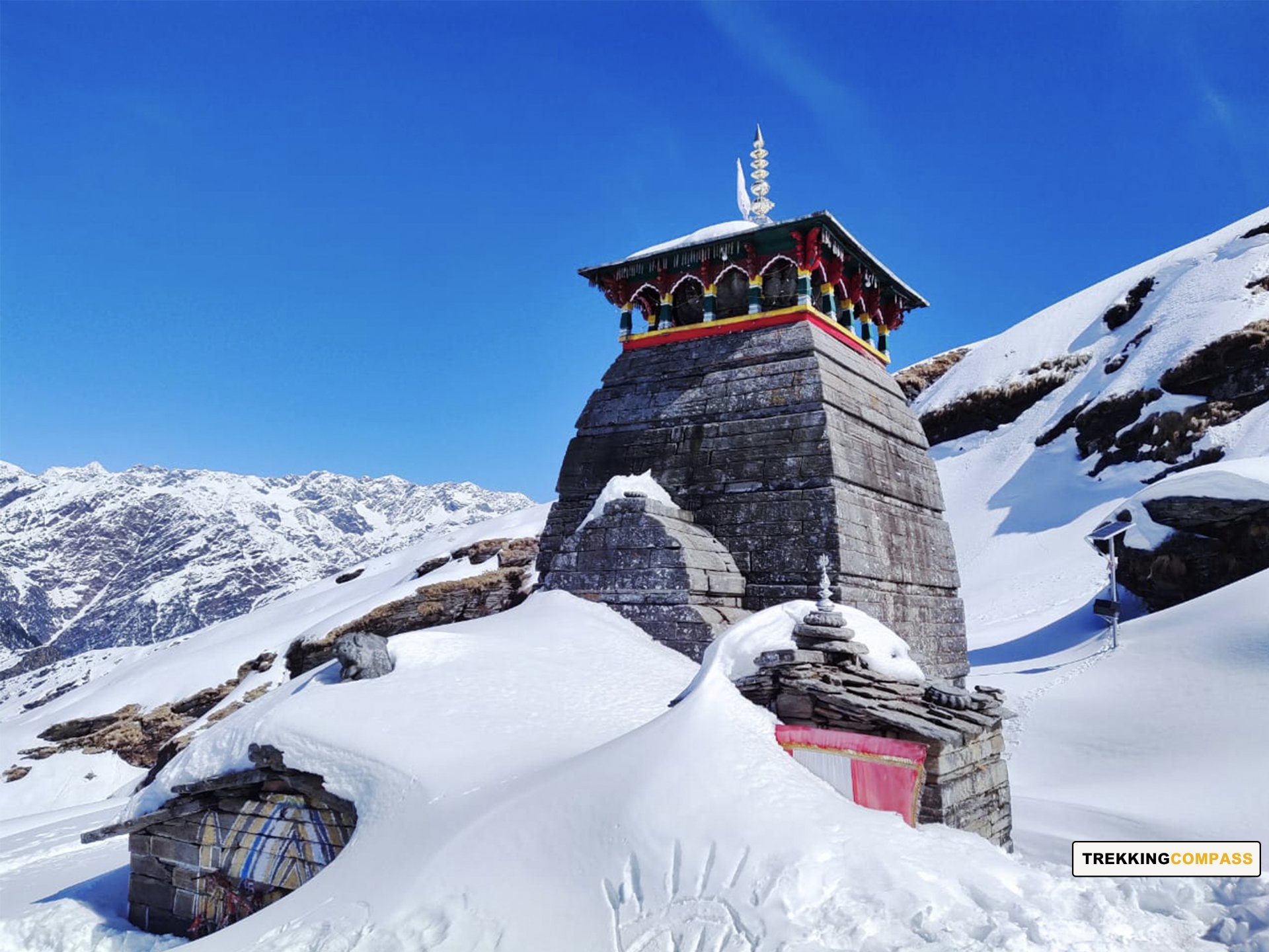
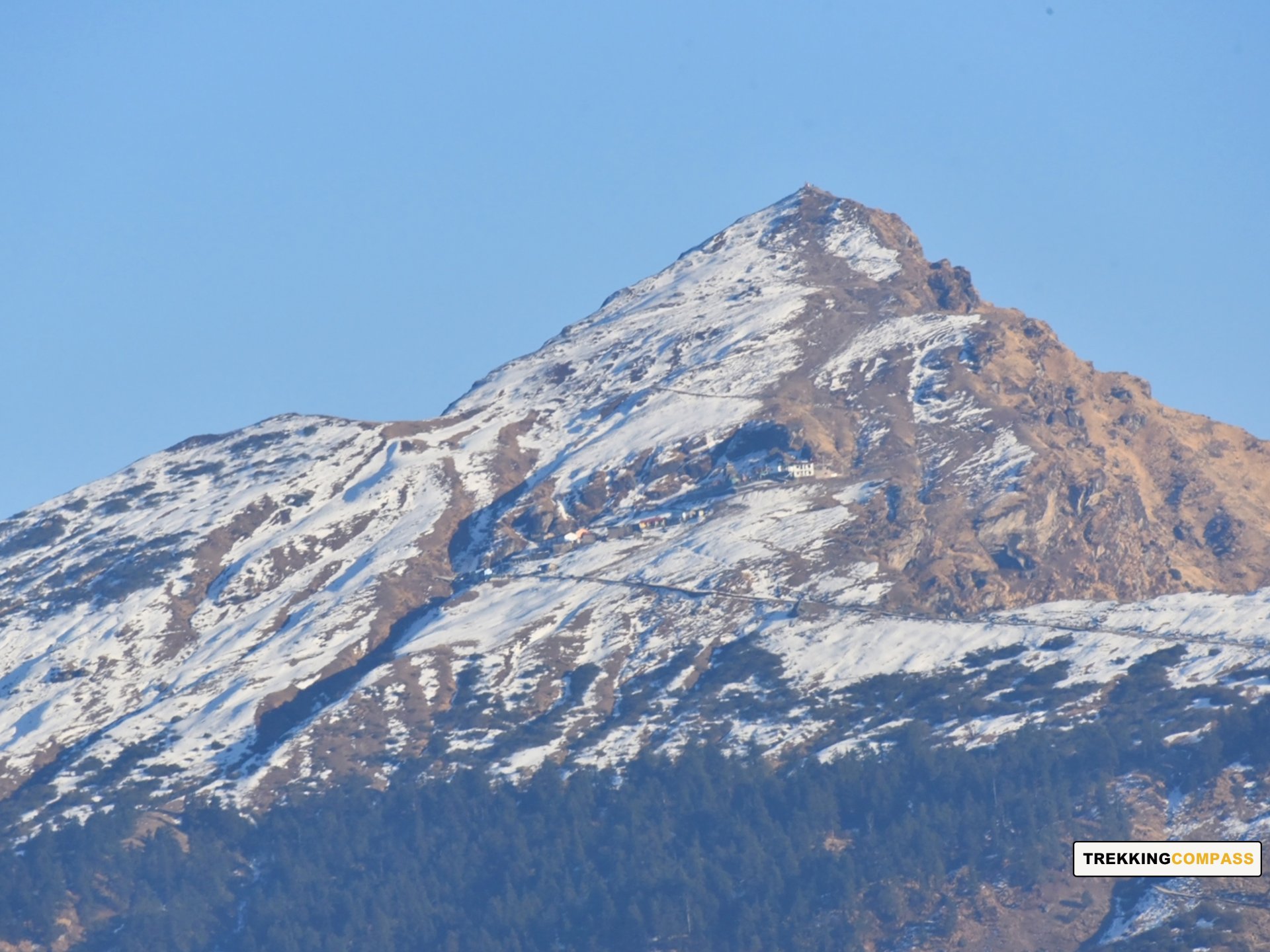
Tungnath Altitude: 12,073 ft (3,680 m)
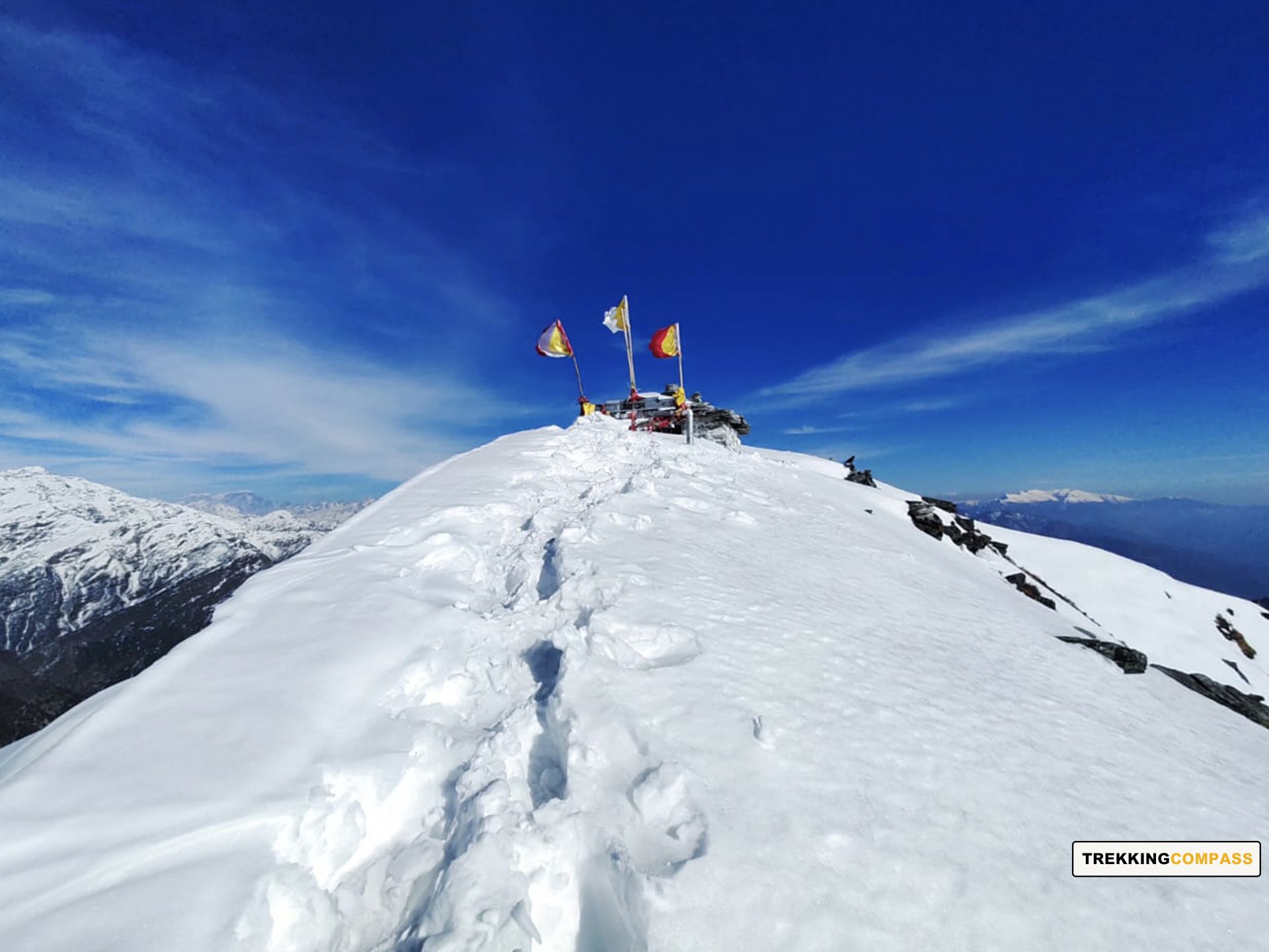
Chandrashila Altitude: 12,100 ft (3,690 m)
Altitude Gain/Loss: 2,698 ft (822 m)
Travel Distance: 20 km (drive) + 5 km + 5 km (trek) (30 km approx.)
Travel Hours: 8 to 9 hrs (approx.)
The day will begin early today keeping in mind, the 20 km drive to Chopta. Then a 10 km trek to Chandrashila through Tungnath Mandir (temple) and back awaits all the trekkers. After the morning breakfast, trekkers will drive through Chopta to the Tungnath Chopta entry gate. All this while towering and accompanying them from afar will be the Chandrashila Peak. The gate reads “तृतीय केदार तुंगनाथ” which translates to “Third Kedar Tungnath.” For Hindu devotees, Tungnath is of great significance, courtesy of the religious beliefs associated with it.
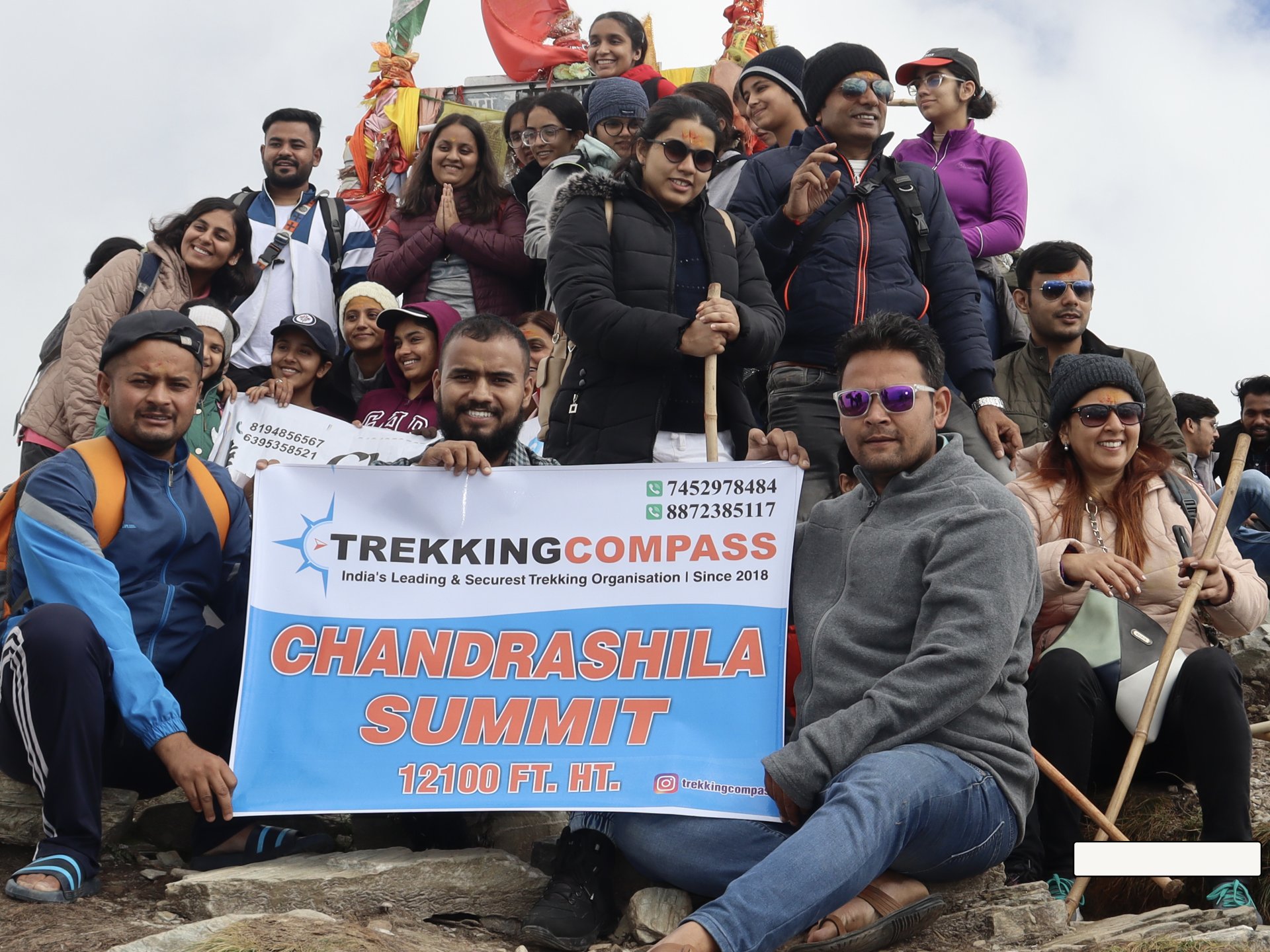
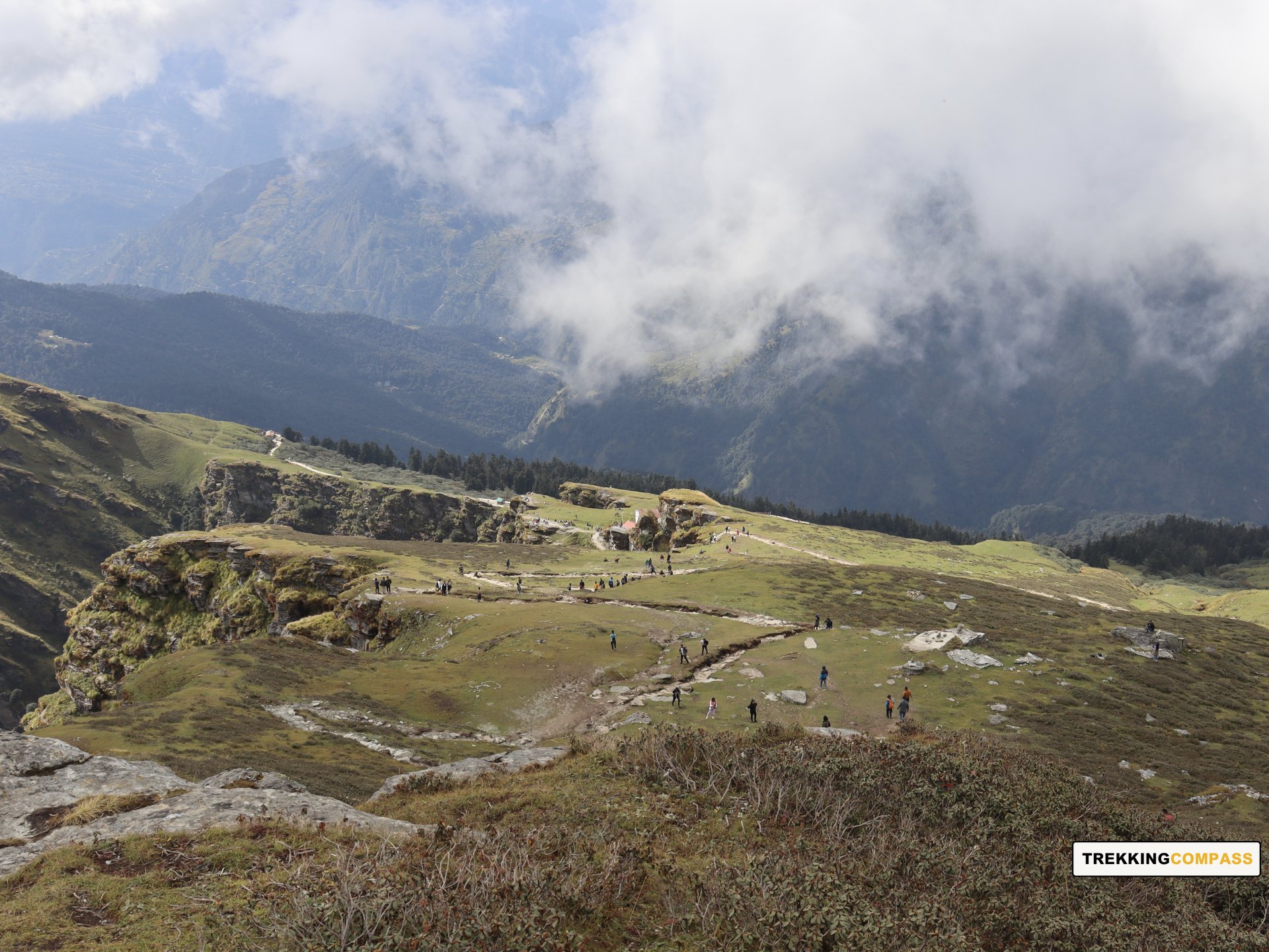
This trek is equally rewarding for other trekkers for the views it offers along with flora and fauna in the area. Chopta Chandrashila trek lies on Chandrakant Parvat hence the name Chandrashila for its summit. The trail to Chandrashila Summit is well-paved and spacious. Unlike other treks, this trek has a moderate crowd in every season. Trekking up, trekkers will hear chants of “जय भोलेनाथ!,” “हर हर महादेव!” All these sum up to praise of Lord Shiva by the devotees climbing up for ‘darshan’ meaning ‘auspicious sight of a deity.’
The trail will take trekkers through different small meadows where you can see the sheep grazing. The sunlight falling on the wildflowers makes them shine bright and stand out. Himalayan Birch, Pink Rhododendron, Rhododendron (Buransh), Himalayan maple, and Black Juniper are some trees and plants one can spot on this trail. Trekkers can also catch glimpses of birds like the Alpine Ascenter, White-throated Bushtit, Eurasian Jay, Himalayan Bluetail, and Himalayan Monal. Other than that there are rare sightings of Wild Boar, Kedarnath Musk Deer, Himalayan Black Bear, etc.
When trekkers are on the paramount of the Chandrashila summit (12,100 ft) at a 1 km distance from Tungnath, the views and experience are dramatic almost like a movie. They’ll see clouds dancing in the valleys and above the ranges, it's magical, to say the least. The sunset and sunrise view of the Indian Himalayan Ranges makes you want to stay there forever. You see up-close views of Trishul 1 and 2, Nanda Ghunti, Chaukhambha 1 and 4, and Nanda Devi Peak. Other peaks you find almost reachable from Chandrashila are Swachhand (6721 m), Janhukut (6805 m), Bhagirath 1 (6,856 m), Kharchakund (6,612 m), Sumeru (6,351 m), Kedarnath Main (6,940 m), etc.
Rishikesh Altitude: 1120 ft (340 m)
Altitude Loss: 8282 ft (2524 m)
Travel Distance: 170 km (approx.)
Travel Hours: 7 to 8 hrs (approx.)
Today's the last day for trekkers to capture all that's around. They'll wake up to a beautiful sunrise at Chopta (the mini Switzerland). Some peaks that the sunlight will dance over are Meru, Ganesh Parwat, Sumeru, Bandarpunch, Chaukhamba, Nilkantha, Nanda Devi, and Tirsul Parvat. It'll be time for trekkers to onboard their vehicles and drive off to Rishikesh through the beautiful road from Chopta. At times they'll feel like they are riding in the sky as the clouds will not be over, but beside you.
Trekkers’ way back will be covered with oaks and deodars on either side of the road. The shadow it casts will be relaxing for some, and cold-casting for some other trekkers. Soon enough they'll meet the Mandakini River that'll accompany you en route, up to Rudraprayag. At Rudraprayag, the Mandakini River merges with the Alaknanda River which changes their partner to Alaknanda. That's not all, at DevPrayag, they'll lose the company of Alaknanda and Maa Ganga (River Ganges) will join the trekkers till their destination.
Holy rivers accompanying trekkers aren't the only bestowal of this route to Rishikesh. There are also temples like Dhari Devi, Nagraja Nursingh, Hariyali Devi, Karthik Swami Mandir, and Koteshwar. The most rewarding part of this day's end is the destination: Rishikesh. Rishikesh, the “Yoga capital of the world” offers trekkers relaxation and a plethora of places to explore. They are Ramjhula, Triveni Ghat, Gita Bhavan, Beatles Ashram, Neelkanth Mahadev Temple, etc. For the adventurous folks, there are experiences like Flying Fox, Rafting, Bungee Jumping, etc.
Accommodation
Meals (Vegetarian only with eggs option available)
Nutritious meals from Day 1's dinner to last day's breakfast, following the itinerary schedule.
Expert Support
First Aid Preparedness
Fully equipped medical kit including a stretcher, oxygen cylinder, blood pressure monitor, oximeter, and stethoscope to ensure safety throughout the journey.
Storage Facilities :- A secure room at the base camp to store additional luggage not needed during the trek.
Permits and Entry Fees :- Coverage of all necessary permits and entry fees, in line with standard charges for Indian nationals.
Transportation :- A round-trip transport from the pick-up point and back at the same point as a part of the itinerary.
Trek Equipment
Insurance :- Personal insurance is mandatory and not included in the package.
Personal Expenses :- Any expenses of a personal nature, including shopping, snacks, hiring a mule or porter for carrying your belongings, or acquiring personal equipment.
Emergency Costs :- Expenses arising from emergency evacuations, hospitalization, or any medical treatments required.
Unspecified Services :- Any services or items not explicitly mentioned under the "INCLUSIONS" section.
Food Costs :- We will not cover any food costs during your transit to and from the base village.
Trekking is not only about enjoying the change of scenery but also about being responsible. Our (Trekking Compass) responsibility is to provide you with an opportunity for a safe trek. But, how do we do that? We do that when you fulfill your end of the responsibility and are honest with us. To keep you safe we need to be sure there isn’t any inherent threat to your being.
Treks are at higher altitudes and it becomes difficult, almost impossible to provide you with immediate medical assistance. Therefore, we cannot help you if you don’t help us. Trekking is only one of the things you can do, but there are plenty of other things to do too. Don’t risk your life for the thrill.
To approach a trek with utmost safety, we want you to submit the following documents:
Personal Confirmation Statement (Compulsory for anyone over 18 years)
You are participating in a trek at high altitudes and it comes with its own sets of risks. This Personal Confirmation Statement will make sure that you understand all the risks you're buying into. Trekking Compass wants you to confirm your complete understanding of these risks so that you come prepared for any mental or physical challenges ahead.
This statement is also a declaration from you that, "All the information I have provided, including medical conditions, is true. If found false under any circumstances, I will be held accountable and it has nothing to do with Trekking Compass."
We have the utmost empathy for you and will do our best to help wherever possible, but only after assessing your readiness and safety for the trek. This is how our team will adequately prepare for whatever risks we might face during the journey. Concerning individuals are requested to thoroughly cross-check the requirements and only then sign the document.
Parent/Guardian Approval Statement (Compulsory for anyone below 18 years)
For participants under 18 years of age, the Parent/Guardian Approval Statement is essential to confirm that a legal guardian understands and consents to the participation in the trek. Once we have this document, we are affirmed that the parent or guardian is fully aware of the risks involved in trekking at high altitudes and is consenting to their child's participation.
No underage (below 18+) children are welcome on the trek without their parent's consent. Submission of this document reassures us that parents are approving that their child meets the health and fitness requirements for the trek, after a thorough examination.
This legal confirmation holds the parent liable for any discrepancies, freeing Trekking Compass from any liabilities for the same. Parents are requested to thoroughly cross-check the requirements and only then sign the document.
Medical Liability Waiver
The Medical Liability Waiver makes sure participants acknowledge the health risks associated with trekking at high altitudes. Common ailments during treks include altitude sickness, dehydration, muscle cramps, hypothermia, and fatigue, all of which can significantly affect your trekking experience. Additionally, weather changes and the physical demands of the terrain may exacerbate pre-existing conditions.
If you have pre-existing medical conditions such as asthma, diabetes, or heart issues, it’s vital to inform us and carry your necessary medications. Trekking Compass cannot provide immediate medical assistance in remote areas, so having the essential medications, such as inhalers, insulin, or any other prescriptions, is crucial for your safety during the trek.
By signing this waiver, you confirm that you are in good health and have taken the necessary precautions. You acknowledge these risks and agree not to hold Trekking Compass liable for any medical issues or accidents that may arise during the trek.
For any further doubts about anything mentioned above, below is our contact information:
OFFICE ADDRESS: Lane No. 4 Krishna Vihar Mohkampur, Dehradun, Uttarakhand, 248005
PHONE NUMBER: +91 7055048487, 7055048488
EMAIL ADDRESS: info@trekkingcompass.com
HOW TO REACH ? (RISHIKESH)
Note: Keep a buffer day in your getaway in addition to the total days in the itinerary. This day will come in handy in case of any political unrest, landslides, or rains. If not, you can use the extra day to get to know Rishikesh. This means that for an itinerary ending on the 15th of a month, book your return tickets for the 16th.
What are the different ways to reach Rishikesh?
On the Chopta-Chandrashila-Deoria Tal trek, our first long-day trip is from Rishikesh to Sari village. Therefore, trekkers need to reach Rishikesh to start the trek. The first move to reach Rishikesh for any trekker is to reach either Dehradun or Delhi. Later, every trekker can choose their choice of transport. The available transports for Rishikesh are:
Medium: BUS
A Friendly Note: You should travel by government buses instead of private ones because the private buses tend to take more time than expected. To avoid missing the pick-up time, try traveling by government bus, wherever possible.
Medium: TRAIN
Medium: FLIGHT
Fly Directly to Dehradun and then to Rishikesh: To fly directly at Jolly Grant Airport Dehradun, there are multiple flights from metropolitan cities. The companies that facilitate these flights are:
Fly to Delhi then take a bus or train to Rishikesh: It’s very easy to fly to Delhi from anywhere in the country and take a bus to Rishikesh. You will find a detailed description of buses in the BUS section. The companies that facilitate these flights to Delhi are:
Note: Make sure that the mode of transport you choose should bring you to Rishikesh a day before Day 1, i.e., Day 0. You can fly to Delhi and Dehradun from Mumbai, Kolkata, Bengaluru, Chennai, Hyderabad, Pune, and to Dehradun from Delhi too.
What happens on the drop-off day
Here are the points that explain your drop-off:
Special Case: What if you miss our pick-up?
You shouldn't panic and follow one of the below-mentioned ways to Sari village:
| Backpack with rain cover / Trolley Bag | Main bag for gear. |
| Day pack with rain cover (20 - 30 L) | For day essentials, if the main pack is off-loaded. |
| Walking stick | Recommended (at least one). |
| Water bottle/ Hydration pack | 2 bottles (1L each) or 1 hydration pack and 1 bottle. |
| Snacks | Energy bars, dry fruits, ORS/electrolytes. |
| Personal Medical Kit | As prescribed by your doctor. |
| T-shirts (Synthetic, quick-dry) | 2 full-sleeve, 2 half-sleeve. |
| Fleece T-shirts | 2 pieces. |
| Wind-stopper / Fleece jacket (upper) | 1 piece. |
| Windproof jacket | 1 piece |
| Down feather / Hollow jacket | 1 piece |
| Thermal innerwear (Upper & Lower) | 1 set. |
| Trekking pants (Synthetic, quick-dry) | 3 pairs. |
| Wind-stopper / Fleece pants (lower) | 1 pair. |
| Waterproof gloves | Not required. |
| Fleece / Woolen gloves | 1 pair. |
| Poncho / Waterproof jacket and pants | 1 set. |
| Head torch / Hand torch | 1 piece. |
| Sun cap | Required. |
| Woolen cap | 1 piece. |
| Balaclava | 1 piece. |
| Buff/ Neck gaiters | 1 synthetic, 1 woolen. |
| Sunglasses | UV protection with side covers (for spectacle users: contacts or photochromatic lenses). |
| Trekking shoes (waterproof, high ankle, good grip) | 1 pair. |
| Floaters / Flip-flops | 1 pair. |
| Cotton socks | 4 pairs. |
| Woolen socks | 2 pair. |
| Sunscreen | 1 piece. |
| Moisturizer | 1 piece. |
| Lip balm/ Chap-stick | 1 piece. |
| Toothbrush and toothbrush | 1 set. |
| Toilet paper and wipes | 1 pack each. |
| Soap/ Hand sanitizer | 1 piece. |
| Quick-dry towel | 1 piece. |
The Chopta–Chandrashila–Deoria Tal Trek is one of Uttarakhand’s most popular short treks, offering a perfect blend of natural beauty, spiritual significance, and Himalayan views. The trek begins from the scenic hamlet of Chopta (also called the “Mini Switzerland of India”), passes through Tungnath (the highest Shiva temple in the world at 3,680 m), and culminates at Chandrashila Summit (3,680–3,900 m depending on route). A side excursion takes trekkers to Deoria Tal, a crystal-clear lake at 2,438 m, known for its mirror-like reflections of Chaukhamba and Kedarnath peaks. This trek is special because it packs dense forests, alpine meadows, religious sites, and a true summit climb into just a few days, making it one of the most rewarding short treks in the Garhwal Himalayas.
This trek can be done almost year-round, each season offering a unique flavor:
Monsoon (July–August) is less ideal due to slippery trails and leeches.
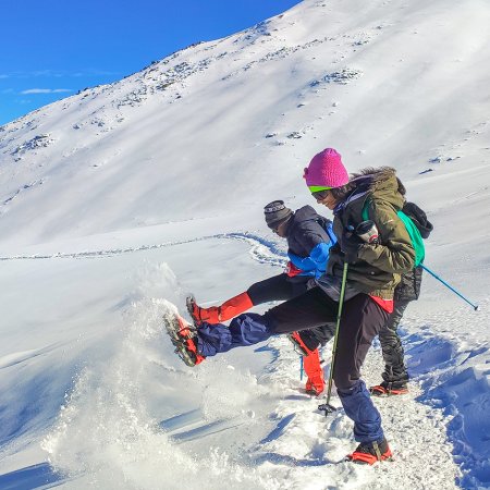
The trek is graded easy to moderate. Distances are short compared to high-altitude glacier treks, but the climb to Chandrashila summit is steep, especially in snow. The ascent involves walking uphill for about 3–4 km continuously, but the reward is unmatched 360° Himalayan views. Beginners can do this trek with preparation, and it is also popular among families.
The trek covers around 14 km in total, depending on whether you include the Deoria Tal excursion. Typically, the trek is done in 4 days, making it one of the shortest yet most rewarding Himalayan treks. Many itineraries include a circuit: Sari → Deoria Tal → Chopta → Tungnath → Chandrashila → back to Chopta/Sari.
The highest point is the Chandrashila Summit at 3,680–3,900 m. From here, trekkers enjoy stunning 360° views of Himalayan peaks, including Chaukhamba, Kedarnath Dome, Trishul, Nanda Devi, and Bandarpunch. The altitude is moderate, so the risk of altitude sickness is minimal compared to treks like Roopkund or Gaumukh.
No. The trek is suitable for beginners and first-time trekkers, provided they have a reasonable level of fitness. Families with children (above 8 years) and even older trekkers often attempt it. That said, the steep summit climb in snow requires stamina and determination.
Trekkers should be able to walk 5–6 km daily with a backpack. Pre-trek fitness preparation can include jogging, brisk walking, yoga, and stair climbing for 3–4 weeks. For winter treks, walking in snow requires extra stamina, so practicing uphill walks beforehand helps.
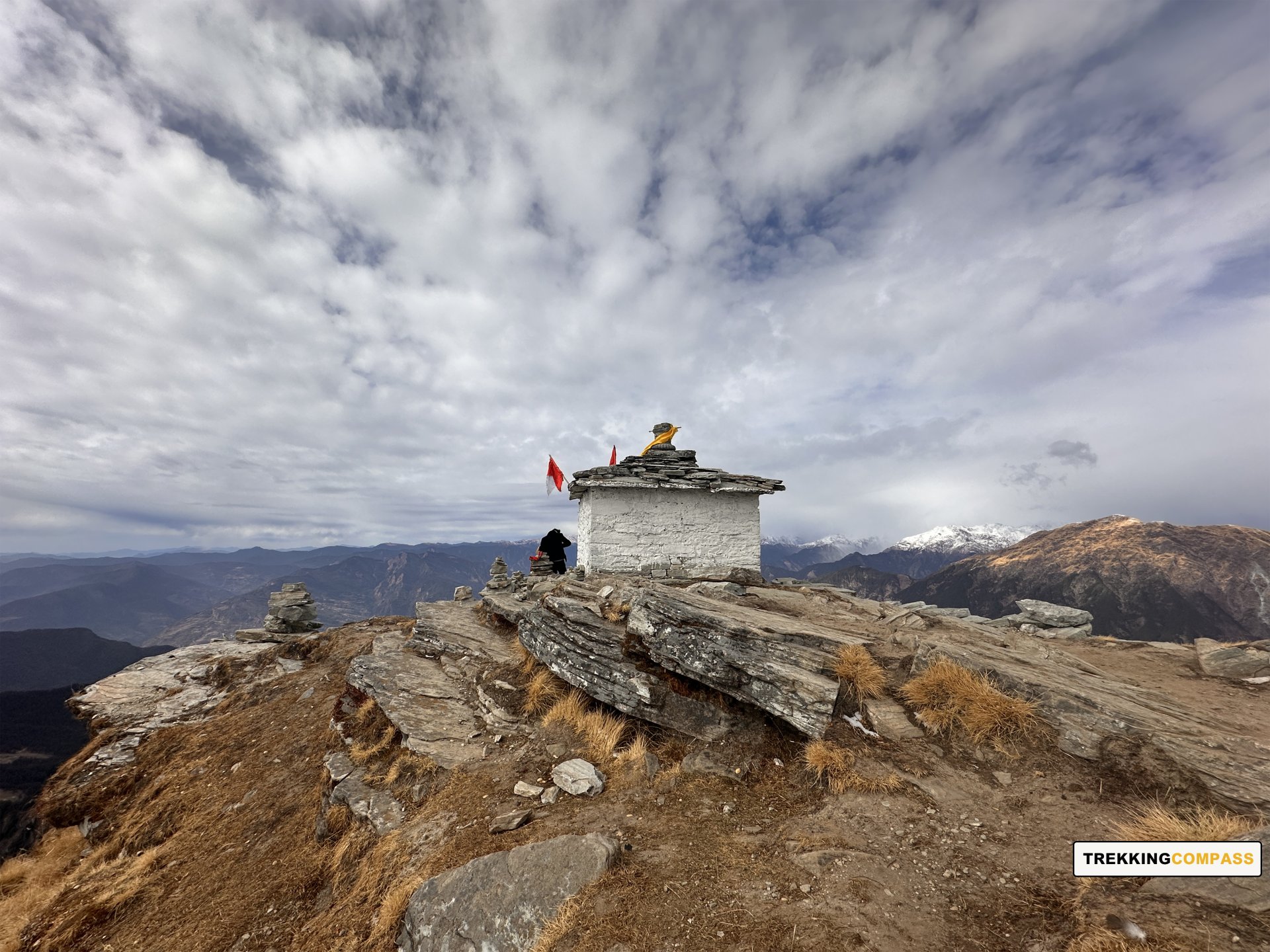
The trek holds deep mythological importance. Tungnath Temple, at 3,680 m, is the highest Shiva temple in the world and part of the Panch Kedar circuit. Legend says that Lord Shiva’s arms appeared at Tungnath when the Pandavas built temples to seek his forgiveness after the Kurukshetra war. Chandrashila Peak (literally “Moon Rock”) is believed to be the place where Lord Rama meditated after defeating Ravana. The spiritual aura combined with Himalayan beauty makes this trek unique.
At Chopta and Sari villages, trekkers can stay in homestays, guesthouses, or small lodges. On the trail, camping is possible at scenic spots near Deoria Tal or Chopta meadows. During the trekking season, small dhabas and basic lodges also operate in Chopta, offering food and shelter. In winter, camps are set up on snow.
Yes, a forest entry fee is required since the trek passes through forested areas of Kedarnath Wildlife Sanctuary. Trekking Compass will arrange the permits of their trekkers.
There are two entry points — Chopta and Sari village (for Deoria Tal). Both are around 200 km from Rishikesh and take about 8–9 hours by road.
Since the trek remains below 4,000 m, the risk of AMS is very low. Most trekkers acclimatize easily, though mild fatigue can occur during the Chandrashila climb. Staying hydrated and pacing yourself prevents discomfort.
Yes, it is one of the safest treks in Uttarakhand, suitable for solo trekkers, families, and groups. The trail is well-trodden and villages are close by for support. In winter, snow can make the climb slippery, but guides usually provide crampons or microspikes. Weather changes can be sudden, so warm clothing and rain gear are essential.
Because it is a short, easy, and immensely rewarding Himalayan trek. In just 4–5 days, you experience everything: meadows, forests, a summit climb, a high-altitude lake, and sacred temples. It combines adventure, spirituality, and photography opportunities, making it suitable for beginners as well as seasoned trekkers seeking a short getaway. Its accessibility, cultural depth, and the unforgettable sunrise from Chandrashila make it one of the most sought-after treks in Uttarakhand.
Our trek leaders are trained in first aid and equipped with oxygen cylinders and stretchers. The nearest medical facilities are available at Sari, and evacuation arrangements are made if required. Travel insurance covering trekking is strongly advised.
Yes, trekkers who don’t wish to carry their backpack can opt for mule/porter services at an extra cost. This allows you to trek light while still enjoying the Chopta–Chandrashila–Deoria Tal experience.
Handpicked routes with strong scenery, reliable pacing, and a premium featured block that still stands apart from the rest of the archive page.
Crafted routes, reliable execution, and a trekking experience that feels premium from planning to summit.
 Safety
Route checks, first-aid readiness, and trained leaders to keep every step confident.
 Routes
Better pacing, better camps, and real acclimatization designed for experience, not speed.
 Groups
Less crowd, more care so you enjoy the trek, not just finish it.
 Trust
Trust
Clear inclusions, no hidden surprises, and real human support on WhatsApp.