16% Off

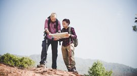
Route Length

Max Altitude

Trek Duration

Trek Difficulty

Base Camp Area

Pickup Point
10+ Years Age
First timer can apply, previous trekking experience is more appreciated.
Cover 5 km of distance in 30 minutes without a stress.
+917055048487, +917055048488
trekkingcompass@gmail.com
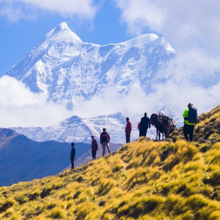
The Sar Pass Trek isn’t a brag on the bucket list. It’s not Everest, and it doesn’t try to be. But that’s exactly what makes it unforgettable.
Set in the Parvati Valley of Himachal Pradesh, the trail begins in Kasol, a village that’s part backpacker hub, part mountain retreat. From there, it’s five days of steady walking through changing landscapes that feel almost too perfect to be real. You have the usual pine forests that smell like campfire stories, alpine meadows so wide they silence even the loudest thoughts. And finally, if luck stays by your side, you get to experience a whiteout world of snow where everything slows down.
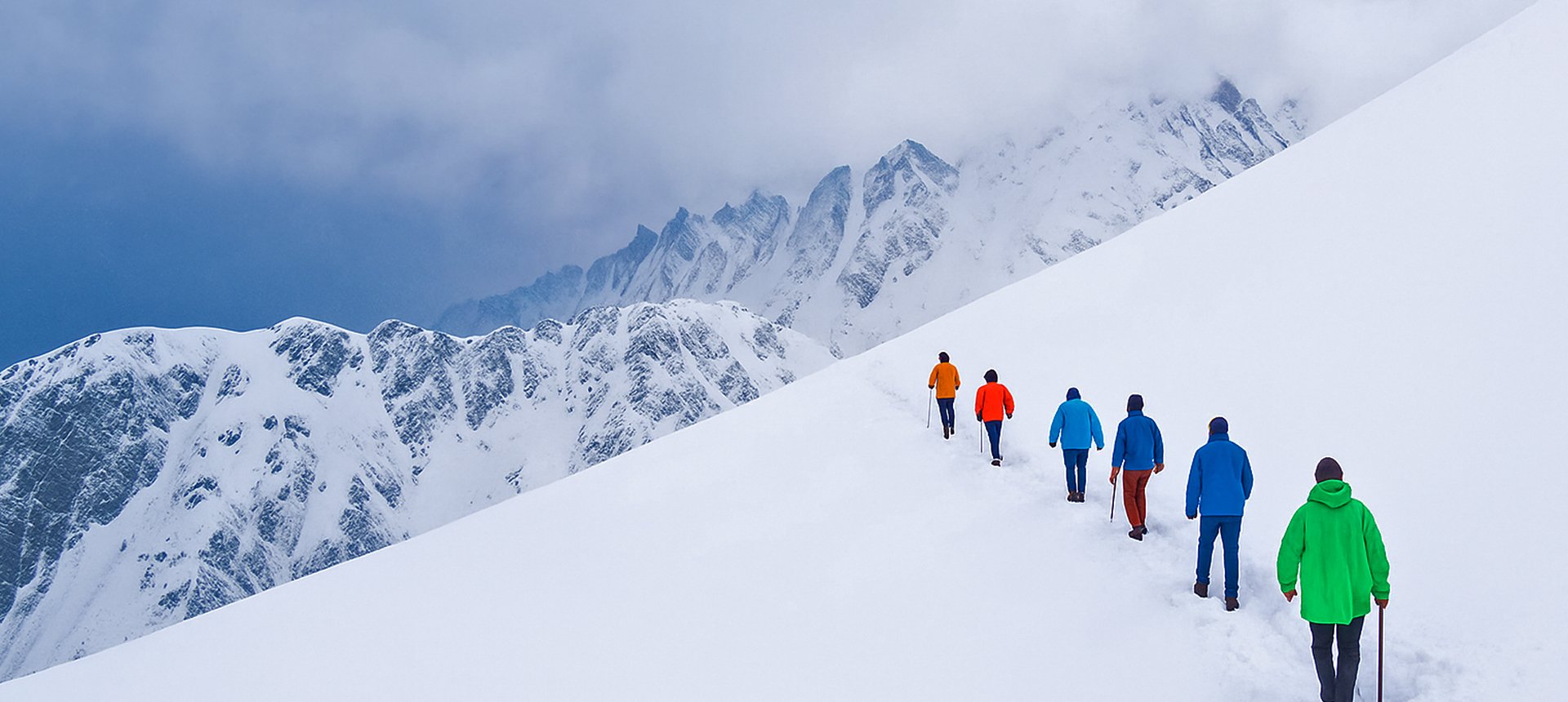
This trek is about contrasts. One day, you’re watching shepherds guide their flocks through a thick forest. Next, you’re cutting steps into a snow slope with the wind biting your face. The terrain flips on you just when you think you’ve figured it out, and that’s where the magic lies. You don’t get bored. You don’t get time to.
At around 13,911 feet, Sar Pass itself isn’t extreme by Himalayan standards. But it’s enough to demand respect. The final climb, especially, isn’t something you forget easily; it's steep, cold, and humbling. You’ll feel every muscle. And then, just as suddenly, you’ll be standing at the top, looking down at a silent, untouched snowfield, with mountains rolling on for miles.
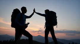
And no, it’s not a spiritual awakening. But it’s close. You come back knowing your limits, knowing your pace, and knowing that sometimes, a cup of chai and a pair of dry socks are all the luxury you need.
Sar Pass is for those who want more than just views; it’s for those who want the full picture: the sweat, the stumble, the snow-slide, and the quiet. Are you ready to swap comfort for clarity, even just for a few days? Sar Pass is worth every step.
Grahan Village Altitude: 7,808 ft (2,380 m)
Altitude Gain: 2,165 ft (660 m)
Travel Distance: 8 km (drive) + 2 km (trek) = 10 km
Travel Hours: 50 mins (drive) + 2 hrs (trek) = 2 hrs 50 mins
Today, you’ll set off from Kasol, a small town known for its lively atmosphere and picturesque setting. After a short drive of 8 km (50 minutes), the trek begins. The path leads you to Grahan Village at an altitude of 7,808 ft (2,380 m), where you’ll gain 2,165 ft (660 m) in elevation. The 2 km (2-hour) trek gives you a taste of what’s to come, taking you through lush forests, with trees and sounds of nature surrounding you.
The trail is not difficult, but it sets the tone for the journey ahead. As you approach Grahan, you’ll notice the peaceful vibe of this quaint village. The traditional stone houses, the simple lifestyle, and the surrounding mountains make this the perfect introduction to the trek. It’s a great place to reflect and get used to the rhythm of the trail.
At Grahan, the night gives you your first glimpse into the solitude and serenity of the trek, such as the stunning views of the valley and peaks rising high above. The cool, fresh air and quiet environment offer a perfect setting for rest and rejuvenation after the drive and initial trek.
Min Thach Altitude: 11,319 ft (3,450 m)
Altitude Gain: 3,511 ft (1,070 m)
Travel Distance: 7.5 km
Travel Hours: 6 hrs (approx.)
It's time to leave Grahan behind and ascend towards Min Thach, where the landscape transforms as you gain more elevation. Starting the day at 7,808 ft (2,380 m), you’ll make your way to 11,319 ft (3,450 m), gaining 3,511 ft (1,070 m) over 7.5 km (approximately 6 hours).
This day is one of steady climbs, taking you through dense forests, along narrow trails, and over rocky terrains. The views are constantly changing, with each step offering new perspectives of the surrounding peaks. As you trek higher, the air becomes cooler, and you’ll be enveloped by alpine meadows dotted with wildflowers.
The trek today is a little more challenging than the first, but with every step, you’ll feel a sense of achievement as you ascend. Min Thach, located at the edge of a plateau, offers breathtaking views of the mountains. It’s an ideal spot to relax and appreciate the quiet beauty of the place.
The cool evening breeze and the peaceful ambiance of Min Thach make it a memorable place to spend the night. You’ll rest and recharge, knowing that the next day will bring you even closer to the grandeur of the Sar Pass.
Nagaru Altitude: 12,500 ft (3,810 m)
Altitude Gain: 1,181 ft (360 m)
Travel Distance: 6.5 km
Travel Hours: 5 hrs (approx.)
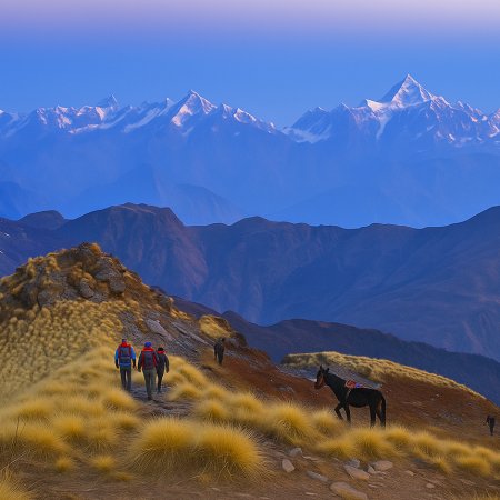
Today, you’ll head to Nagaru, located at 12,500 ft (3,810 m). The 6.5 km (5-hour) trek may not seem long, but the ascent of 1,181 ft (360 m) will make it feel like a solid challenge. The terrain becomes a bit more rugged as you climb, but it’s worth it for the spectacular panoramic views of the surrounding mountains and valleys.
As you climb higher, you’ll notice a change in the vegetation. The lush meadows give way to rocky terrain, and the towering peaks seem closer than ever. Nagaru, with its stunning views, is a great place to catch your breath before the big push to the Sar Pass. The night here will be colder, and the crisp air will remind you that you’re now deep in the heart of the mountains.
The beauty of Nagaru lies in its stillness, offering a sense of isolation that brings peace. You’ll rest here, mentally preparing for the day ahead when you cross the Sar Pass, the trek’s most challenging but rewarding section.
Biskeri Thach Altitude: 10,925 ft (3,330 m)
Sar Pass Altitude: 13,911 ft (4,240 m)
Altitude Gain: 1,411 ft (430 m)
Altitude Loss: 2,986 ft (910 m)
Travel Distance: 13 km
Travel Hours: 7 hrs (approx.)
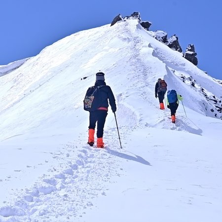
Today is the highlight of the Sar Pass Trek. You’ll start early, knowing that today you’ll conquer the Sar Pass at 13,911 ft (4,240 m). The trek today is the longest, covering 13 km and taking around 7 hours. As you begin your ascent towards the pass, you’ll notice the landscape becoming more barren and rocky, with alpine glaciers surrounding you. The climb up to the Sar Pass is demanding but not impossible. The views as you climb become more and more breathtaking, with snow-capped peaks rising against the clear blue sky.
The feeling of accomplishment when you reach the Sar Pass is unparalleled. From the top, you’ll have a 360-degree view of the surrounding peaks and valleys. It's one of the most memorable moments of the trek. After crossing the Sar Pass, the descent begins, leading you towards Biskeri Thach. The 2,986 ft (910 m) drop is steep, but the trail is clear and well-defined. The rocky terrain gradually gives way to meadows and thick forests, offering a dramatic contrast to the barren landscapes of the pass.
As you descend, you’ll begin to feel the physical toll of the day’s climb, but the beauty of Biskeri Thach makes it all worthwhile. Located at 10,925 ft (3,330 m), Biskeri Thach is the perfect place to rest after a challenging day. Surrounded by dense forests and meadows, it’s a peaceful place to relax and reflect on the day’s achievements.
Barshaini Altitude: 7,940 ft (2,420 m)
Kasol Altitude: 5,643 ft (1,720 m)
Altitude Loss: 2985 ft + 2,297 ft = 5,282 ft (1,610 m)
Travel Distance: 7.5 km (trek) + 15 km (drive) = 22.5 km
Travel Hours: 6 hrs + 2 hr = 8 hrs (approx.)
On the final day, you’ll trek from Biskeri Thach to Barshaini, covering 7.5 km in around 6 hours. The trek begins with a gentle descent, and you’ll gradually make your way back into the lush greenery that marks the lower altitudes of the trek.
The cool mountain air and the dense forests make this day feel like a transition from the rugged terrain of the higher altitudes back to the more familiar surroundings. From Barshaini, you’ll take a 15 km (2-hour) drive back to Kasol. The journey offers a peaceful conclusion to the trek, with beautiful views of the Parvati River and the valley.
By the time you reach Kasol, the mountains will feel like a distant memory, but the memories of the trek, the quiet, the challenge, and the beauty? They will stay with you for a long time. The Sar Pass Trek may be over, but the experience will remain in your heart, reminding you of the incredible adventure you’ve just completed.
Accommodation
Meals (Vegetarian only with eggs option available)
Nutritious meals from Day 1's dinner to last day's breakfast, following the itinerary schedule.
Expert Support
First Aid Preparedness
Fully equipped medical kit including a stretcher, oxygen cylinder, blood pressure monitor, oximeter, and stethoscope to ensure safety throughout the journey.
Storage Facilities :- A secure room at the base camp to store additional luggage not needed during the trek.
Permits and Entry Fees :- Coverage of all necessary permits and entry fees, in line with standard charges for Indian nationals.
Transportation :- A round-trip transport from the pick-up point and back at the same point as a part of the itinerary.
Trek Equipment
Insurance :- Personal insurance is mandatory and not included in the package.
Personal Expenses :- Any expenses of a personal nature, including shopping, snacks, hiring a mule or porter for carrying your belongings, or acquiring personal equipment.
Emergency Costs :- Expenses arising from emergency evacuations, hospitalization, or any medical treatments required.
Unspecified Services :- Any services or items not explicitly mentioned under the "INCLUSIONS" section.
Food Costs :- We will not cover any food costs during your transit to and from the base village.
Trekking is not only about enjoying the change of scenery but also about being responsible. Our (Trekking Compass) responsibility is to provide you with an opportunity for a safe trek. But, how do we do that? We do that when you fulfill your end of the responsibility and are honest with us. To keep you safe we need to be sure there isn’t any inherent threat to your being.
Treks are at higher altitudes and it becomes difficult, almost impossible to provide you with immediate medical assistance. Therefore, we cannot help you if you don’t help us. Trekking is only one of the things you can do, but there are plenty of other things to do too. Don’t risk your life for the thrill.
To approach a trek with utmost safety, we want you to submit the following documents:
Personal Confirmation Statement (Compulsory for anyone over 18 years)
You are participating in a trek at high altitudes and it comes with its own sets of risks. This Personal Confirmation Statement will make sure that you understand all the risks you're buying into. Trekking Compass wants you to confirm your complete understanding of these risks so that you come prepared for any mental or physical challenges ahead.
This statement is also a declaration from you that, "All the information I have provided, including medical conditions, is true. If found false under any circumstances, I will be held accountable and it has nothing to do with Trekking Compass."
We have the utmost empathy for you and will do our best to help wherever possible, but only after assessing your readiness and safety for the trek. This is how our team will adequately prepare for whatever risks we might face during the journey. Concerning individuals are requested to thoroughly cross-check the requirements and only then sign the document.
Parent/Guardian Approval Statement (Compulsory for anyone below 18 years)
For participants under 18 years of age, the Parent/Guardian Approval Statement is essential to confirm that a legal guardian understands and consents to the participation in the trek. Once we have this document, we are affirmed that the parent or guardian is fully aware of the risks involved in trekking at high altitudes and is consenting to their child's participation.
No underage (below 18+) children are welcome on the trek without their parent's consent. Submission of this document reassures us that parents are approving that their child meets the health and fitness requirements for the trek, after a thorough examination.
This legal confirmation holds the parent liable for any discrepancies, freeing Trekking Compass from any liabilities for the same. Parents are requested to thoroughly cross-check the requirements and only then sign the document.
Medical Liability Waiver
The Medical Liability Waiver makes sure participants acknowledge the health risks associated with trekking at high altitudes. Common ailments during treks include altitude sickness, dehydration, muscle cramps, hypothermia, and fatigue, all of which can significantly affect your trekking experience. Additionally, weather changes and the physical demands of the terrain may exacerbate pre-existing conditions.
If you have pre-existing medical conditions such as asthma, diabetes, or heart issues, it’s vital to inform us and carry your necessary medications. Trekking Compass cannot provide immediate medical assistance in remote areas, so having the essential medications, such as inhalers, insulin, or any other prescriptions, is crucial for your safety during the trek.
By signing this waiver, you confirm that you are in good health and have taken the necessary precautions. You acknowledge these risks and agree not to hold Trekking Compass liable for any medical issues or accidents that may arise during the trek.
For any further doubts about anything mentioned above, below is our contact information:
OFFICE ADDRESS: Lane No. 4 Krishna Vihar Mohkampur, Dehradun, Uttarakhand, 248005
PHONE NUMBER: +91 7055048487, 7055048488
EMAIL ADDRESS: info@trekkingcompass.com
Kasol (How to Reach)
The Sar Pass trek in Himachal Pradesh requires your arrival at Kasol, where you meet our team. Kasol is famous for many reasons, but direct connectivity fails to be one of them. To get here, you must first reach Kullu, then take a local bus or cab for the 40 km ride to Kasol. Grahan village is an 8 km drive from here.
Treks in Himachal always come with their fragile weather and terrain. A buffer day is essential to avoid unexpected disruptions. If it remains unused, you can spend it exploring Kasol, Kullu, and the different adventure sports there.
The trek itself spans 5 days and 4 nights, but we recommend keeping 6 days and 5 nights free in your schedule. Any day, you might need that extra day, and it won’t be a waste in any case.
Reaching Kasol from Delhi/Chandigarh
Your place (anywhere in India) to Delhi /Chandigarh and then to Kasol via Kullu is the most feasible way to reach Kathgodam. Trekkers from nearby states such as Uttarakhand, J&K, Ladakh, Punjab, Haryana, and Uttar Pradesh, including Himachal, are welcome to try alternate routes. But for the majority, Delhi/Chandigarh remains the best option, and here’s why:
Medium: BUS
Delhi-Bhuntar-Kasol:
Chandigarh- Bhuntar-Kasol:
Several state-run and private operators provide comfortable AC Volvo bus services. Opting for government-operated buses is advisable. They avoid delays and adhere to schedules, thus being more reliable than private operators.
Note: Once at Bhuntar Bus Station, you can catch a local bus/taxi to Kasol. It takes 2 hrs to cover the 40 km to Kasol.
Medium: TRAIN
Delhi to Chandigarh to Kasol (Time Efficient):
16 trains daily leave Delhi for Chandigarh, and you can catch any. This allows you to reach Chandigarh in time to catch the bus to Bhuntar Bus Stand (220km, 5 hrs), and there, take a local bus/taxi to Kasol. Here are the details for the trains from Delhi to Chandigarh:
Duration:
Timings: Departure starts at 4:15 am and continues till 11:20 pm.
Primary Stations: NDLS (New Delhi), DLI (Old Delhi), NZM (Hazrat Nizamuddin), DKZ (Delhi Kishanganj), etc.
| S.No. | Name of the Train | Train Code |
| 1. | Delhi Kalka Express | 14331 |
| 2. | Chandigarh Shatabdi Express | 12043 |
| 3. | Jammu Tawi Express | 1809 |
| 4. | Una Himachal Express | 19307 |
Delhi to Una to Kasol (Time Consuming):
3 trains daily leave Delhi for Una, and you can catch any. Choose a time slot that suits your bus timings at Una to reach Kullu (205 km, 5 hrs) and then Kasol from there. Here are the details for the trains from Delhi to Una:
Duration:
Timings: Departure starts at 5:50 am and continues till 10:50 pm.
Primary Stations: DEE (Delhi Sarai Rohilla), DSJ (Delhi Safdarjung), NDLS (New Delhi), DLI (Old Delhi), etc.
| S.No. | Name of the Train | Train Code | Time Schedule | Time Taken |
| 1. | Amb Anduara Vande Bharat Express | 22447 | 5:50 am to 10:32 am | 4 hrs 42 mins |
| 2. | Daulatpur Chowk Jan Shatabd Express | 12057 | 2:35 pm to 9:19 pm | 8 hrs 44 mins |
| 3. | Himachal Express | 14053 | 10:50 pm to 6:35 am | 7 hrs 45 mins |
Note: There are no direct trains from Delhi to Kasol.
Medium: FLIGHT
Delhi to Dharamshala to Kasol:
You take a flight to Dharamshala and then a bus/cab to Kullu (178 km, 6hrs). There, you can grab a local bus or taxi to Kasol.
Here are some flight (Delhi to Dharamshala)details:
Flight Providers: Indigo and SpiceJet
Flight Duration:
Delhi to Chandigarh to Kasol:
You take a flight to Chandigarh and then a bus/cab to Kullu (220 km, 5 hrs). There, you can grab a local bus or taxi to Kasol.
Here are some flight (Delhi to Chandigarh) details:
Flight Providers: AllianceAir, Air India, and Indigo.
Flight Duration:
Bhuntar or Kullu Manali Airport also hosts flights from Delhi, Shimla, and Pathankot. These are scarcely available and not recommended. Weather conditions in hilly areas also make flights unpredictable, so essentially, check for schedules to match your itinerary. Overall, Trekking Compass doesn’t recommend taking flights.
Note: Ensure that your chosen mode of transport gets you to Kasol a day before the trek commences (Day 0). This allows acclimatization and preparation.
Flights to Delhi are available from major cities like Mumbai, Kolkata, Bengaluru, Chennai, and Hyderabad. From Delhi, you can proceed to Kasol using any of the options above.
What happens on the drop-off day?
While scheduling your onward travel from Kasol, do consider potential delays due to weather or road conditions. Therefore, either schedule it,
Special Case: What if you miss our pick-up?
If you miss the scheduled pick-up, here are alternative ways to reach Grahan village, the trek’s starting point:
1. Delhi to Bhuntar (bus/flight) to Kasol to Grahan:
2. Delhi to Manali (bus/flight) to Kasol to Grahan:
3. Delhi to Chandigarh to Bhuntar to Kasol to Grahan (train/bus):
| Backpack with rain cover / Trolley Bag | Main bag for gear. |
| Day pack with rain cover (20 - 30 L) | For day essentials, if the main pack is off-loaded. |
| Walking stick | Recommended (at least one). |
| Water bottle/ Hydration pack | 2 bottles (1L each) or 1 hydration pack and 1 bottle. |
| Snacks | Energy bars, dry fruits, ORS/electrolytes. |
| Personal Medical Kit | As prescribed by your doctor. |
| T-shirts (Synthetic, quick-dry) | 2 full-sleeve, 2 half-sleeve. |
| Fleece T-shirts | 2 pieces. |
| Wind-stopper / Fleece jacket (upper) | 1 piece. |
| Windproof jacket | 1 piece |
| Down feather / Hollow jacket | 1 piece |
| Thermal innerwear (Upper & Lower) | 1 set. |
| Trekking pants (Synthetic, quick-dry) | 3 pairs. |
| Wind-stopper / Fleece pants (lower) | 1 pair. |
| Waterproof gloves | Not required. |
| Fleece / Woolen gloves | 1 pair. |
| Poncho / Waterproof jacket and pants | 1 set. |
| Head torch / Hand torch | 1 piece. |
| Sun cap | Required. |
| Woolen cap | 1 piece. |
| Balaclava | 1 piece. |
| Buff/ Neck gaiters | 1 synthetic, 1 woolen. |
| Sunglasses | UV protection with side covers (for spectacle users: contacts or photochromatic lenses). |
| Trekking shoes (waterproof, high ankle, good grip) | 1 pair. |
| Floaters / Flip-flops | 1 pair. |
| Cotton socks | 4 pairs. |
| Woolen socks | 2 pair. |
| Sunscreen | 1 piece. |
| Moisturizer | 1 piece. |
| Lip balm/ Chap-stick | 1 piece. |
| Toothbrush and toothbrush | 1 set. |
| Toilet paper and wipes | 1 pack each. |
| Soap/ Hand sanitizer | 1 piece. |
| Quick-dry towel | 1 piece. |
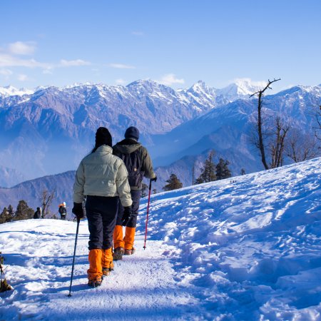
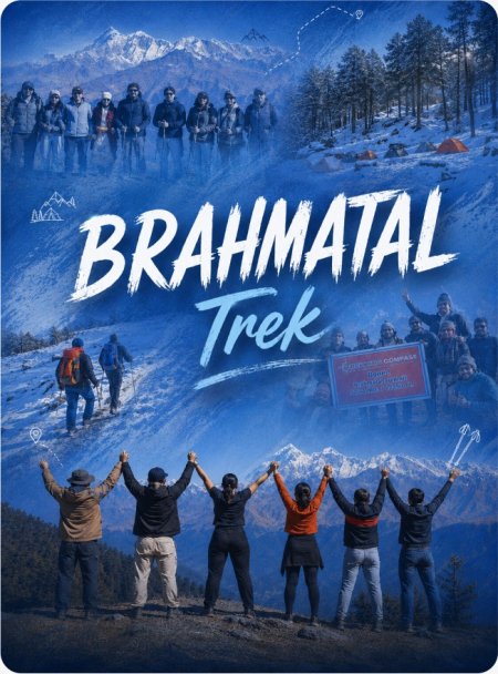
The Sar Pass Trek is one of the most picturesque and beginner-friendly high-altitude treks in the Parvati Valley of Himachal Pradesh. “Sar” in the local dialect means “Lake,” and the trek is named after a small frozen lake that trekkers cross near the top of the pass. Starting from Kasol (1,580 m), the trek passes through pine forests, alpine meadows, quaint Himalayan villages, and snow-covered landscapes before culminating at Sar Pass (4,220 m / 13,850 ft). The journey offers everything — from scenic campsites and thrilling snow slides to panoramic views of peaks like Tosh, Nagaru, and Min Thach. It’s ideal for those looking to experience the Himalayas’ beauty and adventure within a short duration.
The best time is from May to mid-October.
The trek is rated as easy to moderate, making it one of the best choices for beginners. The trail gradually ascends through forests and meadows, with the most challenging part being the steep snow climb to Sar Pass on summit day. Descending often involves a fun snow slide section, which is a major highlight. While not technically difficult, the altitude and cold can be demanding for first-timers.
The trek covers around 37 km and takes 5 days to complete.00
The Sar Pass lies at 4,220 m (13,850 ft). From here, trekkers get mesmerizing views of the snow-covered peaks of the Parvati Valley, including Tosh Glacier, Nagaru ridge, and the distant Pir Panjal range. The altitude is moderate, and most trekkers acclimatize well with proper pacing.
No, prior trekking experience is not mandatory. The Sar Pass Trek is ideal for first-time trekkers who want a taste of snow and altitude. It’s also popular among college groups and families. However, a basic fitness level is required since the trek includes steep climbs and long walking days.
You should have basic stamina and endurance. Being able to walk 6–7 km with a backpack is sufficient. One month before the trek, prepare with jogging, stair climbing, or yoga. Since altitude can cause fatigue, physical preparation will help make the experience comfortable.
The Sar Pass trail winds through Parvati Valley, one of Himachal’s most scenic and spiritual valleys. Villages like Grahan still retain traditional wooden architecture, local deities, and a simple way of life. Trekkers experience a blend of Himachali and Israeli cultures, especially around Kasol. The valley is rich in flora, with deodar, pine, and rhododendron forests, while the high meadows are dotted with wildflowers in summer.
Accommodation in Kasol is in guesthouses or hostels. During the trek, trekkers stay in tented campsites, usually shared between 2–3 people. Camps are set up in scenic clearings like Min Thach and Biskeri Thach. Facilities are basic but sufficient — sleeping bags, mats, and common kitchen and toilet tents are provided.
Yes. Trekking permits are required since the route falls under the Parvati Valley Forest Division. These are usually arranged by Trekking Compass and is included in your package. Carrying government ID proof is mandatory for all participants.
The trek starts from Kasol (1,580 m).
Since the maximum altitude is 4,220 m, the risk of AMS (Acute Mountain Sickness) is low to moderate. Most trekkers acclimatize easily due to gradual ascent. Still, staying hydrated, ascending slowly, and getting adequate rest helps prevent altitude discomfort.
Yes, it’s one of the safest treks in Himachal Pradesh, especially for beginners. The route is well-marked, camps are set up in safe zones, and experienced trek leaders accompany every group. The only challenges are slippery snow near the pass and unpredictable mountain weather, for which proper gear and guidance are essential.
Because it’s a compact Himalayan adventure that offers an incredible variety of experiences in less than a week. You’ll pass through enchanting forests, lively meadows, quaint villages, and snow-laden ridges — all while being surrounded by panoramic Himalayan views. The Sar Pass Trek also features one of the most fun descents in Indian trekking — a natural snow slide that thrills every participant. For beginners, it’s an unforgettable initiation into high-altitude trekking, and for seasoned trekkers, it’s a refreshing, scenic getaway in the heart of the Parvati Valley.
Yes. The trek is suitable for beginners and even families. Generally, participants between 8–60 years can join, provided they are medically fit and prepared for 6–7 days of trekking in the mountains.
And there are different rules for different sets of children. They are:
For both sets, Medical and Disclaimer forms are compulsory on the trek.
Our trek leaders are trained in first aid and equipped with oxygen cylinders and stretchers. The nearest medical facilities are available at kasol, and evacuation arrangements are made if required. Travel insurance covering trekking is strongly advised.
Handpicked routes with strong scenery, reliable pacing, and a premium featured block that still stands apart from the rest of the archive page.
Crafted routes, reliable execution, and a trekking experience that feels premium from planning to summit.
 Safety
Route checks, first-aid readiness, and trained leaders to keep every step confident.
 Routes
Better pacing, better camps, and real acclimatization designed for experience, not speed.
 Groups
Less crowd, more care so you enjoy the trek, not just finish it.
 Trust
Trust
Clear inclusions, no hidden surprises, and real human support on WhatsApp.