16% Off


Route Length

Max Altitude

Trek Duration

Trek Difficulty

Base Camp Area

Pickup Point
10+ Years Age
First timer can apply, previous trekking experience is more appreciated.
Cover 5 km of distance in 30 minutes without a stress.
+917055048487, +917055048488
trekkingcompass@gmail.com
Until recently, trekking in Uttarakhand has largely meant exploring the Garhwal region. Names like Kedarkantha, Har ki Dun, and Valley of Flowers often take the spotlight. But a quiet revelation lies tucked away in the Kumaon region. This surprises even the most seasoned trekkers.
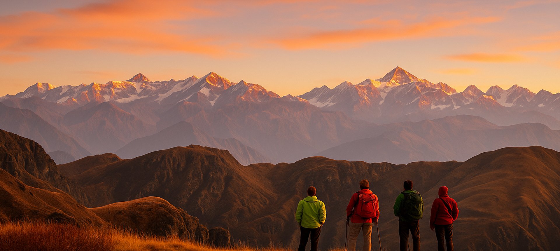
This trail is a journey through solitude and beauty. It winds through quiet Himalayan villages, lush forest corridors, and vast clearings that suddenly open up to jaw-dropping views of the snow-draped mountains. You climb gentle ridges, walk through dense oak forests, and camp in peaceful grasslands that feel untouched by time.
But the true magic of Ranthan lies in its rhododendrons. If you trek here during spring, especially in April, you will find yourself walking through a forest that has exploded in color. Rhododendrons of all sizes and shades fill the landscape. You see low shrubs, stout trees, and towering giants, all covered in clusters of red, pink, and white flowers. They bloom in such numbers that it feels unreal, like walking through a dream painted by nature.
Our team has trekked through several rhododendron trails across the Himalayas, from the Brahmatal trek to the Deoriatal Chandrashila trek. Each has its charm. Yet, Ranthan stands in a league of its own. Even in early May, when the first wave of flowers begins to fade, the forests of Ranthan continue to glow with fresh blooms. These rhododendrons leave you speechless. It has more rhododendrons than during peak bloom elsewhere. That speaks volumes.
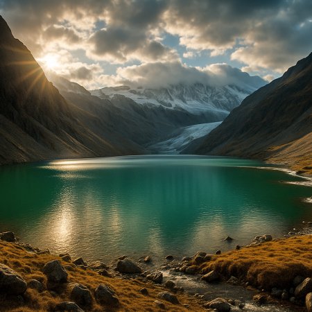
As you climb toward Ranthan Top, the scenery shifts. You leave the forests behind and step onto a long ridge walk with stunning views on either side. To the west, the iconic peaks of Garhwal rise in all their glory—Nanda Devi, Trisul, Dang Thyal, and Mrigthuni. To the east, the majestic Panchachuli range catches the golden light of dawn. The moment you stand at Ranthan Top, surrounded by towering mountains and endless sky, you feel a deep connection with the land.
This is why we believe Ranthan Kharak is the best rhododendron trek in the country. It is remote, yet rewarding. Vibrant, yet peaceful. A rare Himalayan experience that deserves to be on every trekker’s list.
Gogina Altitude: 6,470 ft (1,972 m)
Altitude Gain: 4,650 ft (1,417 m)
Travel Distance: 240 km
Travel Hours: 11 hrs
Your journey begins in Kathgodam, a place many use as a gateway to the Kumaon region. But the real magic begins once you leave behind the rush and head deeper into the mountains. As the road climbs higher, you will notice how the forests start to change. Pine gives way to oak, and tiny villages appear like quiet islands in a sea of green.
The 240 km ride to Gogina takes about 11 hours, but the landscapes keep you curious throughout. There is a calm rhythm to the mountains here, and you will start feeling it even before you begin walking. Gogina sits at 6,470 ft, tucked into a valley that feels untouched. You will reach here by late evening. The air is cooler, and the skies are clearer. It is a small village, simple and welcoming, where the pace of life slows down. Once you arrive, take a short walk, breathe in the crisp air, and rest early. Tomorrow, you start walking.
Namik Altitude: 7,200 ft (2,194 m)
Altitude Gain: 730 ft (222 m)
Travel Distance: 6 km
Travel Hours: 6.5 hrs (approx.)
The trek from Gogina to Namik may look short on the map, just 6 km, but it is a journey of steady beauty. You start early and follow a path that winds past village homes, stone walls, and old water channels. The air smells of cedar and wet earth. Along the way, you might see children on their way to school or a shepherd moving with his flock. These quiet moments make the trail feel alive. With an altitude gain of just 730 ft, the walk allows your body to adjust while your eyes take in new sights.
Namik sits at 7,200 ft and has a rich past. This region once served as a trade route and still carries whispers of old stories. The name “Namik” comes from the word for salt, a nod to its place in trade history. The village here is small, but the views are wide. You can see the mighty Panchachuli range if the sky is clear. The sound of water trickling through stone channels is a constant background. You settle in early and sleep easily; tomorrow will take you even higher.
Bajimanian Kharak Altitude: 9,710 ft (2,960 m)
Altitude Gain: 2,510 ft (765 m)
Travel Distance: 6 km
Travel Hours: 7 hrs (approx.)
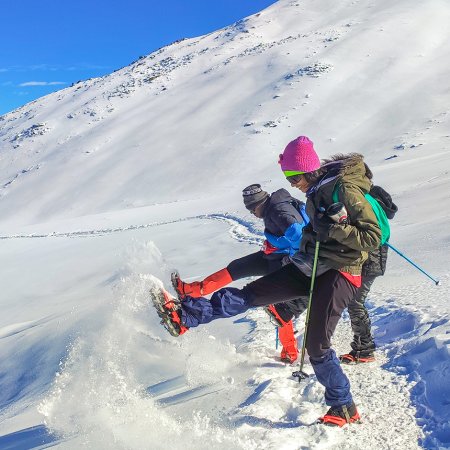
This is the day when the forests deepen, and the trail feels more remote. You begin early from Namik and slowly climb through patches of thick oak and rhododendrons. The air turns cooler, and the trees are taller. You cross small wooden bridges and hear the rustle of leaves with every step. The altitude gain is sharp, a climb of 2,510 ft over just 6 km. So, take it slow. There is no rush. This stretch demands both your legs and lungs, but it gives back, too. The views start to open up. At times, the trees part, and you can see deep valleys below and ridges ahead.
Bajimanian Kharak sits at 9,710 ft. It is an open grazing ground, bordered by a mix of boulders and grass. The wind here carries a different sound, a little stronger, a little colder. The place feels like a natural balcony to the sky. Settle down, sip something warm, and let your breath catch up. You will feel the change not just in altitude but in the quiet around you. No shops, no signal. Just you and the mountains.
Thal Tok Altitude: 11,120 ft (3,389 m)
Chophu Altitude: 11,700 ft (3,566 m)
Altitude Gain: 1,990 ft (606 m)
Travel Distance: 5.7 km
Travel Hours: 6 hrs (approx.)
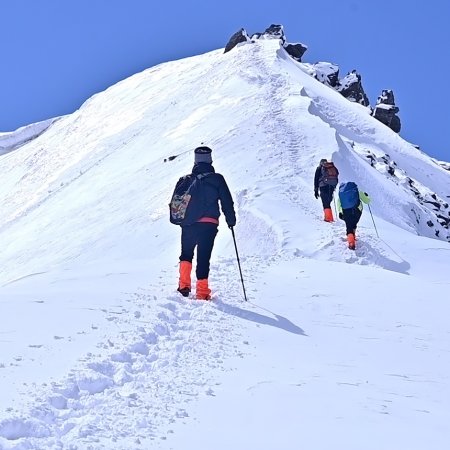
Today is about gaining height and losing the last of the human trail. You leave Bajimanian Kharak and move toward Thal Tok, which stands at 11,120 ft. The trail takes you through sharp bends, uneven rocks, and narrow ridgelines. There is effort in every step. But with the climb comes clarity. As you rise, the tree cover fades, and the views expand. The air feels thinner, and every breath deeper. At Thal Tok, take a break. The spot gives you views that stretch endlessly, with tall peaks in every direction. From here, the trail becomes gentler but more exposed. You walk along soft meadows that wave in the wind.
In a little over an hour, you reach Chophu. At 11,700 ft, Chophu is high, open, and unreal in its silence. The camps here are set under wide skies, and on some days, clouds roll in quietly like old friends. You sleep early, wrapped in layers, knowing that tomorrow you will touch the highest point of the trek.
Ranthan Top Altitude: 12,890 ft (3,929 m)
Parava Thor Altitude: 9,190 ft (2,801 m)
Altitude Gain: 1,190 ft (363 m)
Altitude Loss: 3,700 ft (1,128 m)
Travel Distance: 2 km (uphill) + 6 km (downhill) = 8 km
Travel Hours: 2.5 hrs + 4 hrs = 6.5 hrs (approx.)
This day defines the trek. You begin early, heading out from Chophu toward Ranthan Top. It is just 2 km uphill, but this 2 km asks for every ounce of focus. The air is thin, the climb steep, and the cold more biting. But every step upward rewards you. The ridge opens slowly. Snow-dusted peaks rise around you.
The silence becomes louder. And then, at 12,890 ft, you reach Ranthan Top. The highest point of the trek. Stand still for a moment here. This is not a place you walk past. This is a place you take in. To the north, the Panchachuli range stands sharp and bold. Nanda Kot looms on the other side. Clouds move lazily, and the wind tugs at your jacket. It is cold, quiet, and powerful.
After soaking it all in, you begin the long descent to Parava Thor. Over 3,700 ft of altitude loss lies ahead. The downhill is steep and can be hard on the knees, so take it slow. The trail zigzags through boulders, forests, and open patches of grass. By the time you reach Parava Thor, your legs will be tired, but your heart will be full. The campsite is calm, tucked into a green corner surrounded by tall cliffs. Rest well. Today, you touched the sky.
Gogina Altitude: 6,470 ft (1,972 m)
Altitude Loss: 2,720 ft (829 m)
Travel Distance: 11 km
Travel Hours: 6 hrs (approx.)
The trail today feels easier, not because the path is flat but because your body has now found its rhythm. You begin your descent from Parava Thor and move back toward the world you left behind. The trail drops by 2,720 ft, passing through forests that smell of pine and mud. The sun filters through the trees, casting long shadows on your path. You might even hear the distant ring of cowbells again, a sign that you are closer to the villages now. The walk is long, about 11 km, and takes around 6 hours.
Along the way, you will find yourself thinking back to Ranthan Top, to the views, to the silence. That is the thing about this trek. It changes how you look at the climb, the descent, and even your thoughts. By the time you reach Gogina, it feels familiar now. The village welcomes you back like an old friend. Settle into your stay, stretch your legs, and let the memories settle.
Kathgodam Altitude: 1,820 ft (555 m)
Altitude Loss: 4,650 ft (1,417 m)
Travel Distance: 240 km
Travel Hours: 11 hrs (approx.)
Your journey ends where it began, Kathgodam. The drive is long, about 11 hours, but this time, the distance feels shorter. Maybe it is the mountain air still in your lungs or the calm that now sits quietly with you. The roads snake down from Gogina, passing familiar turns and streams you crossed just days ago.
The altitude drops fast, from 6,470 ft to 1,820 ft, and with each mile, the world becomes louder again. Mobile signals return. Towns appear. But something in you has shifted. That is the quiet promise of treks like these. They leave you a little fuller, a little lighter, and more at ease. When you reach Kathgodam, the trek is over. But the stillness, the views, and the rhythm of your steps…they stay.
Accommodation
Meals (Vegetarian only with eggs option available)
Nutritious meals from Day 1's dinner to last day's breakfast, following the itinerary schedule.
Expert Support
First Aid Preparedness
Fully equipped medical kit including a stretcher, oxygen cylinder, blood pressure monitor, oximeter, and stethoscope to ensure safety throughout the journey.
Storage Facilities :- A secure room at the base camp to store additional luggage not needed during the trek.
Permits and Entry Fees :- Coverage of all necessary permits and entry fees, in line with standard charges for Indian nationals.
Transportation :- A round-trip transport from the pick-up point and back at the same point as a part of the itinerary.
Trek Equipment
Insurance :- Personal insurance is mandatory and not included in the package.
Personal Expenses :- Any expenses of a personal nature, including shopping, snacks, hiring a mule or porter for carrying your belongings, or acquiring personal equipment.
Emergency Costs :- Expenses arising from emergency evacuations, hospitalization, or any medical treatments required.
Unspecified Services :- Any services or items not explicitly mentioned under the "INCLUSIONS" section.
Food Costs :- We will not cover any food costs during your transit to and from the base village.
Trekking is not only about enjoying the change of scenery but also about being responsible. Our (Trekking Compass) responsibility is to provide you with an opportunity for a safe trek. But, how do we do that? We do that when you fulfill your end of the responsibility and are honest with us. To keep you safe we need to be sure there isn’t any inherent threat to your being.
Treks are at higher altitudes and it becomes difficult, almost impossible to provide you with immediate medical assistance. Therefore, we cannot help you if you don’t help us. Trekking is only one of the things you can do, but there are plenty of other things to do too. Don’t risk your life for the thrill.
To approach a trek with utmost safety, we want you to submit the following documents:
Personal Confirmation Statement (Compulsory for anyone over 18 years)
You are participating in a trek at high altitudes and it comes with its own sets of risks. This Personal Confirmation Statement will make sure that you understand all the risks you're buying into. Trekking Compass wants you to confirm your complete understanding of these risks so that you come prepared for any mental or physical challenges ahead.
This statement is also a declaration from you that, "All the information I have provided, including medical conditions, is true. If found false under any circumstances, I will be held accountable and it has nothing to do with Trekking Compass."
We have the utmost empathy for you and will do our best to help wherever possible, but only after assessing your readiness and safety for the trek. This is how our team will adequately prepare for whatever risks we might face during the journey. Concerning individuals are requested to thoroughly cross-check the requirements and only then sign the document.
Parent/Guardian Approval Statement (Compulsory for anyone below 18 years)
For participants under 18 years of age, the Parent/Guardian Approval Statement is essential to confirm that a legal guardian understands and consents to the participation in the trek. Once we have this document, we are affirmed that the parent or guardian is fully aware of the risks involved in trekking at high altitudes and is consenting to their child's participation.
No underage (below 18+) children are welcome on the trek without their parent's consent. Submission of this document reassures us that parents are approving that their child meets the health and fitness requirements for the trek, after a thorough examination.
This legal confirmation holds the parent liable for any discrepancies, freeing Trekking Compass from any liabilities for the same. Parents are requested to thoroughly cross-check the requirements and only then sign the document.
Medical Liability Waiver
The Medical Liability Waiver makes sure participants acknowledge the health risks associated with trekking at high altitudes. Common ailments during treks include altitude sickness, dehydration, muscle cramps, hypothermia, and fatigue, all of which can significantly affect your trekking experience. Additionally, weather changes and the physical demands of the terrain may exacerbate pre-existing conditions.
If you have pre-existing medical conditions such as asthma, diabetes, or heart issues, it’s vital to inform us and carry your necessary medications. Trekking Compass cannot provide immediate medical assistance in remote areas, so having the essential medications, such as inhalers, insulin, or any other prescriptions, is crucial for your safety during the trek.
By signing this waiver, you confirm that you are in good health and have taken the necessary precautions. You acknowledge these risks and agree not to hold Trekking Compass liable for any medical issues or accidents that may arise during the trek.
For any further doubts about anything mentioned above, below is our contact information:
OFFICE ADDRESS: Lane No. 4 Krishna Vihar Mohkampur, Dehradun, Uttarakhand, 248005
PHONE NUMBER: +91 7055048487, 7055048488
EMAIL ADDRESS: info@trekkingcompass.com
Kathgodam (How to Reach)
Any trek in the Kumaon Himalayas most likely requires your arrival at Kathgodam, where you meet our (Trekking Compass) team. Kathgodam is famous for its railway station and the highway, which has roads diverging into every district in the Kumaon region. For the Ranthan Kharak Trek, too, you’ll arrive here, roughly 310 km from Delhi and 240 km from Gogina village.
When traveling in Uttarakhand, always factor in its fragile weather and terrain. A buffer day is essential to avoid unexpected disruptions. If it remains unused, you can spend it exploring Nainital, Bhimtal, or other nearby spots
The trek itself spans 6 days and 5 nights, but we recommend keeping 7 days and 6 nights free in your schedule.
Reaching Kathgodam from Delhi
Your place (anywhere in India) to Delhi and then to Kathgodam is the most feasible way to reach Kathgodam. Trekkers from nearby states such as Himachal, J&K, Ladakh, Punjab, Haryana, and Uttar Pradesh, including Uttarakhand, are welcome to try alternate routes. But for the majority, Delhi remains the best option, and here’s why:
Medium: BUS
Delhi to Kathgodam:
Several state-run and private operators provide comfortable AC Volvo bus services. Opting for government-operated buses is advisable. They avoid delays and adhere to schedules, thus being more reliable than private operators.
Note: Buses from Delhi drop you at Haldwani Bus Station, near Prem Talkies and a petrol pump. From here, hop on a local tuk-tuk or auto for ₹20–40. The ride takes about 20 minutes to cover the 4–5 km stretch to Kathgodam Railway Station.
Medium: TRAIN
Delhi to Kathgodam Railway Station:
Train Options: 3 major trains are available from New Delhi Railway Station to Kathgodam Railway Station.
Duration: Approximately 6 hours.
| S.No. | Name of the Train | Time Schedule | Time Taken |
| 1. | Kathgodam Shatabdi Express - 12040 | 6:20 am to 11:55 am | 5 hrs 35 mins |
| 2. | Uttaranchal Sampark Kranti Express - 15035 | 4:00 pm to 10:45 pm | 6 hrs 45 mins |
| 3. | Ranikhet Express (Overnight Train) - 15013 | 10:05 pm to 5:05 pm | 7 hrs |
Note: Make sure to hop off at Kathgodam Railway Station, where our team awaits you. Haldwani Railway Station isn’t well equipped, and trains halting at Lal Kuan will still require an additional 30-minute ride back to Kathgodam.
Medium: FLIGHT
Fly Directly to Pantnagar Airport:
Nearest Airport to Kathgodam: The Pantnagar Airport is the most proximate airport to Kathgodam, located approximately 15 km from Rudrapur Bus Depot. From Rudrapur, take a bus to Haldwani Bus Stand (32 km). From there, a short auto or tuk-tuk ride will get you to Kathgodam Railway Station.
Flight Options: Direct flights only from Delhi. Layover flights from Lucknow and Dehradun are also available.
| Start Airport | Layover Airport | Type of Flight | Approx duration |
| Indira Gandhi International Airport (New Delhi) | _ | Direct | 1 hr, 5 mins |
| Amausi Airport (Lucknow) | Delhi | With Layover | 1 hr |
| Jolly Grant Airport (Dehradun) | Delhi | With Layover | 55 mins |
Due to weather conditions, flights can be unpredictable, so it's essential to check schedules and availability in advance. Flights aren’t recommended; choose trains instead.
Note: Ensure that your chosen mode of transport brings you to Kathgodam a day before the trek commences (Day 0). This allows acclimatization and preparation.
Flights to Delhi are available from major cities like Mumbai, Kolkata, Bengaluru, Chennai, and Hyderabad. From Delhi, you can proceed to Kathgodam using any of the options above.
What happens on the drop-off day?
While scheduling your onward travel from Kathgodam, do consider potential delays due to weather or road conditions. Therefore, either schedule it,
Special Case: What if you miss our pick-up?
If you miss the scheduled pick-up, here are alternative ways to reach Gogina village, the trek’s starting point:
| Backpack with rain cover / Trolley Bag | Main bag for gear. |
| Day pack with rain cover (20 - 30 L) | For day essentials, if the main pack is off-loaded. |
| Walking stick | Recommended (at least one). |
| Water bottle/ Hydration pack | 2 bottles (1L each) or 1 hydration pack and 1 bottle. |
| Snacks | Energy bars, dry fruits, ORS/electrolytes. |
| Personal Medical Kit | As prescribed by your doctor. |
| T-shirts (Synthetic, quick-dry) | 2 full-sleeve, 2 half-sleeve. |
| Fleece T-shirts | 2 pieces. |
| Wind-stopper / Fleece jacket (upper) | 1 piece. |
| Windproof jacket | 1 piece |
| Down feather / Hollow jacket | 1 piece |
| Thermal innerwear (Upper & Lower) | 1 set. |
| Trekking pants (Synthetic, quick-dry) | 3 pairs. |
| Wind-stopper / Fleece pants (lower) | 1 pair. |
| Waterproof gloves | Not required. |
| Fleece / Woolen gloves | 1 pair. |
| Poncho / Waterproof jacket and pants | 1 set. |
| Head torch / Hand torch | 1 piece. |
| Sun cap | Required. |
| Woolen cap | 1 piece. |
| Balaclava | 1 piece. |
| Buff/ Neck gaiters | 1 synthetic, 1 woolen. |
| Sunglasses | UV protection with side covers (for spectacle users: contacts or photochromatic lenses). |
| Trekking shoes (waterproof, high ankle, good grip) | 1 pair. |
| Floaters / Flip-flops | 1 pair. |
| Cotton socks | 4 pairs. |
| Woolen socks | 2 pair. |
| Sunscreen | 1 piece. |
| Moisturizer | 1 piece. |
| Lip balm/ Chap-stick | 1 piece. |
| Toothbrush and toothbrush | 1 set. |
| Toilet paper and wipes | 1 pack each. |
| Soap/ Hand sanitizer | 1 piece. |
| Quick-dry towel | 1 piece. |
The Ranthan Kharak Trek is a hidden gem of Uttarakhand, taking trekkers through alpine meadows, oak forests, and remote valleys of the Kumaon Himalayas. It is less commercialized, offering solitude, wildlife sightings, and pristine Himalayan landscapes.
The best time is from May–June and September–October. Summers bring green meadows and rhododendron blooms, while autumn offers clear skies and golden landscapes. Winters are harsh, and monsoons make trails slippery.
The trek is moderate, involving daily walks of 6–8 hours on undulating terrain. It is suitable for trekkers with some prior experience.
The trek covers around 37 km and typically takes 6–7 days.
Ranthan Kharak reaches up to 3880 m (12,890 ft), with excellent views of the Kumaon Himalayas.
Yes, it is advisable to have done at least one moderate trek before attempting Ranthan Kharak due to its remoteness.
A moderate level of fitness is needed. Trekkers should prepare with cardio, hiking practice, and leg strength training.
The trek involves camping in tents, with basic facilities.
Yes, forest department permits are needed since the trek passes through restricted zones. Your Ranthan Kharak Trek package with Trekking Compass includes all required paperwork, so you don’t need to worry about arranging them separately.
Yes, but it is remote and not as commercialized as other treks, so trekking with a guide or group is strongly recommended.
The trek usually starts from Kathgodam and is easily reachable via road or railway.
Mild AMS is possible as the trek crosses 4,000 m. Gradual ascent and hydration help prevent it.
ATMs: Available in Bageshwar.
Network: Patchy beyond base village.
Electricity: Only in lower villages.
Because it remains one of the least explored Kumaon treks, offering raw Himalayan beauty and solitude away from commercial trails.
Our trek leaders are trained in first aid and equipped with oxygen cylinders and stretchers. The nearest medical facilities are available at Kathgodam and evacuation arrangements are made if required. Travel insurance covering trekking is strongly advised.
Handpicked routes with strong scenery, reliable pacing, and a premium featured block that still stands apart from the rest of the archive page.
Crafted routes, reliable execution, and a trekking experience that feels premium from planning to summit.
 Safety
Route checks, first-aid readiness, and trained leaders to keep every step confident.
 Routes
Better pacing, better camps, and real acclimatization designed for experience, not speed.
 Groups
Less crowd, more care so you enjoy the trek, not just finish it.
 Trust
Trust
Clear inclusions, no hidden surprises, and real human support on WhatsApp.