16% Off
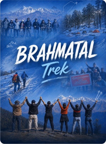

Route Length

Max Altitude

Trek Duration

Trek Difficulty

Base Camp Area

Pickup Point
10+ Years Age
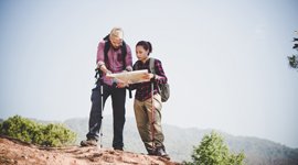
First timer can apply, previous trekking experience is more appreciated.
Cover 5 km of distance in 30 minutes without a stress.
+917055048487, +917055048488
trekkingcompass@gmail.com
Adi Kailash and Om Parvat Yatra takes you to a breathtaking altitude of 14,764 ft (Nabhidhang), and here’s the catch: not a single day of trekking is required. If that leaves your jaw hanging, hold on tight as Adi Kailash Yatra’s route has a lengthy list of surprises.
On a spiritual level, Adi Kailash Yatra is often seen as the closest alternative to the Kailash Mansarovar Yatra, especially after Tibet came under Chinese control. Among the Panch Kailashas, the five sacred peaks in Hinduism scattered across the globe, Adi Kailash holds the second highest reverence. The Om Paravt yatra adds the compulsory layer of spiritual significance to this 6-day-long trek in the Kumaon region of Uttarakhand.
Pilgrims and mountain lovers from around the world venture into this journey, each drawn by spiritual, meditative, scenic, or deeply personal reasons. The legends tied to Om Parvat (5,600 m), Adi Kailash (6,310 m), Kutti Village, Bheem Ki Kheti, Parwati Mukut, Parwati Nabi, Gauri Kund, and Parwati Sarovar attract pilgrims and their curiosity, year after year, without fail. Here, they sit, introspect, offer prayers, meditate, and manifest their heart’s desires. And in their words, “It feels otherworldly.” Even those not seeking spirituality often echo this very feeling.
The Adi Kailash trek doesn’t stop at this; it has much more to offer. It includes places like Kainchi Dham, Dol Ashram, Patal Bhuvaneshwar, Ved Vyas Gufa, Jageshwar Dham, Kali Mata Mandir at Kala Pani, Chaukori, Bhimtal, etc. Beyond Adi Kailash and Om Parvat, the route rewards travelers with stunning views of several majestic Himalayan giants: Mt. Nemjung (7,140 m), Ganesh Parvat (6,532 m), Brahma Parvat (6,321 m), Mt. Chaukhamba (7,138 m), Mt. Nanda Devi (7,817 m), Mt. Trishul (7,120 m), Nanda Kot (6,861 m), and Panchachuli (6,904 m) peaks.
The drive from one destination to the next is anything but ordinary. You’ll cross lush valleys, winding hills, cascading waterfalls, hanging bridges, and even witness the confluence of rivers (some from India, others flowing in from Nepal). As you journey onward from Bundi, the green hills gradually part like curtains, revealing towering Himalayan peaks that stay with you like quiet companions on the road. And after 11 checkposts, countless sights, and unforgettable moments, your Adi Kailash and Om Parvat Yatra comes full circle.
This trek offers a wealth of myths and legends, along with numerous blessings from nature. So, whatever your reason, you will take something permanent and life-altering back home.
Kathgodam Altitude: 1,490 ft (454 m)
Pithoragarh Altitude: 5,280 ft (1,609 m)
Altitude Gain: 3,790 ft (1,155 m)
Travel Distance: 207 km (approx.)
Travel Hours: 8 hrs (approx.)
Today is all about a quaint drive through the hills and valleys of the Kumaon Division in Uttarakhand. This 8-hour drive will take you on a trip to three different districts: Nainital, Almora, and Pithoragarh. Each has its surprises and will not let you down on any front, be it views or visit-worthy places. There are two routes to Pithoragarh from Kathgodam, and both have something popular to offer.
1st Route: Kathgodam→ Bhimtal→Kutani→ Dhanachuli→ Nata Dol→ Dol→ Jageshwar Dham→ Panar Bridge→ Sirgaon→Shera (ghat)→ Jhular Pul (ghat)→ Pithoragarh. (207 km, 8 hrs)
2nd Route: Kathgodam→ Bhimtal→ Bhowali→ Kainchi→ Khairna Pul→ Almora→ Jageshwar Dham→ Dhaula Devi Town→ Sidhia Khet→ Sirgaon→Panar Bridge→ Pithoragarh. (209 km, 8 hrs or more)
We will likely choose the 1st route, as it's less likely to be crowded and more likely to ensure that you reach Pithoragarh on time to rest and acclimatize. The 2nd route is expected to host a crowd due to the pilgrims coming for Kainchi Dham darshans, and we might get stuck in a jam for hours.
The second route we take has a lot to offer, including the Dol Ashram, which is unique to this route. Other than that, the spiralling roads lined with pine and deodars are a beautiful sight to behold. Dhaula Devi Temple, Gurna Devi Temple, and Siddheshwar Temple are also prominent religious sites en route.
For Jageshwar Dham, we go a little (2-3 km) off-road from the main route to Pithoragarh, and you get darshans in this ancient temple only at a walking distance of 100-200 m. This stone relic is undoubtedly the highlight of the day. Next up is dinner and rest in Pithoragarh, marking today’s end.
Gunji/Nabi Altitude: 10,450 ft (3,185 m)
Dharchula Altitude: 3,100 ft (945 m)
Altitude Gain: 5,170 ft (1,576 m)
Travel Distance: 165 km
Travel Hours: 7 hrs (approx.)
The 5,170 ft altitude gain is not the only highlight for today, as you are about to see an international border that flows. Before that, your day starts with boarding vehicles for Gunji/Nabi (used as options because they are located at a kilometre’s distance from one another. The 165 kilometer drive takes you 7 or, in case it’s a busy day, 8 hrs. For the earlier part of the route, you see crowded markets as you cross Pithoragarh (the biggest district in the Kumaon region). After bidding adieu to Pithoragarh, your route till Dharchula looks like this:
Jajardewal→ Nainipatal→ Dhoosakhan→ Satgarh→ Kanalichina→ Harkhola→ Charma→ Ogla→ Jauljibi→ Baluwakot→ Dharchula
The most considerable points about this route are the small and large hills. They are one behind the other, dissipating different shades of green on a background of a blue, cloud-scattered sky. Spiralling roads throw curves at you that make your heart skip a beat at every turn around a hill. Some famous things about the above destinations are:
Bholeshwar Mahadev Mandir at Dhooskhan
Step farming at Satgarh
Kanalichina's small market
Ogla’s dhabas (small restaurants)
When you are at Jauljibi, you cross a bridge. Its importance is because of the Kali Nadi and Gori Ganga (originating from the Milam glacier) confluence that it is built over. Kali Nadi is your constant companion after Jauljibi till Kala Pani (the origin source of Kali Nadi). At Dharchula, you come to realise that Kali Nadi is the flowing border between India and Nepal. On one side we have Dharchula (India) and on the other side of the river is Darchula (Nepal). The permits for the Adi Kailash yatra are also allotted from Dharchula.
Dharchula onwards, the route takes you through Tawaghat, Bundi, Chialekh, and eventually to Gunji/Nabi. The stay at Gunji or Nabi is as per availability. The areas crossed before Gunji/Nabi have surprises too, like:
Tawaghat's iron bridge over the confluence of Dhauli Ganga and Kali Ganga.
Ghasku has a suspension bridge to connect Nepal and India.
A 280 m waterfall, which is courtesy of Chirkila Dam on Kali Nadi.
Bundi onwards, snow-clad, life-size Kumaon Himalayas start to show themselves.
Mt. Namjung or Mt. Nemjung (23,430 ft) from Bundi is considered the home of a local deity, Namjung (an avatar of Lord Shiva).
Permit checkpost at Chialekh, which doesn’t even allow locals to cross without a permit.
Nabhidhang Altitude: 14,764 ft (4,500 m)
Altitude Gain/Loss: 4,314 ft (1,315 m)
Travel Distance: 25 km + 25 km = 50 km (approx.)
Trek Distance: 100 - 200 m (approx.)
Travel Hours: 4 hrs (approx.)
Time isn’t a concern today, as the only trekking distance you cover is merely 100 - 200 m, which is a climb uphill on Nabhidhang. The only purpose is to get a clearer view of Om Parvat (18,373 ft). The day starts at Gunji/Nabi in a homestay with breakfast, and then we board 4x4 Bolero Campers for the drive towards Nabhidhang. The vehicle is a must because the road to Om Parvat is off-trail and motorable. It hosts water streams from the nearby glaciers, making it difficult to cross the road safely with small vehicles.
The landscape completely breaks pattern after crossing a blue bridge that takes you to Nabhidhang. The green hills, the alpine trees, all disappear; you’ll suddenly feel like you’re in Ladakh. The terrain resembles a glacier with moraines, landslide zones, snow, or mud, depending on the season of your visit.
Before the 25 km drive to Om Parvat, you reach Kala Pani at about 20 km from Gunji. This place is significant for its Kali Mata Mandir (11,811 ft), presumed to be the origin of Kali Nadi (the biggest river in the Kumaon region). A small stream flowing below Kali Mata’s idol inside this temple is the source, and a wooden plank shields it. Geographically, Kali Nadi originates from a glacier in the mountains right behind the temple.
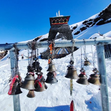
The temple is 100 m from the roadhead, and many pilgrims visit here after the darshans of Om Parvat, which we will do while returning too. Right across this temple is Ved Vyas Gufa, where he meditated. Soon, you’re at Nabhidhang and see a gate painted orange and yellow. You can see Om Parvat from the base camp. If you walk up to the gate and then the temple near it, you see a far better and magnanimous view of the Om Parvat.
Pilgrims meditate and manifest sitting in front of this natural wonder, a mountain encrypted with an 🕉️(Om). This encrypted OM appears even prominent when a good amount of snow fills the carving. Some even offer prayers and conduct havans in the mandir (temple). The Om Parvat welcomes each eye with beauty that keeps them awestruck.
A little further on, Nabhidhang has a navel-shaped glacier, which looks far more identifiable with snow on it. It is considered “Parwati Nabhi” by the locals and pilgrims alike. With this, you return to Gunji, have dinner, and rest.
Jolingkong Altitude: 14,436 ft (4,400 m)
Altitude Gain/Loss: 3,986 ft (1,215 m)
Travel Distance: 34 km + 34 km = 68 km (approx.)
Trek Distance: 1 to 2 km (approx.)
Travel Hours: 3-4 hrs (approx.)
Today throws curveballs at you one after another, be it the landscape, the weather, or the sites to visit. You start your day by boarding vehicles that will drive you to Jolingkong, 20 km from Gunji. The route is straight out of a Hollywood movie; it's more like Twilight during winter. Together, the snow's dryness pairs with the forest green deodars lining the route, creating magic.
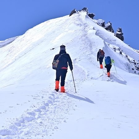
On the trail to Adi Kailash, just before reaching base camp, you pass through the near-abandoned village of Kutti. Tucked into this desolate landscape is a broken fort-like structure perched on a small hill, locally known as the Pandav Kila. Legend has it that the Pandava brothers, along with their mother Kunti, once took refuge here during their exile. The village, echoing with silence and myth, still whispers its story.
After a 15 km drive from Kutti, you reach Jolingkong, where you find a lot of shelters. They have beds and restaurants available there, only during the pilgrimage season. The route to Jyolingkong and the trek further to Adi Kailash consists of huge mountains, whose colours change with the season. They are green, white, and brown depending on the season you visit them.
The drive to Jolingkong has mesmerising views of two peaks: The Brahma Parvat (20,738 ft) and the Ganesh Parvat (21,430 ft), where the Ganesh Nala originates. Other peaks that you view today are:
Parvati Mukut (the crown of Goddess Parwati) is a peak with cone-shaped structures atop its summit point. It shows after a ½-kilometer trek from Jolingkong.
Adi Kailash/Baba Kailash/Chota Kailash/Jolingkong Peak (20,702 ft) is after a 1-2 km trek from Jolingkong.
The trail to Adi Kailash is muddy, but recent developments in the area have led to a cemented trail after the yellow and green railings to the Parwati Sarovar (14,764 ft) start. This divine lake looks boundless, frozen or not. On the other side of the sarovar, you can see Bheem Ki Kheti. The legend associated with this area is that Bheem grew a wheat crop on this land. Proving the magical myth, the wheat crop grows out of this land every year.
At a 100 m uphill trek from Parvati Sarovar is a Lord Shiva and Maa Parwati temple (4,600 m), which has Adi Kailash in its background. This temple is only open during the pilgrimage season and otherwise remains closed. Anyone who wants to enter the temple and get prashad (blessings) has to purify themselves by washing their hands and face in the divine water of the lake.
Adi Kailash Parvat finds its religious significance in the belief that Mahadev (Lord Shiva) camped here while taking baraat (wedding procession) to wed Mata Parvati (Goddess Parvati). Another legend tells of Raavana performing his penance here, earning the divine powers he’s famed for. At the summit of Adi Kailash, three natural lines mark the peak, resembling the Tripund Tilak, the sacred symbol worn by Lord Shiva.
Chaukori Altitude: 6,562 ft (2,000 m)
Altitude Loss: 3,888 ft (1,185 m)
Travel Distance: 176 km (approx.)
Travel Hours: 7.5 hrs (approx.)
Our trek takes a different turn today as we drive towards Chaukori, a hill station 176 km away from Gunji. The hill station is a tourist attraction, popular between May and June. Usually visited by people to get relief from summer’s scorching heat and enjoy the chilly winds at Chaukori from the Himalayas.
Kali Nadi keeps you company from Gunji to Gori Ganga pul (bridge). Before crossing this bridge, you cross Chialekh checkpost, Budhi village, Malpa bridge, Tankul bridge, Pangla, Ghasku, Tawaghat bridge, Dharchula, and Jauljibi. Every spot looks a little familiar on your way back; you’re now a part of these places and their stories.
Soon, you reach Ogla, which has a famous Hanuman Mandir en route, and then comes Didihat. After Didihat, you cross over the Ramganga river through the Ramganga Bridge at Thal. Eventually, you cross Sagrikhet and reach Udiyari bend. The following three roads diverge from here:
Road towards Chaukori and Bageshwar
Road towards Munsyari and Pithoragarh
Road towards Berinag and Patal Bhuwaneshwar
We then take the road to Chaukori today. A little drive further, we are at Kotna Devi Temple. The local forest goddess, Maa Kotna, is worshipped here. For darshans, you trek 1½ km uphill from the roadhead, which is the highest point (9,055 ft) in Chaukori. Religious significance aside, this spot has a 360° view of the valleys around it, as well as the hills.
At Chaukori, you can catch a beautiful sunrise and sunset with the gigantic Himalayan views from there. Other visit-worthy spots include a tea garden, Musk Deer park, Hanging Rock, and the Himalayas viewpoint.
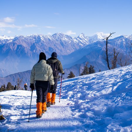
Himalayan views from Chaukori are particularly famous because the geographical placement of this hill station makes them appear close to the place. The most prominent peaks visible from here are Mt. Chaukhamba (23,419 ft), Mt. Nanda Devi (25,646 ft), Mt. Trishul (23,360 ft), Panchanchuli (22,651 ft), and Nandakot (22,510 ft) peaks.
Birdwatching and dense forests there make for tourist attractions too. The forest cover is a mix of banj (oak, which is local to Uttarakhand), buraansh (rhododendrons), kafal (bayberry), uteesh (Indian alder), deodar, and pine trees.
Patal Bhuvaneshwar Altitude: 4,500 ft (1,372 m)
Kathgodam Altitude: 1,490 ft (454 m)
Altitude Loss: 5,072 ft (1,546 m)
Travel Distance: 225 km (approx.)
Travel Hours: 8-9 hrs (approx.)
The last day of this trek is not as quiet as most treks are; it has offerings that leave you awestruck. The day starts with a riveting sunrise against the backdrop of a blue sky and towering snow-clad peaks of the Kumaon Himalayas. If hypnosis is a thing, it’d look something like this peaceful yet loud sunrise at Chaukori.
After breakfast at Chaukori, it is time to bid farewell to some known and unknown bends on the Kumaon hill. Soon, you are at Patal Bhuvaneshwar as you reach, and you’ve just crossed another hill station in Pithoragarh district called Berinag. This limestone cave is a famous Hindu cave temple dedicated to Lord Shiva. Among many legends related to this cave site, one that’s famously known is that this 160 m cave is a secret, underground way to Mt. Kailash. The famous five brothers (The Pandavas) from the Mahabharata took this route to meet Lord Shiva, which is a strong belief among the locals here.
After the darshan (seeing the deity), our route takes us back to Bans, where a route cuts to Almora. We cross Seraghat and Dhaulchinna to reach Almora. Here we decide which route to take forward.
1st Route: Almora→ Khairna Pul→ Kainchi→ Bhimtal→ Ranibagh→ Kathgodam. (225 km, 7 hrs)
2nd Route: Almora→ Dol→ Nata Dol→ Dhanachuli→ Kutani→ Bhimtal→ Ranibagh→ Kathgodam. (263 km, 9 hrs)
The route taken will depend on the ease and quickness, as we have to reach Kathgodam in time. On your way from Bans to Dhaulchinna, you get along the Saryu River and the Kosi River till Suyal Bari right before Kainchi. Once you are at Bhimtal, sightseeing at the less-crowded jheel (lake) is a good idea too.
If you do not plan to return home today, Bhimtal is a nice place to stay and enjoy the hills and its quiet life. Hourly buses and taxis are available from Bhimtal to Kathgodam and Haldwani, so there’s no chance of missing the train or bus back home.
Accommodation
Meals (Vegetarian only )
Nutritious meals from Day 1's dinner to last day's breakfast, following the itinerary schedule.
Expert Support
First Aid Preparedness
Fully equipped medical kit including a stretcher, oxygen cylinder, blood pressure monitor, oximeter, and stethoscope to ensure safety throughout the journey.
Storage Facilities :- A secure room at the base camp to store additional luggage not needed during the trek.
Permits and Entry Fees :- Coverage of all necessary permits and entry fees, in line with standard charges for Indian nationals.
Transportation :- A round-trip transport from the pick-up point and back at the same point as a part of the itinerary.
Trek Equipment
Insurance :- Personal insurance is mandatory and not included in the package.
Personal Expenses :- Any expenses of a personal nature, including shopping, snacks, hiring a mule or porter for carrying your belongings, or acquiring personal equipment.
Emergency Costs :- Expenses arising from emergency evacuations, hospitalization, or any medical treatments required.
Unspecified Services :- Any services or items not explicitly mentioned under the "INCLUSIONS" section.
Food Costs :- We will not cover any food costs during your transit to and from the base village.
Trekking is not only about enjoying the change of scenery but also about being responsible. Our (Trekking Compass) responsibility is to provide you with an opportunity for a safe trek. But, how do we do that? We do that when you fulfill your end of the responsibility and are honest with us. To keep you safe we need to be sure there isn’t any inherent threat to your being.
Treks are at higher altitudes and it becomes difficult, almost impossible to provide you with immediate medical assistance. Therefore, we cannot help you if you don’t help us. Trekking is only one of the things you can do, but there are plenty of other things to do too. Don’t risk your life for the thrill.
To approach a trek with utmost safety, we want you to submit the following documents:
Personal Confirmation Statement (Compulsory for anyone over 18 years)
You are participating in a trek at high altitudes and it comes with its own sets of risks. This Personal Confirmation Statement will make sure that you understand all the risks you're buying into. Trekking Compass wants you to confirm your complete understanding of these risks so that you come prepared for any mental or physical challenges ahead.
This statement is also a declaration from you that, "All the information I have provided, including medical conditions, is true. If found false under any circumstances, I will be held accountable and it has nothing to do with Trekking Compass."
We have the utmost empathy for you and will do our best to help wherever possible, but only after assessing your readiness and safety for the trek. This is how our team will adequately prepare for whatever risks we might face during the journey. Concerning individuals are requested to thoroughly cross-check the requirements and only then sign the document.
Parent/Guardian Approval Statement (Compulsory for anyone below 18 years)
For participants under 18 years of age, the Parent/Guardian Approval Statement is essential to confirm that a legal guardian understands and consents to the participation in the trek. Once we have this document, we are affirmed that the parent or guardian is fully aware of the risks involved in trekking at high altitudes and is consenting to their child's participation.
No underage (below 18+) children are welcome on the trek without their parent's consent. Submission of this document reassures us that parents are approving that their child meets the health and fitness requirements for the trek, after a thorough examination.
This legal confirmation holds the parent liable for any discrepancies, freeing Trekking Compass from any liabilities for the same. Parents are requested to thoroughly cross-check the requirements and only then sign the document.
Medical Liability Waiver
The Medical Liability Waiver makes sure participants acknowledge the health risks associated with trekking at high altitudes. Common ailments during treks include altitude sickness, dehydration, muscle cramps, hypothermia, and fatigue, all of which can significantly affect your trekking experience. Additionally, weather changes and the physical demands of the terrain may exacerbate pre-existing conditions.
If you have pre-existing medical conditions such as asthma, diabetes, or heart issues, it’s vital to inform us and carry your necessary medications. Trekking Compass cannot provide immediate medical assistance in remote areas, so having the essential medications, such as inhalers, insulin, or any other prescriptions, is crucial for your safety during the trek.
By signing this waiver, you confirm that you are in good health and have taken the necessary precautions. You acknowledge these risks and agree not to hold Trekking Compass liable for any medical issues or accidents that may arise during the trek.
For any further doubts about anything mentioned above, below is our contact information:
OFFICE ADDRESS: Lane No. 4 Krishna Vihar Mohkampur, Dehradun, Uttarakhand, 248005
PHONE NUMBER: +91 7055048487, 7055048488
EMAIL ADDRESS: info@trekkingcompass.com
Kathgodam (How to Reach)
Any trek in the Kumaon Himalayas most likely requires your arrival at Kathgodam, where you meet our (Trekking Compass) team. Kathgodam is famous for its railway station and the highway, which has roads diverging into every district in the Kumaon region. For the Adi Kailash & Om Parvat Yatra, too, you’ll arrive here, roughly 310 km from Delhi.
When traveling in Uttarakhand, always factor in its fragile weather and terrain. A buffer day is essential to avoid unexpected disruptions. If it remains unused, you can spend it exploring Nainital, Bhimtal, or other nearby spots
The trek itself spans 6 days and 5 nights, but we recommend keeping 7 days and 6 nights free in your schedule.
Reaching Kathgodam from Delhi
Your place (anywhere in India) to Delhi and then to Kathgodam is the most feasible way to reach Kathgodam. Trekkers from nearby states such as Himachal, J&K, Ladakh, Punjab, Haryana, and Uttar Pradesh, including Uttarakhand, are welcome to try alternate routes. But for the majority, Delhi remains the best option, and here’s why:
Medium: BUS
Delhi to Kathgodam:
Departure Point: ISBT Kashmere Gate and ISBT Anand Vihar, Delhi
Duration: Approximately 8 hrs (arrival timings vary as per the traffic)
Frequency: Regular departures (start departing from 6:30 am and keep departing till 11:59 pm)
Bus Types: AC, non-AC, Volvo, Janrath, seater, and sleeper.
Book online at: MakeMyTrip, redBus, etc.
Several state-run and private operators provide comfortable AC Volvo bus services. Opting for government-operated buses is advisable. They avoid delays and adhere to schedules, thus being more reliable than private operators.
Note: Buses from Delhi drop you at Haldwani Bus Station, near Prem Talkies and a petrol pump. From here, hop on a local tuk-tuk or auto for ₹20–40. The ride takes about 20 minutes to cover the 4–5 km stretch to Kathgodam Railway Station.
Medium: TRAIN
Delhi to Kathgodam Railway Station:
Train Options: 3 major trains are available from New Delhi Railway Station to Kathgodam Railway Station.
Duration: Approximately 6 hours.
| S.No. | Name of the Train | Time Schedule |
| 1. | Kathgodam Shatabdi Express -12040 | 6:20 am to 11:55 am |
| 2. | Uttaranchal Sampark Kranti Express - 15035 | 4:00 pm to 10:45 pm |
| 3. | Ranikhet Express (Overnight Train) - 15013 | 10:05 pm to 5:05 pm |
Note: Make sure to hop off at Kathgodam Railway Station, where our team awaits you. Haldwani Railway Station isn’t well equipped, and trains halting at Lal Kuan will still require an additional 30-minute ride back to Kathgodam.
Medium: FLIGHT
Fly Directly to Pantnagar Airport:
Nearest Airport to Kathgodam: The Pantnagar Airport is the most proximate airport to Kathgodam, located approximately 15 km from Rudrapur Bus Depot. From Rudrapur, take a bus to Haldwani Bus Stand (32 km). From there, a short auto or tuk-tuk ride will get you to Kathgodam Railway Station.
Flight Options: Direct flights only from Delhi. Layover flights from Lucknow and Dehradun are also available.
| Start Airport | Layover Airport | Type of Flight | Approx duration |
| Indira Gandhi International Airport (New Delhi) | _ | Direct | 1 hr, 5 mins |
| Amausi Airport (Lucknow) | Delhi | With Layover | 1 hr |
| Jolly Grant Airport (Dehradun) | Delhi | With Layover | 55 mins |
Due to weather conditions, flights can be unpredictable, so it's essential to check schedules and availability in advance. Flights aren’t recommended; choose trains instead.
Note: Ensure that your chosen mode of transport brings you to Kathgodam a day before the trek commences (Day 0). This allows acclimatization and preparation.
Flights to Delhi are available from major cities like Mumbai, Kolkata, Bengaluru, Chennai, and Hyderabad. From Delhi, you can proceed to Kathgodam using any of the options above.
What happens on the drop-off day?
While scheduling your onward travel from Kathgodam, do consider potential delays due to weather or road conditions. Therefore, either schedule it,
| Backpack with rain cover / Trolley Bag | Main bag for gear. |
| Day pack with rain cover (20 - 30 L) | For day essentials, if the main pack is off-loaded. |
| Walking stick | Recommended (at least one). |
| Water bottle/ Hydration pack | 2 bottles (1L each) or 1 hydration pack and 1 bottle. |
| Snacks | Energy bars, dry fruits, ORS/electrolytes. |
| Personal Medical Kit | As prescribed by your doctor. |
| T-shirts (Synthetic, quick-dry) | 2 full-sleeve, 2 half-sleeve. |
| Fleece T-shirts | 2 pieces. |
| Wind-stopper / Fleece jacket (upper) | 1 piece. |
| Windproof jacket | 1 piece |
| Down feather / Hollow jacket | 1 piece |
| Thermal innerwear (Upper & Lower) | 1 set. |
| Trekking pants (Synthetic, quick-dry) | 3 pairs. |
| Wind-stopper / Fleece pants (lower) | 1 pair. |
| Waterproof gloves | Not required. |
| Fleece / Woolen gloves | 1 pair. |
| Poncho / Waterproof jacket and pants | 1 set. |
| Head torch / Hand torch | 1 piece. |
| Sun cap | Required. |
| Woolen cap | 1 piece. |
| Balaclava | 1 piece. |
| Buff/ Neck gaiters | 1 synthetic, 1 woolen. |
| Sunglasses | UV protection with side covers (for spectacle users: contacts or photochromatic lenses). |
| Trekking shoes (waterproof, high ankle, good grip) | 1 pair. |
| Floaters / Flip-flops | 1 pair. |
| Cotton socks | 4 pairs. |
| Woolen socks | 2 pair. |
| Sunscreen | 1 piece. |
| Moisturizer | 1 piece. |
| Lip balm/ Chap-stick | 1 piece. |
| Toothbrush and toothbrush | 1 set. |
| Toilet paper and wipes | 1 pack each. |
| Soap/ Hand sanitizer | 1 piece. |
| Quick-dry towel | 1 piece. |
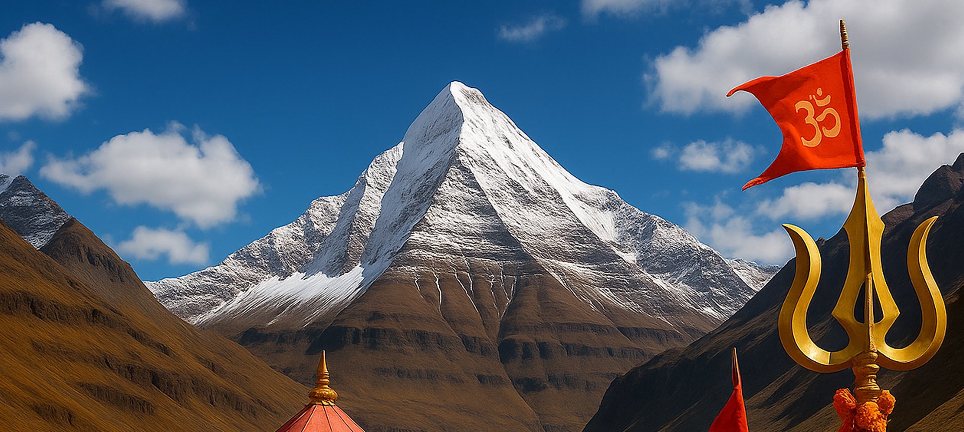
The Adi Kailash Yatra (also known as Chhota Kailash) is a spiritual pilgrimage in Uttarakhand’s Kumaon Himalayas. It takes devotees to Adi Kailash, considered the earthly abode of Lord Shiva, and Om Parvat, a unique mountain where natural snow formations resemble the sacred ‘ॐ’ symbol. The journey is both a trek and a road trip through remote valleys near the Indo-Tibet border.
The best season is from May to mid-October, with June and September being the most popular. During these months, the weather is stable, roads are open, and skies are clear for good views of Om Parvat. Winters make the region inaccessible due to heavy snowfall.
The yatra is considered easy to moderate. Much of the route is motorable (via Dharchula, Gunji, and Navidang), but the final stretches to Adi Kailash and Om Parvat involve short treks or walks on uneven terrain.
Adi Kailash stands at 6,191 m (20,312 ft), though trekkers reach the holy Adi Kailash Parvat darshan point at lower altitude. Om Parvat rises to 6,191 m, with its ‘ॐ’ formation visible clearly from Nabidang (4,000 m).
No. Since most of the journey is covered by road, even pilgrims without trekking background can undertake it. However, participants must be reasonably fit.
You should be able to walk 5–6 km on hilly terrain. As the route touches high altitude, stamina and breathing capacity are important.
Adi Kailash is revered as a manifestation of Mount Kailash in Tibet. Devotees believe that a darshan here brings blessings equivalent to visiting Kailash Mansarovar. Om Parvat’s natural snow ‘ॐ’ is considered a divine symbol, making the journey spiritually fulfilling.
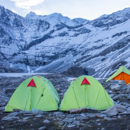
Accommodation is basic — tented camps, homestays, or government guesthouses in villages like Gunji, Kuti, and Dharchula.
Being close to the Indo-China border, special permits from the SDM Office at Dharchula and Inner Line permits are mandatory. These are arranged through government-approved tour operators.
Yes, since the yatra goes above 3,500 m, trekkers may feel breathlessness, headache, or fatigue. Proper rest and hydration help in acclimatization.
The journey begins from Dharchula (Uttarakhand), accessible from Haldwani, Kathgodam, or Pithoragarh. From there, the route continues via Gunji and Nabidang.
Yes, when done with authorized operators. However, landslides and weather shifts can cause delays, so flexibility is required.
Yes, many senior pilgrims undertake this yatra, but they must be medically fit for high-altitude travel.
Because it is both a spiritual and natural wonder — darshan of Om Parvat’s sacred snow symbol and the holy Adi Kailash Parvat, all in the heart of the Kumaon Himalayas.
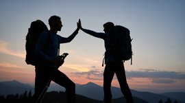
Handpicked routes with strong scenery, reliable pacing, and a premium featured block that still stands apart from the rest of the archive page.
Crafted routes, reliable execution, and a trekking experience that feels premium from planning to summit.
 Safety
Route checks, first-aid readiness, and trained leaders to keep every step confident.
 Routes
Better pacing, better camps, and real acclimatization designed for experience, not speed.
 Groups
Less crowd, more care so you enjoy the trek, not just finish it.
 Trust
Trust
Clear inclusions, no hidden surprises, and real human support on WhatsApp.